Johnstonville Topo Map Georgia
To zoom in, hover over the map of Johnstonville
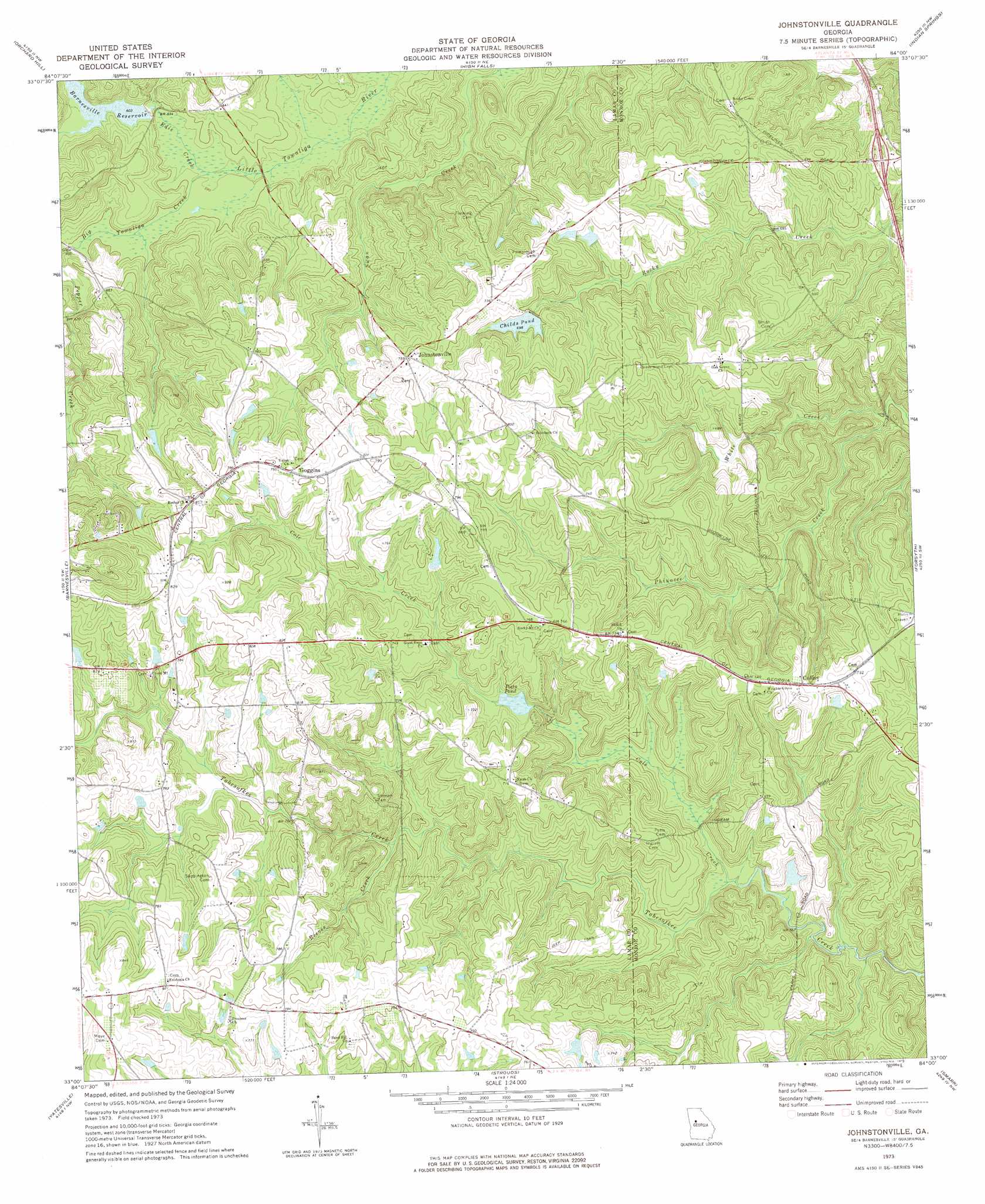
USGS Topo Quad 33084a1 - 1:24,000 scale
| Topo Map Name: | Johnstonville |
| USGS Topo Quad ID: | 33084a1 |
| Print Size: | ca. 21 1/4" wide x 27" high |
| Southeast Coordinates: | 33° N latitude / 84° W longitude |
| Map Center Coordinates: | 33.0625° N latitude / 84.0625° W longitude |
| U.S. State: | GA |
| Filename: | o33084a1.jpg |
| Download Map JPG Image: | Johnstonville topo map 1:24,000 scale |
| Map Type: | Topographic |
| Topo Series: | 7.5´ |
| Map Scale: | 1:24,000 |
| Source of Map Images: | United States Geological Survey (USGS) |
| Alternate Map Versions: |
Johnstonville GA 1973, updated 1976 Download PDF Buy paper map Johnstonville GA 2011 Download PDF Buy paper map Johnstonville GA 2014 Download PDF Buy paper map |
1:24,000 Topo Quads surrounding Johnstonville
Griffin North |
Luella |
Locust Grove |
Jackson |
Lloyd Shoals Dam |
Griffin South |
Orchard Hill |
High Falls |
Indian Springs |
Berner |
Zebulon |
Barnesville |
Johnstonville |
Forsyth |
East Juliette |
Thomaston |
Yatesville |
Strouds |
Smarr |
Bolingbroke |
Lincoln Park |
Logtown |
Culloden |
Moran |
Lizella |
> Back to 33084a1 at 1:100,000 scale
> Back to 33084a1 at 1:250,000 scale
> Back to U.S. Topo Maps home
Johnstonville topo map: Gazetteer
Johnstonville: Airports
Antique Acres Airport elevation 235m 770′De De Airport elevation 244m 800′
Johnstonville: Crossings
Exit 64 elevation 191m 626′Johnstonville: Dams
Barnesville Reservoir Dam elevation 180m 590′Childs Pond Dam elevation 213m 698′
Davis Lake Dam elevation 225m 738′
Jones Lake Dam elevation 182m 597′
Sanders Dam elevation 217m 711′
Smith Lake Dam elevation 224m 734′
Johnstonville: Lakes
Potts Pond elevation 200m 656′Johnstonville: Populated Places
Collier elevation 222m 728′Goggins elevation 241m 790′
Johnstonville elevation 230m 754′
Lamont (historical) elevation 255m 836′
Johnstonville: Reservoirs
Barnesville Reservoir elevation 180m 590′Childs Pond elevation 213m 698′
Davis Lake elevation 225m 738′
Fred Vaughn Lake elevation 204m 669′
Jones Lake elevation 182m 597′
Sanders Lake elevation 217m 711′
Smith Lake elevation 224m 734′
Johnstonville: Streams
Big Towaliga Creek elevation 178m 583′Cole Creek elevation 173m 567′
Edie Creek elevation 178m 583′
Phinazee Creek elevation 167m 547′
Prairie Creek elevation 184m 603′
Reeves Creek elevation 195m 639′
Johnstonville digital topo map on disk
Buy this Johnstonville topo map showing relief, roads, GPS coordinates and other geographical features, as a high-resolution digital map file on DVD: