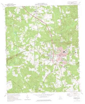
Barnesville Topo Map Georgia
To zoom in, hover over the map of Barnesville
USGS Topo Quad 33084a2 - 1:24,000 scale
| Topo Map Name: | Barnesville |
| USGS Topo Quad ID: | 33084a2 |
| Print Size: | ca. 21 1/4" wide x 27" high |
| Southeast Coordinates: | 33° N latitude / 84.125° W longitude |
| Map Center Coordinates: | 33.0625° N latitude / 84.1875° W longitude |
| U.S. State: | GA |
| Filename: | o33084a2.jpg |
| Download Map JPG Image: | Barnesville topo map 1:24,000 scale |
| Map Type: | Topographic |
| Topo Series: | 7.5´ |
| Map Scale: | 1:24,000 |
| Source of Map Images: | United States Geological Survey (USGS) |
| Alternate Map Versions: |
Barnesville GA 1973, updated 1976 Download PDF Buy paper map Barnesville GA 2011 Download PDF Buy paper map Barnesville GA 2014 Download PDF Buy paper map |
1:24,000 Topo Quads surrounding Barnesville
> Back to 33084a1 at 1:100,000 scale
> Back to 33084a1 at 1:250,000 scale
> Back to U.S. Topo Maps home
Barnesville topo map: Gazetteer
Barnesville: Dams
Akin Lake Dam elevation 234m 767′Arms Lake Dam elevation 234m 767′
Camnaflax Lake Dam Number 3 elevation 232m 761′
Camnaflax Lake Dam Number 4 elevation 237m 777′
Finny Lake Dam elevation 233m 764′
McCord Lake Dam elevation 218m 715′
Pennington Lake Dam elevation 217m 711′
Potato Creek Structure Number 103 Dam elevation 233m 764′
Wildlife Land Pond Dam elevation 221m 725′
Barnesville: Populated Places
Aldora elevation 250m 820′Barnesville elevation 261m 856′
Graddick (historical) elevation 257m 843′
Milner elevation 257m 843′
Milner Crossroads elevation 248m 813′
Powell (historical) elevation 260m 853′
Revere (historical) elevation 259m 849′
Wilkinsons (historical) elevation 257m 843′
Woodfin Mill elevation 223m 731′
Barnesville: Post Offices
Barnesville Post Office elevation 261m 856′Barnesville: Reservoirs
Akin Lake elevation 234m 767′Arms Lake elevation 234m 767′
Camnaflax Lake Number 3 elevation 232m 761′
Camnaflax Lake Number 4 elevation 237m 777′
Finny Lake elevation 233m 764′
McCord Lake elevation 218m 715′
Pennington Lake elevation 217m 711′
Potato Creek Structure Number 103 Lak elevation 233m 764′
Wildlife Land Pond elevation 221m 725′
Woodfin Lake (historical) elevation 217m 711′
Barnesville: Streams
Grape Creek elevation 218m 715′Hardin Creek elevation 216m 708′
Little Potato Creek elevation 209m 685′
Pepper Creek elevation 185m 606′
Turner Creek elevation 185m 606′
Turnpike Creek elevation 214m 702′
Barnesville: Summits
Hog Mountain elevation 311m 1020′Pine Mountain elevation 292m 958′
Barnesville digital topo map on disk
Buy this Barnesville topo map showing relief, roads, GPS coordinates and other geographical features, as a high-resolution digital map file on DVD:


