Hollonville Topo Map Georgia
To zoom in, hover over the map of Hollonville
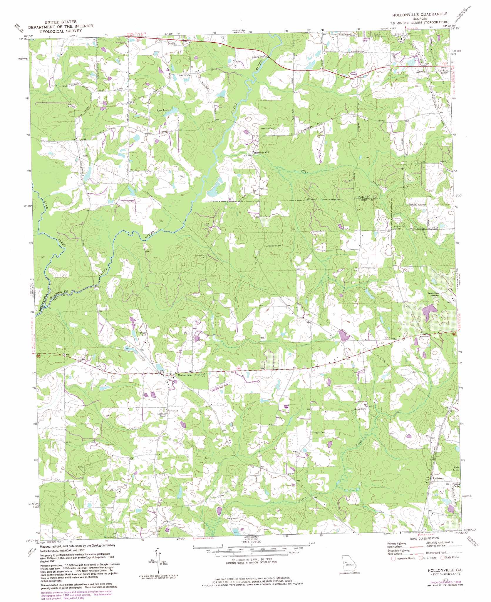
USGS Topo Quad 33084b4 - 1:24,000 scale
| Topo Map Name: | Hollonville |
| USGS Topo Quad ID: | 33084b4 |
| Print Size: | ca. 21 1/4" wide x 27" high |
| Southeast Coordinates: | 33.125° N latitude / 84.375° W longitude |
| Map Center Coordinates: | 33.1875° N latitude / 84.4375° W longitude |
| U.S. State: | GA |
| Filename: | o33084b4.jpg |
| Download Map JPG Image: | Hollonville topo map 1:24,000 scale |
| Map Type: | Topographic |
| Topo Series: | 7.5´ |
| Map Scale: | 1:24,000 |
| Source of Map Images: | United States Geological Survey (USGS) |
| Alternate Map Versions: |
Hollonville GA 1971, updated 1973 Download PDF Buy paper map Hollonville GA 1971, updated 1983 Download PDF Buy paper map Hollonville GA 2011 Download PDF Buy paper map Hollonville GA 2014 Download PDF Buy paper map |
1:24,000 Topo Quads surrounding Hollonville
Madras |
Tyrone |
Fayetteville |
Hampton |
Mcdonough |
Sharpsburg |
Senoia |
Brooks |
Griffin North |
Luella |
Luthersville |
Haralson |
Hollonville |
Griffin South |
Orchard Hill |
Greenville |
Gay |
Concord |
Zebulon |
Barnesville |
Warm Springs |
Woodbury |
Sunset Village |
Thomaston |
Yatesville |
> Back to 33084a1 at 1:100,000 scale
> Back to 33084a1 at 1:250,000 scale
> Back to U.S. Topo Maps home
Hollonville topo map: Gazetteer
Hollonville: Airports
B and L Strip Airport elevation 254m 833′Powers Airport elevation 234m 767′
Shade Tree Airport elevation 262m 859′
Vintage Field elevation 262m 859′
Hollonville: Bridges
Sullivans Bridge (historical) elevation 213m 698′Hollonville: Dams
Johnson Lake Dam elevation 264m 866′Winship Lake Dam elevation 231m 757′
Hollonville: Lakes
Syes Lake elevation 229m 751′Hollonville: Populated Places
Beeks (historical) elevation 268m 879′Blantons Mill elevation 225m 738′
Hollonville elevation 253m 830′
Reidsboro elevation 276m 905′
Zetella elevation 262m 859′
Hollonville: Reservoirs
Johnson Lake elevation 264m 866′Hollonville: Streams
Flat Creek elevation 219m 718′Line Creek elevation 213m 698′
Hollonville digital topo map on disk
Buy this Hollonville topo map showing relief, roads, GPS coordinates and other geographical features, as a high-resolution digital map file on DVD: