Haralson Topo Map Georgia
To zoom in, hover over the map of Haralson
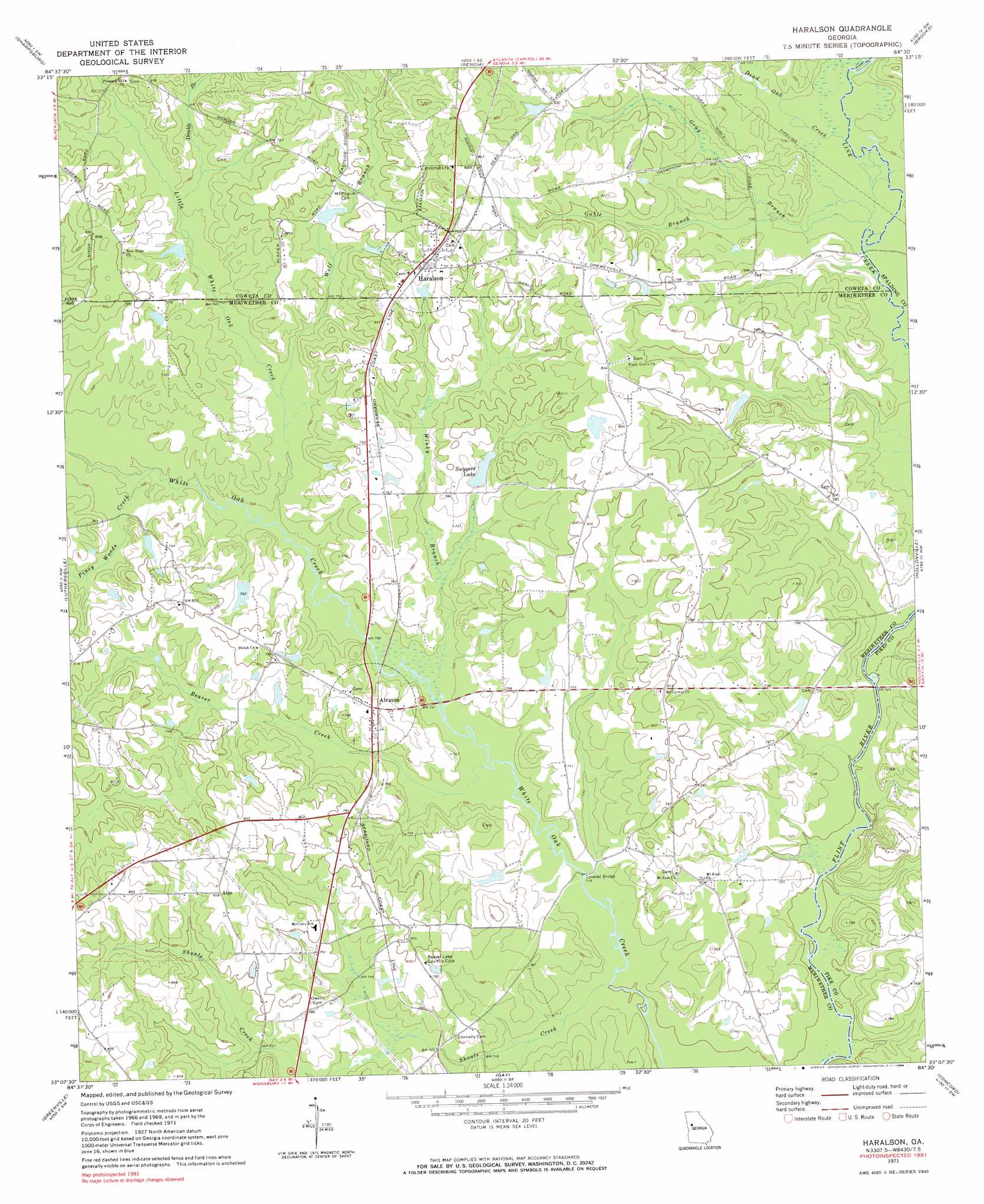
USGS Topo Quad 33084b5 - 1:24,000 scale
| Topo Map Name: | Haralson |
| USGS Topo Quad ID: | 33084b5 |
| Print Size: | ca. 21 1/4" wide x 27" high |
| Southeast Coordinates: | 33.125° N latitude / 84.5° W longitude |
| Map Center Coordinates: | 33.1875° N latitude / 84.5625° W longitude |
| U.S. State: | GA |
| Filename: | o33084b5.jpg |
| Download Map JPG Image: | Haralson topo map 1:24,000 scale |
| Map Type: | Topographic |
| Topo Series: | 7.5´ |
| Map Scale: | 1:24,000 |
| Source of Map Images: | United States Geological Survey (USGS) |
| Alternate Map Versions: |
Haralson GA 1971, updated 1973 Download PDF Buy paper map Haralson GA 1971, updated 1984 Download PDF Buy paper map Haralson GA 2011 Download PDF Buy paper map Haralson GA 2014 Download PDF Buy paper map |
1:24,000 Topo Quads surrounding Haralson
Newnan North |
Madras |
Tyrone |
Fayetteville |
Hampton |
Newnan South |
Sharpsburg |
Senoia |
Brooks |
Griffin North |
Grantville |
Luthersville |
Haralson |
Hollonville |
Griffin South |
Odessadale |
Greenville |
Gay |
Concord |
Zebulon |
Durand |
Warm Springs |
Woodbury |
Sunset Village |
Thomaston |
> Back to 33084a1 at 1:100,000 scale
> Back to 33084a1 at 1:250,000 scale
> Back to U.S. Topo Maps home
Haralson topo map: Gazetteer
Haralson: Airports
Fagundes Field elevation 244m 800′Gable Branch Airport elevation 254m 833′
Haralson: Bridges
White Oak Creek Covered Bridge elevation 218m 715′Haralson: Dams
Blount-Kirkland Lake Dam elevation 230m 754′Carr Lake Dam elevation 247m 810′
Dennis Dam elevation 230m 754′
Moss Dam elevation 231m 757′
Spencer Lake Dam elevation 248m 813′
Swygert Lake Dam elevation 229m 751′
Haralson: Lakes
Blue Pond elevation 236m 774′Haralson: Populated Places
Alps elevation 259m 849′Alvaton elevation 233m 764′
Carmel elevation 250m 820′
Farmdale (historical) elevation 252m 826′
Haralson elevation 255m 836′
Haralson: Reservoirs
Blount-Kirkland Lake elevation 230m 754′Carr Lake elevation 247m 810′
Dennis Lake elevation 230m 754′
Moss Lake elevation 231m 757′
Spencer Lake elevation 248m 813′
Swygert Lake elevation 229m 751′
Williams Lake elevation 235m 770′
Haralson: Streams
Beaver Creek elevation 215m 705′Dead Oak Creek elevation 218m 715′
Double Branch elevation 226m 741′
Gable Branch elevation 219m 718′
Gray Branch elevation 217m 711′
Little White Oak Creek elevation 217m 711′
Piney Woods Creek elevation 219m 718′
Shoals Creek elevation 214m 702′
Winky Branch elevation 219m 718′
Wolf Branch elevation 223m 731′
Haralson digital topo map on disk
Buy this Haralson topo map showing relief, roads, GPS coordinates and other geographical features, as a high-resolution digital map file on DVD: