Griffin North Topo Map Georgia
To zoom in, hover over the map of Griffin North
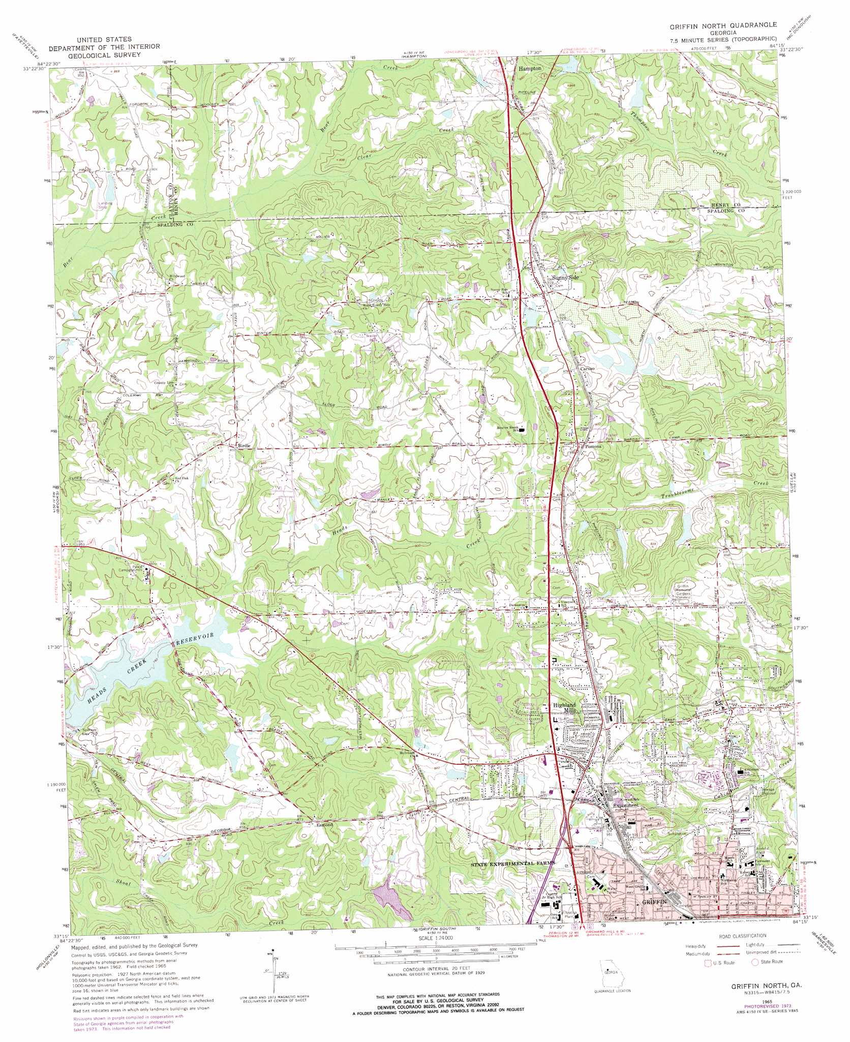
USGS Topo Quad 33084c3 - 1:24,000 scale
| Topo Map Name: | Griffin North |
| USGS Topo Quad ID: | 33084c3 |
| Print Size: | ca. 21 1/4" wide x 27" high |
| Southeast Coordinates: | 33.25° N latitude / 84.25° W longitude |
| Map Center Coordinates: | 33.3125° N latitude / 84.3125° W longitude |
| U.S. State: | GA |
| Filename: | o33084c3.jpg |
| Download Map JPG Image: | Griffin North topo map 1:24,000 scale |
| Map Type: | Topographic |
| Topo Series: | 7.5´ |
| Map Scale: | 1:24,000 |
| Source of Map Images: | United States Geological Survey (USGS) |
| Alternate Map Versions: |
Griffin North GA 1965, updated 1967 Download PDF Buy paper map Griffin North GA 1965, updated 1975 Download PDF Buy paper map Griffin North GA 2011 Download PDF Buy paper map Griffin North GA 2014 Download PDF Buy paper map |
1:24,000 Topo Quads surrounding Griffin North
Fairburn |
Riverdale |
Jonesboro |
Stockbridge |
Kelleytown |
Tyrone |
Fayetteville |
Hampton |
Mcdonough |
Ola |
Senoia |
Brooks |
Griffin North |
Luella |
Locust Grove |
Haralson |
Hollonville |
Griffin South |
Orchard Hill |
High Falls |
Gay |
Concord |
Zebulon |
Barnesville |
Johnstonville |
> Back to 33084a1 at 1:100,000 scale
> Back to 33084a1 at 1:250,000 scale
> Back to U.S. Topo Maps home
Griffin North topo map: Gazetteer
Griffin North: Airports
Beaverbrook Aerodrome elevation 272m 892′Halls Flying Ranch Airport elevation 240m 787′
Pinebrook Estates Airport elevation 250m 820′
Griffin North: Dams
Cheatam Lake Dam elevation 259m 849′Childers Lake Dam elevation 238m 780′
Floyds Lake Dam elevation 236m 774′
Hall Dam elevation 235m 770′
Heads Creek Dam elevation 232m 761′
Miriatoto Lake Dam elevation 246m 807′
Shoal Creek Lake Dam elevation 244m 800′
Southern Fruit Lake Dam elevation 259m 849′
Southern Fruit Lake Dam B elevation 265m 869′
Taylors Lake Dam elevation 249m 816′
Twilly Lake Dam elevation 282m 925′
Griffin North: Populated Places
Birdie elevation 267m 875′Burdett (historical) elevation 263m 862′
Caruso elevation 279m 915′
Esmond elevation 268m 879′
Experiment elevation 289m 948′
Highland Mills elevation 287m 941′
Pomona elevation 269m 882′
Sunny Side elevation 281m 921′
Griffin North: Reservoirs
Cheatam Lake elevation 259m 849′Childers Lake elevation 238m 780′
Floyds Lake elevation 236m 774′
Hall Lake elevation 235m 770′
Heads Creek elevation 232m 761′
Heads Creek Reservoir elevation 237m 777′
Miriatoto Lake elevation 246m 807′
Shoal Creek Lake elevation 244m 800′
Southern Fruit Lake elevation 259m 849′
Southern Fruit Lake B elevation 265m 869′
Taylors Lake elevation 249m 816′
Twilly Lake elevation 282m 925′
Griffin North: Streams
Clear Creek elevation 237m 777′Griffin North digital topo map on disk
Buy this Griffin North topo map showing relief, roads, GPS coordinates and other geographical features, as a high-resolution digital map file on DVD: