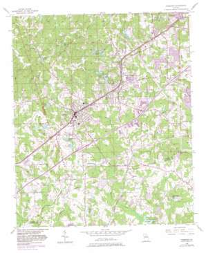
Fairburn Topo Map Georgia
To zoom in, hover over the map of Fairburn
USGS Topo Quad 33084e5 - 1:24,000 scale
| Topo Map Name: | Fairburn |
| USGS Topo Quad ID: | 33084e5 |
| Print Size: | ca. 21 1/4" wide x 27" high |
| Southeast Coordinates: | 33.5° N latitude / 84.5° W longitude |
| Map Center Coordinates: | 33.5625° N latitude / 84.5625° W longitude |
| U.S. State: | GA |
| Filename: | o33084e5.jpg |
| Download Map JPG Image: | Fairburn topo map 1:24,000 scale |
| Map Type: | Topographic |
| Topo Series: | 7.5´ |
| Map Scale: | 1:24,000 |
| Source of Map Images: | United States Geological Survey (USGS) |
| Alternate Map Versions: |
Fairburn GA 1954, updated 1956 Download PDF Buy paper map Fairburn GA 1954, updated 1968 Download PDF Buy paper map Fairburn GA 1954, updated 1969 Download PDF Buy paper map Fairburn GA 1954, updated 1974 Download PDF Buy paper map Fairburn GA 1954, updated 1983 Download PDF Buy paper map Fairburn GA 1999, updated 2002 Download PDF Buy paper map Fairburn GA 2011 Download PDF Buy paper map Fairburn GA 2014 Download PDF Buy paper map |
1:24,000 Topo Quads surrounding Fairburn
> Back to 33084e1 at 1:100,000 scale
> Back to 33084a1 at 1:250,000 scale
> Back to U.S. Topo Maps home
Fairburn topo map: Gazetteer
Fairburn: Airports
Beck Field elevation 301m 987′Coleman Field elevation 303m 994′
Smith Field elevation 273m 895′
Stonewall Heliport elevation 304m 997′
Fairburn: Crossings
Interchange 12 elevation 308m 1010′Interchange 13 elevation 294m 964′
Interchange 14 elevation 287m 941′
Fairburn: Dams
Arnolds Lake Dam elevation 262m 859′Bradbury Lake Dam elevation 259m 849′
City Lake Dam elevation 294m 964′
Cooks Lake Dam elevation 278m 912′
Dixie Lake Dam Number One elevation 274m 898′
Dixie Lake Number Two Dam elevation 281m 921′
Durhams Dam elevation 301m 987′
Ganoname1196 Dam elevation 296m 971′
Green Valley Lake Dam elevation 282m 925′
Harris Dam elevation 287m 941′
Lake Estes Dam elevation 290m 951′
Lake Feldwood Dam elevation 274m 898′
Lake Frances Dam elevation 285m 935′
Lake Frances Dam elevation 269m 882′
Lees Lake Dam elevation 259m 849′
Milams Lake Dam elevation 300m 984′
Valley Lakes Dam Number 2 elevation 265m 869′
Wright Lake Dam elevation 279m 915′
Fairburn: Lakes
Dixie Lakes elevation 275m 902′Fairburn: Parks
Dixie Lakes Park elevation 291m 954′Duncan Memorial Park elevation 291m 954′
Fairburn Commercial Historic District elevation 313m 1026′
Fairburn: Populated Places
Bench Mark elevation 294m 964′Bethany elevation 296m 971′
Brandon Hill elevation 283m 928′
Brogdon elevation 301m 987′
Christian Corners elevation 270m 885′
Fairburn elevation 313m 1026′
Fife elevation 293m 961′
Fireside elevation 304m 997′
Gledstone Hills elevation 286m 938′
Lees Mill elevation 261m 856′
Mallory Estates elevation 285m 935′
McClenney Estates elevation 289m 948′
Melanie Manor elevation 283m 928′
Morning Creek Estates elevation 288m 944′
Muir Woods elevation 292m 958′
Pine Acres Mobile Home Park elevation 280m 918′
River Forest elevation 286m 938′
Rosegate Manor elevation 305m 1000′
Sandy Ridge Estates elevation 299m 980′
Shandra Estates elevation 290m 951′
Shannon Chase elevation 301m 987′
Shannon Glen elevation 291m 954′
Shannon Villas elevation 294m 964′
Stonewall elevation 311m 1020′
Suffolk Downs elevation 293m 961′
Sunrise elevation 280m 918′
The Woods elevation 287m 941′
Union City elevation 295m 967′
Wellington elevation 299m 980′
Fairburn: Post Offices
Fairburn Post Office elevation 310m 1017′Union City Post Office elevation 310m 1017′
Fairburn: Reservoirs
Arnolds Lake elevation 262m 859′Bradbury Lake elevation 259m 849′
City Lake elevation 294m 964′
Cooks Lake elevation 278m 912′
Dixie Lake Number One elevation 274m 898′
Dixie Lake Number Two elevation 281m 921′
Durhams Lake elevation 301m 987′
Edwards Lake elevation 293m 961′
Eubanks Lake elevation 299m 980′
Green Valley Lake elevation 284m 931′
Green Valley Lake elevation 282m 925′
Harris Lake elevation 287m 941′
Hendersons Lake elevation 298m 977′
Koweta Lake elevation 251m 823′
Lake Feldwood elevation 274m 898′
Lake Frances elevation 285m 935′
Lees Lake elevation 259m 849′
McClenney Lake elevation 270m 885′
McClure Lake elevation 273m 895′
Milams Lake elevation 300m 984′
Morning Creek Lake elevation 290m 951′
Valley Lake Number 2 elevation 265m 869′
Valley Lakes elevation 269m 882′
Wright Lake elevation 279m 915′
Fairburn: Streams
Peeks Branch Shoal Creek elevation 267m 875′Trickum Creek elevation 267m 875′
Fairburn digital topo map on disk
Buy this Fairburn topo map showing relief, roads, GPS coordinates and other geographical features, as a high-resolution digital map file on DVD:


