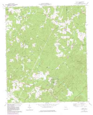
Hulett Topo Map Georgia
To zoom in, hover over the map of Hulett
USGS Topo Quad 33084e8 - 1:24,000 scale
| Topo Map Name: | Hulett |
| USGS Topo Quad ID: | 33084e8 |
| Print Size: | ca. 21 1/4" wide x 27" high |
| Southeast Coordinates: | 33.5° N latitude / 84.875° W longitude |
| Map Center Coordinates: | 33.5625° N latitude / 84.9375° W longitude |
| U.S. State: | GA |
| Filename: | o33084e8.jpg |
| Download Map JPG Image: | Hulett topo map 1:24,000 scale |
| Map Type: | Topographic |
| Topo Series: | 7.5´ |
| Map Scale: | 1:24,000 |
| Source of Map Images: | United States Geological Survey (USGS) |
| Alternate Map Versions: |
Hulett GA 1973, updated 1975 Download PDF Buy paper map Hulett GA 1973, updated 1983 Download PDF Buy paper map Hulett GA 2011 Download PDF Buy paper map Hulett GA 2014 Download PDF Buy paper map |
1:24,000 Topo Quads surrounding Hulett
> Back to 33084e1 at 1:100,000 scale
> Back to 33084a1 at 1:250,000 scale
> Back to U.S. Topo Maps home
Hulett topo map: Gazetteer
Hulett: Airports
Erlen Airport elevation 308m 1010′Kolibri Airport elevation 311m 1020′
Lyons Landing Airport elevation 324m 1062′
Morgan Airport elevation 313m 1026′
Hulett: Dams
Green Lake Dam elevation 318m 1043′J L Lawhon Dam elevation 226m 741′
Janes Lake Dam elevation 322m 1056′
Lake Connie Dam elevation 335m 1099′
Law Lake Dam elevation 321m 1053′
Richards Lake Dam elevation 229m 751′
Seals Dam elevation 336m 1102′
Strickland Lake Dam elevation 354m 1161′
Hulett: Populated Places
Banning elevation 274m 898′Banning Mills elevation 295m 967′
Cross Plains elevation 330m 1082′
Dingler Crossroads elevation 298m 977′
Emily (historical) elevation 337m 1105′
Hodge (historical) elevation 342m 1122′
Lang (historical) elevation 373m 1223′
Tyree elevation 365m 1197′
Hulett: Reservoirs
Green Lake elevation 318m 1043′Janes Lake elevation 322m 1056′
Lake Connie elevation 335m 1099′
Law Lake elevation 321m 1053′
Richards Lake elevation 229m 751′
Seals Lake elevation 336m 1102′
Strickland Lake elevation 354m 1161′
Hulett: Streams
Crews Creek elevation 275m 902′Dixon Mill Creek elevation 318m 1043′
Gilley Creek elevation 292m 958′
Guthrie Creek elevation 273m 895′
Hesterlee Creek elevation 318m 1043′
Jacks Creek elevation 286m 938′
Little Snake Creek elevation 278m 912′
Norman Creek elevation 297m 974′
Stovall Creek elevation 286m 938′
Hulett digital topo map on disk
Buy this Hulett topo map showing relief, roads, GPS coordinates and other geographical features, as a high-resolution digital map file on DVD:


