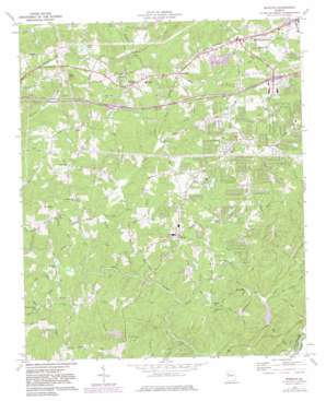
Winston Topo Map Georgia
To zoom in, hover over the map of Winston
USGS Topo Quad 33084f7 - 1:24,000 scale
| Topo Map Name: | Winston |
| USGS Topo Quad ID: | 33084f7 |
| Print Size: | ca. 21 1/4" wide x 27" high |
| Southeast Coordinates: | 33.625° N latitude / 84.75° W longitude |
| Map Center Coordinates: | 33.6875° N latitude / 84.8125° W longitude |
| U.S. State: | GA |
| Filename: | o33084f7.jpg |
| Download Map JPG Image: | Winston topo map 1:24,000 scale |
| Map Type: | Topographic |
| Topo Series: | 7.5´ |
| Map Scale: | 1:24,000 |
| Source of Map Images: | United States Geological Survey (USGS) |
| Alternate Map Versions: |
Winston GA 1973, updated 1975 Download PDF Buy paper map Winston GA 1973, updated 1983 Download PDF Buy paper map Winston GA 2011 Download PDF Buy paper map Winston GA 2014 Download PDF Buy paper map |
1:24,000 Topo Quads surrounding Winston
> Back to 33084e1 at 1:100,000 scale
> Back to 33084a1 at 1:250,000 scale
> Back to U.S. Topo Maps home
Winston topo map: Gazetteer
Winston: Crossings
Exit 7 elevation 359m 1177′Exit 8 elevation 345m 1131′
Pumpkintown Ferry (historical) elevation 219m 718′
Winston: Dams
Barnett Lake Dam elevation 318m 1043′Cedar Lake Dam elevation 335m 1099′
Flyblow Creek Dam elevation 282m 925′
Hay North Lake Dam elevation 324m 1062′
Johnson Lake Dam elevation 290m 951′
Lake Sarah Glenn Dam elevation 319m 1046′
Mill Glenn Lake Dam elevation 323m 1059′
Noland Lake Dam elevation 339m 1112′
Spring Hill Lake Dam elevation 299m 980′
Talerico Lake Dam elevation 323m 1059′
Thurmon Lake Dam elevation 282m 925′
Winston: Lakes
Windy Valley Lake elevation 300m 984′Winston: Parks
F M Boatwright Memorial Park elevation 341m 1118′Winston: Populated Places
Aberdeen Estates elevation 310m 1017′Aline Estates elevation 305m 1000′
Audubon Forest elevation 341m 1118′
Bear Creek Estates elevation 324m 1062′
Bent Pine elevation 352m 1154′
Blain Woods elevation 342m 1122′
Bright Star elevation 337m 1105′
Coronado Forest elevation 354m 1161′
Cowan Mill Estates elevation 358m 1174′
Daniell Mill Estates elevation 318m 1043′
Douglas Ridge elevation 348m 1141′
Ephesus Heights elevation 352m 1154′
Executive Heights elevation 348m 1141′
Fouts Mill elevation 239m 784′
Glen Ridge elevation 327m 1072′
Goodwindy Estates elevation 346m 1135′
Gregory Heights elevation 330m 1082′
Imperial Estates elevation 318m 1043′
Johnson Land elevation 309m 1013′
Kings Point elevation 303m 994′
Kings West elevation 318m 1043′
Laurel Heights elevation 330m 1082′
Mill Glen elevation 338m 1108′
Montage Manor elevation 328m 1076′
Oakdale Estates elevation 300m 984′
Orchard Park elevation 294m 964′
Seminole Valley elevation 333m 1092′
Shallowford Heights elevation 296m 971′
Sherrian Estates elevation 355m 1164′
Stewart Mill Acres elevation 342m 1122′
Sugar Creek elevation 343m 1125′
Sweetwater Bluff elevation 303m 994′
The Noles Estates elevation 341m 1118′
The Oaks elevation 349m 1145′
Twin Pine Estates elevation 359m 1177′
West Lake elevation 323m 1059′
White City elevation 360m 1181′
White Oak Estates elevation 338m 1108′
Winston elevation 365m 1197′
Woods Valley elevation 323m 1059′
Worthington Estates elevation 306m 1003′
Winston: Reservoirs
Barnett Lake elevation 318m 1043′Cedar Lake elevation 335m 1099′
Easons Lake elevation 331m 1085′
Hay North Lake elevation 324m 1062′
Johnson Lake elevation 290m 951′
Lake Sarah Glenn elevation 319m 1046′
Lake Sweetwater elevation 282m 925′
Mill Glenn Lake elevation 323m 1059′
Noland Lake elevation 339m 1112′
Spring Hill Lake elevation 299m 980′
Talerico Lake elevation 323m 1059′
Thurmon Lake elevation 282m 925′
Winston: Streams
Baldwin Creek elevation 228m 748′Bear Creek elevation 217m 711′
Billy Creek elevation 275m 902′
Caine Creek elevation 226m 741′
Flyblow Creek elevation 237m 777′
Little Bear Creek elevation 227m 744′
Mobley Creek elevation 263m 862′
Nancy Long Creek elevation 289m 948′
Pool Creek elevation 277m 908′
Yellow Rock Creek elevation 248m 813′
Winston: Summits
Andy Mountain elevation 405m 1328′Cedar Mountain elevation 379m 1243′
Winston digital topo map on disk
Buy this Winston topo map showing relief, roads, GPS coordinates and other geographical features, as a high-resolution digital map file on DVD:


