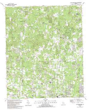
Lost Mountain Topo Map Georgia
To zoom in, hover over the map of Lost Mountain
USGS Topo Quad 33084h6 - 1:24,000 scale
| Topo Map Name: | Lost Mountain |
| USGS Topo Quad ID: | 33084h6 |
| Print Size: | ca. 21 1/4" wide x 27" high |
| Southeast Coordinates: | 33.875° N latitude / 84.625° W longitude |
| Map Center Coordinates: | 33.9375° N latitude / 84.6875° W longitude |
| U.S. State: | GA |
| Filename: | o33084h6.jpg |
| Download Map JPG Image: | Lost Mountain topo map 1:24,000 scale |
| Map Type: | Topographic |
| Topo Series: | 7.5´ |
| Map Scale: | 1:24,000 |
| Source of Map Images: | United States Geological Survey (USGS) |
| Alternate Map Versions: |
Lost Mountain GA 1954, updated 1956 Download PDF Buy paper map Lost Mountain GA 1954, updated 1968 Download PDF Buy paper map Lost Mountain GA 1954, updated 1969 Download PDF Buy paper map Lost Mountain GA 1954, updated 1983 Download PDF Buy paper map Lost Mountain GA 1992, updated 1993 Download PDF Buy paper map Lost Mountain GA 2011 Download PDF Buy paper map Lost Mountain GA 2014 Download PDF Buy paper map |
1:24,000 Topo Quads surrounding Lost Mountain
> Back to 33084e1 at 1:100,000 scale
> Back to 33084a1 at 1:250,000 scale
> Back to U.S. Topo Maps home
Lost Mountain topo map: Gazetteer
Lost Mountain: Dams
Fort Yargo Lake Dam elevation 326m 1069′Ganoname1156 Dam elevation 306m 1003′
Lake Somerset Dam elevation 305m 1000′
Mud Creek Lake Dam elevation 312m 1023′
Wofford Lake Dam elevation 311m 1020′
Lost Mountain: Parks
Lost Mountain Park elevation 343m 1125′Oregon Park elevation 316m 1036′
Picketts Mill State Historical Site elevation 325m 1066′
Wild Horse Creek Park elevation 281m 921′
Lost Mountain: Populated Places
Brooks Farm elevation 344m 1128′California elevation 317m 1040′
Calumet West elevation 286m 938′
Cobb Crossing elevation 348m 1141′
Country Lake elevation 287m 941′
Creekwood Estates elevation 315m 1033′
Cross Creek Estates elevation 291m 954′
Davis Crossroads elevation 297m 974′
Due West Estates elevation 305m 1000′
Fox Ridge elevation 337m 1105′
Gold Creek elevation 329m 1079′
Hardy Hills elevation 336m 1102′
Hearthwood elevation 306m 1003′
Lost Mountain elevation 369m 1210′
Lost Mountain Woods elevation 341m 1118′
Macland elevation 306m 1003′
McEachern Woods elevation 316m 1036′
Powder Creek Crossing elevation 305m 1000′
Powder Mill elevation 331m 1085′
Red Rock elevation 322m 1056′
Red Rock Hills elevation 318m 1043′
Southfork elevation 336m 1102′
Story (historical) elevation 316m 1036′
Timberchase elevation 325m 1066′
Watson Glen elevation 354m 1161′
West Hampton elevation 330m 1082′
Wynford Chase elevation 293m 961′
Lost Mountain: Reservoirs
Bearden Lake elevation 311m 1020′Browns Lake elevation 299m 980′
Corn Lake elevation 305m 1000′
Corns Lake elevation 305m 1000′
Fort Yargo Lake elevation 326m 1069′
Lake Lucile elevation 292m 958′
Mud Creek Lake Dam elevation 312m 1023′
Wofford Lake elevation 311m 1020′
Lost Mountain: Streams
Mill Creek elevation 285m 935′Mud Creek elevation 274m 898′
Rakestraw Creek elevation 280m 918′
Ward Creek elevation 279m 915′
Lost Mountain: Summits
Lost Mountain elevation 462m 1515′Pine Mountain elevation 399m 1309′
Lost Mountain digital topo map on disk
Buy this Lost Mountain topo map showing relief, roads, GPS coordinates and other geographical features, as a high-resolution digital map file on DVD:


