Lineville East Topo Map Alabama
To zoom in, hover over the map of Lineville East
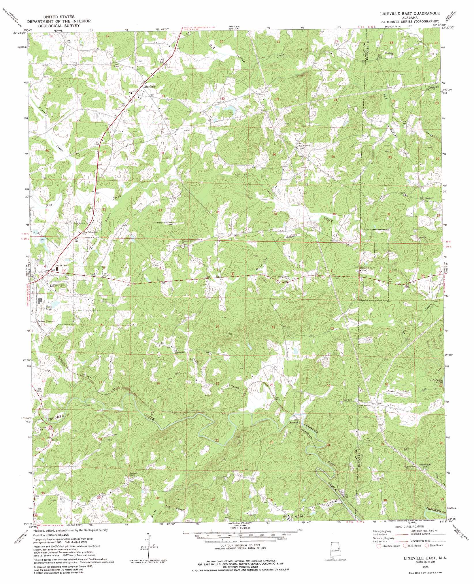
USGS Topo Quad 33085c6 - 1:24,000 scale
| Topo Map Name: | Lineville East |
| USGS Topo Quad ID: | 33085c6 |
| Print Size: | ca. 21 1/4" wide x 27" high |
| Southeast Coordinates: | 33.25° N latitude / 85.625° W longitude |
| Map Center Coordinates: | 33.3125° N latitude / 85.6875° W longitude |
| U.S. State: | AL |
| Filename: | o33085c6.jpg |
| Download Map JPG Image: | Lineville East topo map 1:24,000 scale |
| Map Type: | Topographic |
| Topo Series: | 7.5´ |
| Map Scale: | 1:24,000 |
| Source of Map Images: | United States Geological Survey (USGS) |
| Alternate Map Versions: |
Lineville East AL 1970, updated 1973 Download PDF Buy paper map Lineville East AL 1970, updated 1986 Download PDF Buy paper map Lineville East AL 2011 Download PDF Buy paper map Lineville East AL 2014 Download PDF Buy paper map |
1:24,000 Topo Quads surrounding Lineville East
Munford |
Oxford |
Hollis Crossroads |
Ross Mountain |
Hightower |
Ironaton |
Cheaha Mountain |
Delta |
Micaville |
Newell |
Clairmont Springs |
Lineville West |
Lineville East |
Ofelia |
Wedowee |
Millerville |
Gibsonville |
Mellow Valley |
Wadley North |
Roanoke West |
Hackneyville |
New Site |
Daviston |
Wadley South |
Milltown |
> Back to 33085a1 at 1:100,000 scale
> Back to 33084a1 at 1:250,000 scale
> Back to U.S. Topo Maps home
Lineville East topo map: Gazetteer
Lineville East: Dams
Lineville Dam elevation 292m 958′Lineville East: Mines
Benjamin Prospect elevation 227m 744′Cockrell Placer Mine elevation 232m 761′
Griffin Mine elevation 292m 958′
Grizzel Prospect elevation 230m 754′
Lineville East: Populated Places
Abner (historical) elevation 313m 1026′Barfield elevation 316m 1036′
Berwick elevation 240m 787′
Cragford elevation 262m 859′
Dingler elevation 288m 944′
Shiloh elevation 326m 1069′
Lineville East: Post Offices
Court Hill Post Office (historical) elevation 325m 1066′Flat Rock Post Office (historical) elevation 307m 1007′
Lineville East: Reservoirs
Lineville Club Lake elevation 292m 958′Lineville East: Streams
Buck Creek elevation 275m 902′Hurricane Branch elevation 267m 875′
Jeter Branch elevation 290m 951′
Little Creek elevation 231m 757′
Prairie Creek elevation 295m 967′
Lineville East: Summits
Flat Rock elevation 242m 793′Lineville East digital topo map on disk
Buy this Lineville East topo map showing relief, roads, GPS coordinates and other geographical features, as a high-resolution digital map file on DVD: