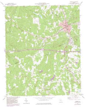
Bremen Topo Map Georgia
To zoom in, hover over the map of Bremen
USGS Topo Quad 33085f2 - 1:24,000 scale
| Topo Map Name: | Bremen |
| USGS Topo Quad ID: | 33085f2 |
| Print Size: | ca. 21 1/4" wide x 27" high |
| Southeast Coordinates: | 33.625° N latitude / 85.125° W longitude |
| Map Center Coordinates: | 33.6875° N latitude / 85.1875° W longitude |
| U.S. State: | GA |
| Filename: | o33085f2.jpg |
| Download Map JPG Image: | Bremen topo map 1:24,000 scale |
| Map Type: | Topographic |
| Topo Series: | 7.5´ |
| Map Scale: | 1:24,000 |
| Source of Map Images: | United States Geological Survey (USGS) |
| Alternate Map Versions: |
Bremen GA 1973, updated 1975 Download PDF Buy paper map Bremen GA 1973, updated 1983 Download PDF Buy paper map Bremen GA 2011 Download PDF Buy paper map Bremen GA 2014 Download PDF Buy paper map |
1:24,000 Topo Quads surrounding Bremen
> Back to 33085e1 at 1:100,000 scale
> Back to 33084a1 at 1:250,000 scale
> Back to U.S. Topo Maps home
Bremen topo map: Gazetteer
Bremen: Airports
West Georgia Regional Airport elevation 345m 1131′Bremen: Crossings
Interchange 2 elevation 390m 1279′Interchange Three elevation 384m 1259′
Bremen: Dams
Bremen Reservoir Lake Dam elevation 345m 1131′Camp Waco Lake Dam elevation 354m 1161′
Godwin Lake Dam elevation 340m 1115′
Miller Lake Dam elevation 325m 1066′
West Lake Dam elevation 344m 1128′
Bremen: Populated Places
Bowdon Junction elevation 377m 1236′Bremen elevation 425m 1394′
Budapest elevation 415m 1361′
Jake elevation 393m 1289′
Mandeville elevation 360m 1181′
Mount Zion elevation 366m 1200′
Waco elevation 421m 1381′
West Crossing elevation 369m 1210′
Bremen: Post Offices
Bremen Post Office elevation 427m 1400′Waco Post Office elevation 416m 1364′
Bremen: Reservoirs
Bremen Reservoir elevation 345m 1131′Camp Waco Lake elevation 354m 1161′
Godwin Lake elevation 340m 1115′
Miller Lake elevation 325m 1066′
Muse Lake elevation 329m 1079′
Swims Lake elevation 320m 1049′
West Lake elevation 344m 1128′
Bremen: Streams
Bush Creek elevation 317m 1040′Little Turkey Creek elevation 329m 1079′
Bremen: Summits
Reeds Mountain elevation 475m 1558′West Hill elevation 384m 1259′
Bremen digital topo map on disk
Buy this Bremen topo map showing relief, roads, GPS coordinates and other geographical features, as a high-resolution digital map file on DVD:


