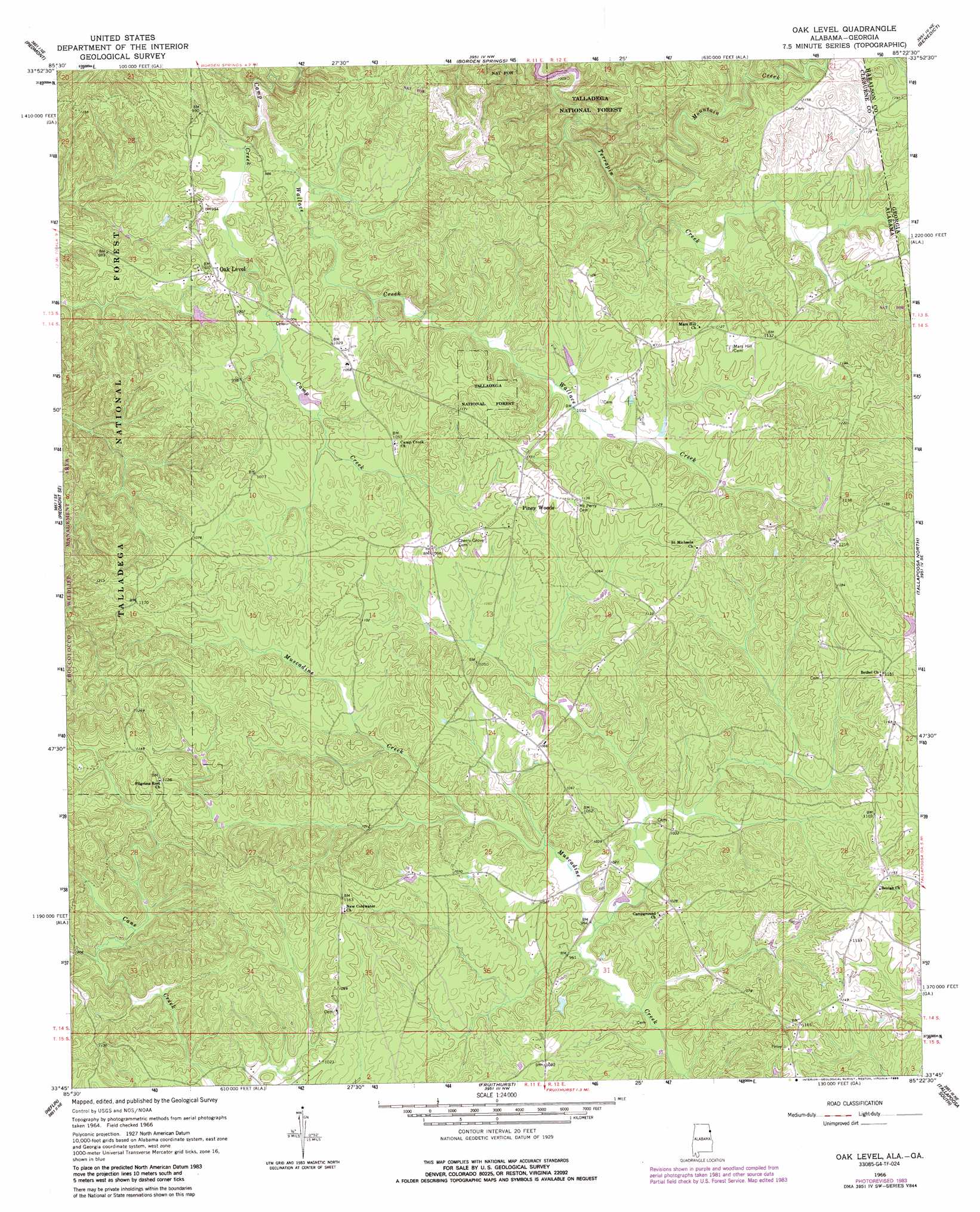
Oak Level Topo Map Alabama
To zoom in, hover over the map of Oak Level
USGS Topo Quad 33085g4 - 1:24,000 scale
| Topo Map Name: | Oak Level |
| USGS Topo Quad ID: | 33085g4 |
| Print Size: | ca. 21 1/4" wide x 27" high |
| Southeast Coordinates: | 33.75° N latitude / 85.375° W longitude |
| Map Center Coordinates: | 33.8125° N latitude / 85.4375° W longitude |
| U.S. States: | AL, GA |
| Filename: | o33085g4.jpg |
| Download Map JPG Image: | Oak Level topo map 1:24,000 scale |
| Map Type: | Topographic |
| Topo Series: | 7.5´ |
| Map Scale: | 1:24,000 |
| Source of Map Images: | United States Geological Survey (USGS) |
| Alternate Map Versions: |
Oak Level AL 1966, updated 1968 Download PDF Buy paper map Oak Level AL 1966, updated 1977 Download PDF Buy paper map Oak Level AL 1966, updated 1985 Download PDF Buy paper map Oak Level AL 1975, updated 1977 Download PDF Buy paper map Oak Level AL 2011 Download PDF Buy paper map Oak Level AL 2014 Download PDF Buy paper map |
| FStopo: | US Forest Service topo Oak Level is available: Download FStopo PDF Download FStopo TIF |
1:24,000 Topo Quads surrounding Oak Level
Weisner Mountain |
Ellisville |
Indian Mountain |
Cedartown West |
Cedartown East |
Piedmont Nw |
Piedmont |
Borden Springs |
Benedict |
Felton |
Jacksonville East |
Piedmont Se |
Oak Level |
Tallapoosa North |
Buchanan |
Choccolocco |
Heflin |
Fruithurst |
Tallapoosa South |
Bremen |
Hollis Crossroads |
Ross Mountain |
Hightower |
Bowdon West |
Bowdon East |
> Back to 33085e1 at 1:100,000 scale
> Back to 33084a1 at 1:250,000 scale
> Back to U.S. Topo Maps home
Oak Level topo map: Gazetteer
Oak Level: Populated Places
Bethel elevation 349m 1145′Coldwater elevation 307m 1007′
Mars Hill elevation 341m 1118′
Oak Level elevation 305m 1000′
Piney Woods elevation 341m 1118′
Oak Level: Streams
Mountain Creek elevation 297m 974′Wallace Creek elevation 304m 997′
Oak Level digital topo map on disk
Buy this Oak Level topo map showing relief, roads, GPS coordinates and other geographical features, as a high-resolution digital map file on DVD: