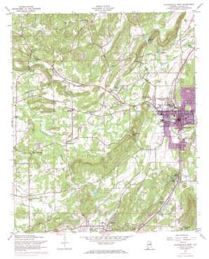
Jacksonville West Topo Map Alabama
To zoom in, hover over the map of Jacksonville West
USGS Topo Quad 33085g7 - 1:24,000 scale
| Topo Map Name: | Jacksonville West |
| USGS Topo Quad ID: | 33085g7 |
| Print Size: | ca. 21 1/4" wide x 27" high |
| Southeast Coordinates: | 33.75° N latitude / 85.75° W longitude |
| Map Center Coordinates: | 33.8125° N latitude / 85.8125° W longitude |
| U.S. State: | AL |
| Filename: | o33085g7.jpg |
| Download Map JPG Image: | Jacksonville West topo map 1:24,000 scale |
| Map Type: | Topographic |
| Topo Series: | 7.5´ |
| Map Scale: | 1:24,000 |
| Source of Map Images: | United States Geological Survey (USGS) |
| Alternate Map Versions: |
Jacksonville AL 1947, updated 1953 Download PDF Buy paper map Jacksonville AL 1956, updated 1960 Download PDF Buy paper map Jacksonville West AL 1956, updated 1973 Download PDF Buy paper map Jacksonville West AL 1956, updated 1973 Download PDF Buy paper map Jacksonville West AL 2011 Download PDF Buy paper map Jacksonville West AL 2014 Download PDF Buy paper map |
1:24,000 Topo Quads surrounding Jacksonville West
> Back to 33085e1 at 1:100,000 scale
> Back to 33084a1 at 1:250,000 scale
> Back to U.S. Topo Maps home
Jacksonville West topo map: Gazetteer
Jacksonville West: Airports
Jacksonville Municipal Airport elevation 217m 711′Reilly AHP Airport elevation 221m 725′
Jacksonville West: Dams
Edward Dam elevation 172m 564′Gray Dam elevation 187m 613′
Keyes Dam elevation 229m 751′
Patterson Dam elevation 174m 570′
Policeman Lake Dam elevation 192m 629′
Jacksonville West: Lakes
Boozers Lake elevation 187m 613′Darbys Lake elevation 246m 807′
Hamiltons Lake elevation 210m 688′
Nesbitt Lake elevation 187m 613′
Jacksonville West: Parks
Askew Field elevation 220m 721′Germany Springs Park elevation 194m 636′
Jacksonville City Park elevation 200m 656′
John Pelham Monument elevation 201m 659′
Memorial Stadium elevation 204m 669′
Jacksonville West: Populated Places
Angel elevation 181m 593′Betta-Life elevation 203m 666′
Blue Springs elevation 202m 662′
Bonny Brook elevation 213m 698′
Booker T City elevation 194m 636′
Brutonville elevation 197m 646′
Cedar Springs elevation 177m 580′
Eastwood elevation 231m 757′
Four Mile elevation 217m 711′
Germania Springs (historical) elevation 204m 669′
Halls Chapel elevation 210m 688′
Jacksonville elevation 216m 708′
June Bug (historical) elevation 213m 698′
Leydens Mill elevation 171m 561′
Mack (historical) elevation 177m 580′
Mount Polk elevation 186m 610′
Pleasant Valley (historical) elevation 219m 718′
Possum Trot elevation 194m 636′
Post Oak elevation 197m 646′
Prickettville elevation 174m 570′
Sulphur Springs elevation 176m 577′
Tredegar elevation 185m 606′
Weaver elevation 228m 748′
West Point elevation 223m 731′
Jacksonville West: Reservoirs
Aderholts Lake elevation 214m 702′Edwards Lake elevation 172m 564′
Keyes Lake elevation 229m 751′
Patterson Lake elevation 174m 570′
Policemen Lake elevation 192m 629′
Jacksonville West: Springs
Big Spring elevation 201m 659′Cedar Spring elevation 176m 577′
Edwards Spring elevation 196m 643′
Fourmile Spring elevation 231m 757′
Germania Spring elevation 195m 639′
Glass Spring elevation 187m 613′
Indian Spring elevation 168m 551′
Kings Spring elevation 179m 587′
Schenks White Sulpher Springs elevation 176m 577′
Seven Springs elevation 178m 583′
Surrett Spring elevation 170m 557′
Tolbert Springs elevation 192m 629′
Jacksonville West: Streams
Flat Tire Creek elevation 183m 600′Hanes Branch elevation 192m 629′
Little Tallasseehatchee Creek elevation 177m 580′
Rabes Branch elevation 173m 567′
Ricks Branch elevation 182m 597′
Sulphur Springs Creek elevation 169m 554′
Weavers Creek elevation 170m 557′
Jacksonville West: Summits
Nesbitt Hill elevation 263m 862′Jacksonville West: Valleys
Maxwell Cove elevation 194m 636′Jacksonville West digital topo map on disk
Buy this Jacksonville West topo map showing relief, roads, GPS coordinates and other geographical features, as a high-resolution digital map file on DVD:


