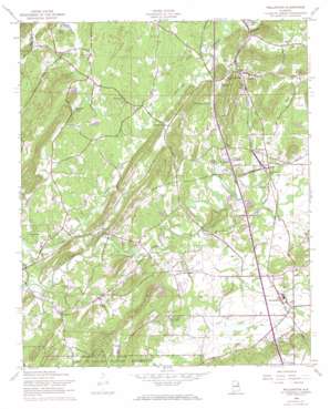
Wellington Topo Map Alabama
To zoom in, hover over the map of Wellington
USGS Topo Quad 33085g8 - 1:24,000 scale
| Topo Map Name: | Wellington |
| USGS Topo Quad ID: | 33085g8 |
| Print Size: | ca. 21 1/4" wide x 27" high |
| Southeast Coordinates: | 33.75° N latitude / 85.875° W longitude |
| Map Center Coordinates: | 33.8125° N latitude / 85.9375° W longitude |
| U.S. State: | AL |
| Filename: | o33085g8.jpg |
| Download Map JPG Image: | Wellington topo map 1:24,000 scale |
| Map Type: | Topographic |
| Topo Series: | 7.5´ |
| Map Scale: | 1:24,000 |
| Source of Map Images: | United States Geological Survey (USGS) |
| Alternate Map Versions: |
Wellington AL 1947, updated 1953 Download PDF Buy paper map Wellington AL 1956, updated 1960 Download PDF Buy paper map Wellington AL 1956, updated 1973 Download PDF Buy paper map Wellington AL 1956, updated 1973 Download PDF Buy paper map Wellington AL 1956, updated 1973 Download PDF Buy paper map Wellington AL 2011 Download PDF Buy paper map Wellington AL 2014 Download PDF Buy paper map |
1:24,000 Topo Quads surrounding Wellington
> Back to 33085e1 at 1:100,000 scale
> Back to 33084a1 at 1:250,000 scale
> Back to U.S. Topo Maps home
Wellington topo map: Gazetteer
Wellington: Dams
Bells Dam elevation 174m 570′Big Oak Dam elevation 175m 574′
Coley Dam elevation 168m 551′
Coley Dam elevation 164m 538′
Donner Dam elevation 165m 541′
Kellys Dam elevation 155m 508′
McCullars Number 1 Dam elevation 168m 551′
McCullars Number 2 Dam elevation 156m 511′
Nunally Dam elevation 175m 574′
Saxon Dam elevation 178m 583′
Thrasher Dam elevation 166m 544′
Wellington: Gaps
Youngblood Gap elevation 171m 561′Wellington: Lakes
Boozers Lake elevation 163m 534′Wellington: Mines
Ohatchee Quarry elevation 161m 528′Wellington: Populated Places
Alexandria elevation 175m 574′Beasley (historical) elevation 174m 570′
Bethel elevation 176m 577′
Chigger Ridge (historical) elevation 168m 551′
Clark (historical) elevation 160m 524′
Crystal Springs elevation 166m 544′
Duke elevation 177m 580′
Grayton elevation 159m 521′
Hebron (historical) elevation 168m 551′
Hill Top (historical) elevation 180m 590′
Ingram Wells elevation 165m 541′
Laney elevation 169m 554′
Lowrimores Crossroads elevation 197m 646′
McCullars (historical) elevation 185m 606′
Melrose elevation 180m 590′
Middleton elevation 165m 541′
Peeks Hill (historical) elevation 170m 557′
Reads Mill elevation 162m 531′
Rudd (historical) elevation 164m 538′
Tallaseehatchee (historical) elevation 164m 538′
Union elevation 169m 554′
Wellington elevation 166m 544′
West Wellington elevation 176m 577′
Woodruff (historical) elevation 168m 551′
Wellington: Post Offices
Martins Crossroads Post Office elevation 167m 547′Rudd Post Office (historical) elevation 164m 538′
Wellington: Ranges
Ohatchee Mountains elevation 225m 738′Wellington: Reservoirs
Bells Lake elevation 174m 570′Big Oak Lake elevation 175m 574′
Coley Lake elevation 168m 551′
Coleys Lake elevation 164m 538′
Crystal Springs Lake elevation 166m 544′
Donner Lake elevation 165m 541′
Kellys Lake elevation 155m 508′
McCullars Lake Number 1 elevation 168m 551′
McCullars Lake Number Two elevation 156m 511′
Samplers Lake elevation 166m 544′
Saxons Lake elevation 178m 583′
Thrasher Lake elevation 166m 544′
Welikee Lake elevation 162m 531′
Wellington: Springs
Alexandria Spring elevation 175m 574′Circle H Spring elevation 167m 547′
Crystal Springs elevation 168m 551′
Hebron Springs elevation 172m 564′
McCullars Spring elevation 164m 538′
Reads Spring elevation 163m 534′
White Willow Spring elevation 165m 541′
Wellington: Streams
Alexandria Creek elevation 151m 495′Battle Creek elevation 154m 505′
Bobs Creek elevation 163m 534′
Boyd Spring Branch elevation 162m 531′
Easterwood Branch elevation 164m 538′
Hales Fork elevation 203m 666′
Havers Creek elevation 153m 501′
Linders Spring Branch elevation 164m 538′
Tallasseehatchee Creek elevation 146m 479′
Virgil Creek elevation 158m 518′
Wellington: Summits
Brook Mountain elevation 271m 889′Chalybeate Mountain elevation 252m 826′
Point Calhoun elevation 199m 652′
Rock Pile Mountain elevation 269m 882′
Wellington: Valleys
Alexandria Valley elevation 152m 498′Wellington digital topo map on disk
Buy this Wellington topo map showing relief, roads, GPS coordinates and other geographical features, as a high-resolution digital map file on DVD:


