Weogufka Topo Map Alabama
To zoom in, hover over the map of Weogufka
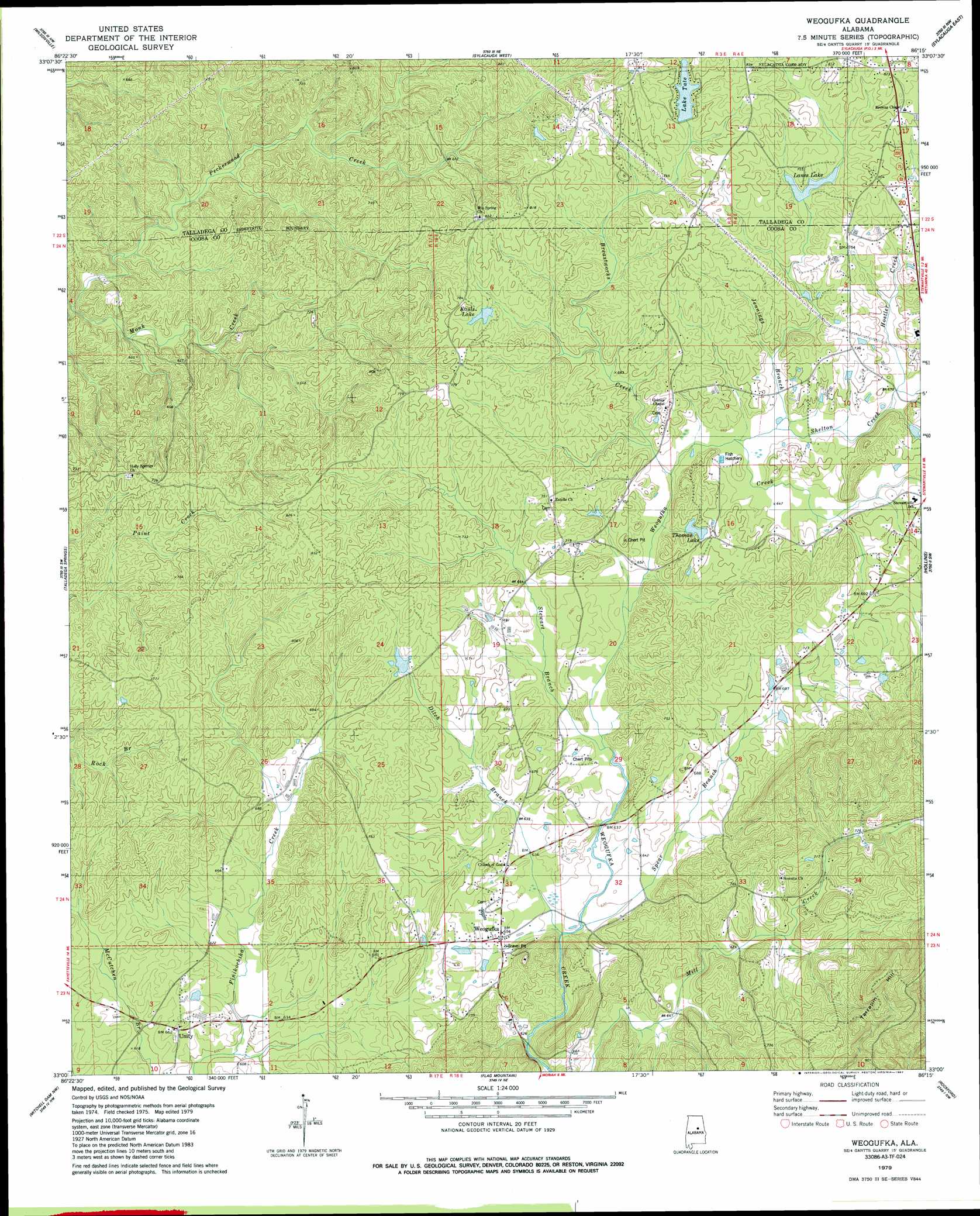
USGS Topo Quad 33086a3 - 1:24,000 scale
| Topo Map Name: | Weogufka |
| USGS Topo Quad ID: | 33086a3 |
| Print Size: | ca. 21 1/4" wide x 27" high |
| Southeast Coordinates: | 33° N latitude / 86.25° W longitude |
| Map Center Coordinates: | 33.0625° N latitude / 86.3125° W longitude |
| U.S. State: | AL |
| Filename: | o33086a3.jpg |
| Download Map JPG Image: | Weogufka topo map 1:24,000 scale |
| Map Type: | Topographic |
| Topo Series: | 7.5´ |
| Map Scale: | 1:24,000 |
| Source of Map Images: | United States Geological Survey (USGS) |
| Alternate Map Versions: |
Weogufka AL 1979, updated 1980 Download PDF Buy paper map Weogufka AL 1979, updated 1987 Download PDF Buy paper map Weogufka AL 2011 Download PDF Buy paper map Weogufka AL 2014 Download PDF Buy paper map |
1:24,000 Topo Quads surrounding Weogufka
Westover |
Harpersville |
Childersburg |
Winterboro |
Porter Gap |
Columbiana |
Wilsonville |
Sylacauga West |
Sylacauga East |
Bulls Gap |
Shelby |
Talladega Springs |
Weogufka |
Hollins |
Goodwater |
Lay Dam |
Mitchell Dam Nw |
Flag Mountain |
Rockford |
Kellyton |
Clanton East |
Mitchell Dam |
Richville |
Rockford Sw |
Equality |
> Back to 33086a1 at 1:100,000 scale
> Back to 33086a1 at 1:250,000 scale
> Back to U.S. Topo Maps home
Weogufka topo map: Gazetteer
Weogufka: Dams
A W Rayfield Dam elevation 221m 725′Cullen Thomas Dam elevation 205m 672′
H Kaul Dam elevation 235m 770′
Lane Dam elevation 219m 718′
Tate Dam elevation 233m 764′
Weogufka: Populated Places
Unity elevation 201m 659′Weogufka elevation 197m 646′
Weogufka: Post Offices
Juniata Post Office (historical) elevation 244m 800′Lumberton Post Office (historical) elevation 251m 823′
Weogufka Post Office elevation 196m 643′
Weogufka: Reservoirs
Kauls Lake elevation 235m 770′Lake Tate elevation 235m 770′
Lanes Lake elevation 223m 731′
Thomas Lake elevation 207m 679′
Weogufka: Streams
Baxley Branch elevation 186m 610′Breastworks Creek elevation 195m 639′
Ditch Branch elevation 185m 606′
Hostler Creek elevation 201m 659′
Jennings Branch elevation 197m 646′
Monk Creek elevation 159m 521′
Shelton Creek elevation 197m 646′
Spear Branch elevation 186m 610′
Stewart Branch elevation 189m 620′
Weogufka: Summits
Baxley Mountain elevation 252m 826′Weogufka digital topo map on disk
Buy this Weogufka topo map showing relief, roads, GPS coordinates and other geographical features, as a high-resolution digital map file on DVD: