Ashville Topo Map Alabama
To zoom in, hover over the map of Ashville
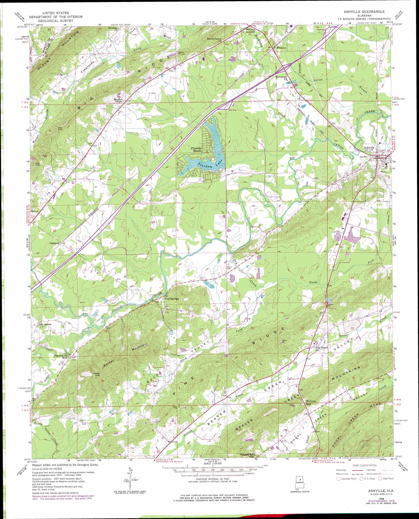
USGS Topo Quad 33086g3 - 1:24,000 scale
| Topo Map Name: | Ashville |
| USGS Topo Quad ID: | 33086g3 |
| Print Size: | ca. 21 1/4" wide x 27" high |
| Southeast Coordinates: | 33.75° N latitude / 86.25° W longitude |
| Map Center Coordinates: | 33.8125° N latitude / 86.3125° W longitude |
| U.S. State: | AL |
| Filename: | o33086g3.jpg |
| Download Map JPG Image: | Ashville topo map 1:24,000 scale |
| Map Type: | Topographic |
| Topo Series: | 7.5´ |
| Map Scale: | 1:24,000 |
| Source of Map Images: | United States Geological Survey (USGS) |
| Alternate Map Versions: |
Ashville AL 1958, updated 1960 Download PDF Buy paper map Ashville AL 1958, updated 1978 Download PDF Buy paper map Ashville AL 1975, updated 1977 Download PDF Buy paper map Ashville AL 2011 Download PDF Buy paper map Ashville AL 2014 Download PDF Buy paper map |
1:24,000 Topo Quads surrounding Ashville
Blountsville |
Clarence |
Altoona |
Howelton |
Gadsden West |
Cleveland |
Oneonta |
Hyatt Gap |
Steele |
Dunaway Mountain |
Remlap |
Springville |
Ashville |
Cox Gap |
Ohatchee |
Argo |
Odenville |
Wattsville |
Ragland |
Francis Mill |
Leeds |
Cooks Springs |
Pell City |
Riverside |
Eastaboga |
> Back to 33086e1 at 1:100,000 scale
> Back to 33086a1 at 1:250,000 scale
> Back to U.S. Topo Maps home
Ashville topo map: Gazetteer
Ashville: Areas
Appalachian Highlands elevation 178m 583′Ashville: Cliffs
Cedar Cliff elevation 351m 1151′Ashville: Crossings
Interchange 166 elevation 177m 580′Ashville: Dams
Cobb Dam elevation 177m 580′Farr Dam elevation 184m 603′
Pinedale Dam elevation 170m 557′
Stolle Dam elevation 185m 606′
Ashville: Gaps
McCrory Gap elevation 206m 675′Ashville: Populated Places
Ashville elevation 172m 564′Caldwell elevation 190m 623′
Cool Springs elevation 177m 580′
Pinedale Shores elevation 176m 577′
Whitney elevation 182m 597′
Whitney Junction elevation 177m 580′
Ashville: Reservoirs
Cobb Lake elevation 177m 580′Farr S Lake elevation 184m 603′
Pinedale Lake elevation 172m 564′
Stolle Lake elevation 185m 606′
Ashville: Ridges
Beaver Creek Mountains elevation 262m 859′Big Ridge elevation 266m 872′
Ashville: Streams
Dry Creek elevation 171m 561′Left Hand Prong Little Canoe Creek elevation 177m 580′
Little Canoe Creek elevation 177m 580′
Locust Branch elevation 165m 541′
Muckleroy Creek elevation 169m 554′
North Fork Dry Creek elevation 175m 574′
South Fork Dry Creek elevation 175m 574′
Walker Branch elevation 206m 675′
Ashville: Summits
Barker Mountain elevation 385m 1263′Ashville: Valleys
Bucks Valley elevation 176m 577′Ashville digital topo map on disk
Buy this Ashville topo map showing relief, roads, GPS coordinates and other geographical features, as a high-resolution digital map file on DVD: