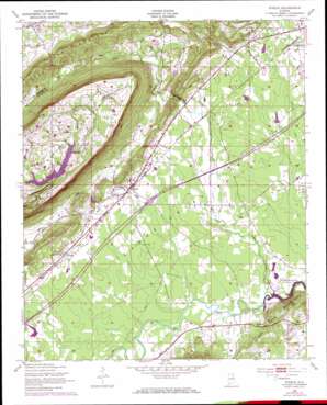
Steele Topo Map Alabama
To zoom in, hover over the map of Steele
USGS Topo Quad 33086h2 - 1:24,000 scale
| Topo Map Name: | Steele |
| USGS Topo Quad ID: | 33086h2 |
| Print Size: | ca. 21 1/4" wide x 27" high |
| Southeast Coordinates: | 33.875° N latitude / 86.125° W longitude |
| Map Center Coordinates: | 33.9375° N latitude / 86.1875° W longitude |
| U.S. State: | AL |
| Filename: | o33086h2.jpg |
| Download Map JPG Image: | Steele topo map 1:24,000 scale |
| Map Type: | Topographic |
| Topo Series: | 7.5´ |
| Map Scale: | 1:24,000 |
| Source of Map Images: | United States Geological Survey (USGS) |
| Alternate Map Versions: |
Steele AL 1947, updated 1953 Download PDF Buy paper map Steele AL 1947, updated 1973 Download PDF Buy paper map Steele AL 1975, updated 1977 Download PDF Buy paper map Steele AL 2011 Download PDF Buy paper map Steele AL 2014 Download PDF Buy paper map |
1:24,000 Topo Quads surrounding Steele
> Back to 33086e1 at 1:100,000 scale
> Back to 33086a1 at 1:250,000 scale
> Back to U.S. Topo Maps home
Steele topo map: Gazetteer
Steele: Arches
Chandler Natural Bridge elevation 207m 679′Steele: Crossings
Interchange 174 elevation 170m 557′Steele: Dams
Chandler Mountain Dam elevation 375m 1230′Ezell Jenkins Dam elevation 408m 1338′
Littles Dam elevation 176m 577′
Pope Dam elevation 181m 593′
Rumac Dam elevation 167m 547′
Wesson Dam elevation 169m 554′
Steele: Populated Places
Gallant elevation 246m 807′Gilbert elevation 195m 639′
Hood elevation 161m 528′
Ramsey elevation 188m 616′
Shahan (historical) elevation 197m 646′
Shiloh elevation 182m 597′
Steele elevation 177m 580′
Steele: Post Offices
Steele Post Office elevation 179m 587′Steele: Reservoirs
Chandler Mountain Lake elevation 375m 1230′Ezell Jenkins Lake elevation 408m 1338′
Lake Rumac elevation 168m 551′
Littles Lake elevation 176m 577′
Pope Lake elevation 181m 593′
Wessons Lake elevation 169m 554′
Steele: Springs
Shirley Spring elevation 180m 590′Steele: Streams
Little Canoe Creek elevation 155m 508′Millers Creek elevation 204m 669′
Steele: Summits
Red Mountain elevation 303m 994′Steele: Valleys
Canoe Creek Valley elevation 158m 518′Steele digital topo map on disk
Buy this Steele topo map showing relief, roads, GPS coordinates and other geographical features, as a high-resolution digital map file on DVD:


