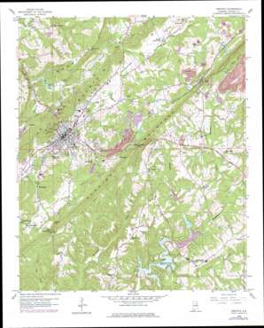
Oneonta Topo Map Alabama
To zoom in, hover over the map of Oneonta
USGS Topo Quad 33086h4 - 1:24,000 scale
| Topo Map Name: | Oneonta |
| USGS Topo Quad ID: | 33086h4 |
| Print Size: | ca. 21 1/4" wide x 27" high |
| Southeast Coordinates: | 33.875° N latitude / 86.375° W longitude |
| Map Center Coordinates: | 33.9375° N latitude / 86.4375° W longitude |
| U.S. State: | AL |
| Filename: | o33086h4.jpg |
| Download Map JPG Image: | Oneonta topo map 1:24,000 scale |
| Map Type: | Topographic |
| Topo Series: | 7.5´ |
| Map Scale: | 1:24,000 |
| Source of Map Images: | United States Geological Survey (USGS) |
| Alternate Map Versions: |
Oneonta AL 1958, updated 1960 Download PDF Buy paper map Oneonta AL 1958, updated 1972 Download PDF Buy paper map Oneonta AL 1958, updated 1978 Download PDF Buy paper map Oneonta AL 1975, updated 1977 Download PDF Buy paper map Oneonta AL 2011 Download PDF Buy paper map Oneonta AL 2014 Download PDF Buy paper map |
1:24,000 Topo Quads surrounding Oneonta
> Back to 33086e1 at 1:100,000 scale
> Back to 33086a1 at 1:250,000 scale
> Back to U.S. Topo Maps home
Oneonta topo map: Gazetteer
Oneonta: Airports
Robbins Field elevation 330m 1082′Oneonta: Areas
Rolling Fields elevation 331m 1085′Oneonta: Dams
Doctor Pattons Lower Lake Dam elevation 258m 846′Highland Lake Dam elevation 278m 912′
McKay Lake Dam elevation 284m 931′
McPherson Dam elevation 240m 787′
Robbins Lake Dam elevation 311m 1020′
Sugarland Lake Dam elevation 297m 974′
Vandegrift Pond Dam elevation 262m 859′
Whited Lake Dam elevation 233m 764′
Will Engle Dam elevation 296m 971′
Oneonta: Gaps
Spout Spring Gap elevation 286m 938′Taits Gap elevation 300m 984′
The Narrows elevation 259m 849′
Oneonta: Mines
Bennett Mine elevation 299m 980′Robin Coal Mines elevation 317m 1040′
Taits Gap Drift Mine elevation 342m 1122′
Oneonta: Parks
Oneonta Recreation Park elevation 261m 856′Woodland Park elevation 270m 885′
Oneonta: Populated Places
Appalachian elevation 341m 1118′Champion elevation 292m 958′
Chepultepec elevation 241m 790′
Eastwood elevation 287m 941′
Highland Lake elevation 273m 895′
Hoods Crossroads elevation 238m 780′
Mattawana elevation 236m 774′
Murphree elevation 244m 800′
Oneonta elevation 262m 859′
Straight Mountain elevation 348m 1141′
Taits Gap elevation 332m 1089′
Oneonta: Post Offices
Murphrees Valley Post Office (historical) elevation 240m 787′Oneonta Post Office elevation 267m 875′
Oneonta: Reservoirs
Doctor Pattons Lower Lake elevation 258m 846′Highland Lake elevation 273m 895′
Ingram Lake elevation 245m 803′
McKay Lake elevation 284m 931′
McPherson Lake elevation 240m 787′
Robbins Lake elevation 311m 1020′
Sugarland Lake elevation 297m 974′
Vandegrift Pond elevation 262m 859′
Whited Lake elevation 227m 744′
Will Engle Lake elevation 296m 971′
Oneonta: Streams
Brasher Creek elevation 273m 895′Champion Creek elevation 241m 790′
Harris Creek elevation 239m 784′
Hoods Creek elevation 246m 807′
Jourden Creek elevation 277m 908′
Sand Creek elevation 273m 895′
Oneonta: Summits
Iron Mountain elevation 300m 984′Oneonta digital topo map on disk
Buy this Oneonta topo map showing relief, roads, GPS coordinates and other geographical features, as a high-resolution digital map file on DVD:


