Ralph Topo Map Alabama
To zoom in, hover over the map of Ralph
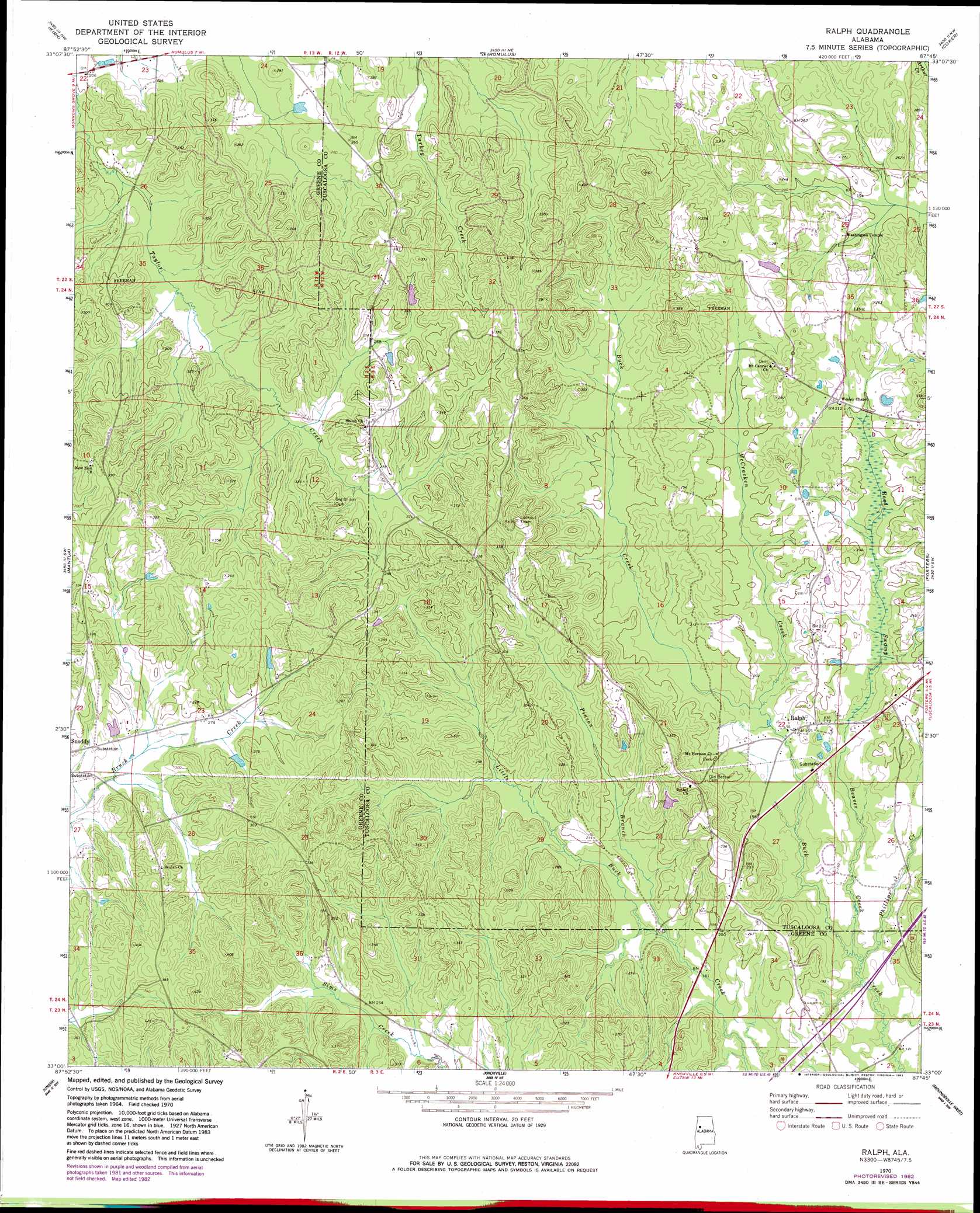
USGS Topo Quad 33087a7 - 1:24,000 scale
| Topo Map Name: | Ralph |
| USGS Topo Quad ID: | 33087a7 |
| Print Size: | ca. 21 1/4" wide x 27" high |
| Southeast Coordinates: | 33° N latitude / 87.75° W longitude |
| Map Center Coordinates: | 33.0625° N latitude / 87.8125° W longitude |
| U.S. State: | AL |
| Filename: | o33087a7.jpg |
| Download Map JPG Image: | Ralph topo map 1:24,000 scale |
| Map Type: | Topographic |
| Topo Series: | 7.5´ |
| Map Scale: | 1:24,000 |
| Source of Map Images: | United States Geological Survey (USGS) |
| Alternate Map Versions: |
Ralph AL 1970, updated 1972 Download PDF Buy paper map Ralph AL 1970, updated 1983 Download PDF Buy paper map Ralph AL 2011 Download PDF Buy paper map Ralph AL 2014 Download PDF Buy paper map |
1:24,000 Topo Quads surrounding Ralph
Carrollton |
Gordo |
Elrod |
Lake Lurleen |
Lake Tuscaloosa South |
Cunningham |
Kirk |
Romulus |
Coker |
Tuscaloosa |
Pleasant Ridge |
Mantua |
Ralph |
Fosters |
Englewood |
West Greene |
Union |
Knoxville |
Moundville West |
Moundville East |
Boligee |
Eutaw |
Warrior Dam |
Sawyerville |
Ingram |
> Back to 33087a1 at 1:100,000 scale
> Back to 33086a1 at 1:250,000 scale
> Back to U.S. Topo Maps home
Ralph topo map: Gazetteer
Ralph: Dams
Shechi Lake Dam Number Two elevation 69m 226′Ralph: Populated Places
Ralph elevation 48m 157′Shadowood elevation 63m 206′
Ralph: Post Offices
Ralph Post Office elevation 48m 157′Ralph: Reservoirs
Shechi Lake Number Two elevation 69m 226′Ralph: Springs
Copperas Springs elevation 62m 203′Ralph: Streams
Beaver Creek elevation 36m 118′McCracken Creek elevation 46m 150′
Phillips Creek elevation 36m 118′
Pinson Branch elevation 49m 160′
Ralph: Swamps
Reed Swamp elevation 52m 170′Ralph digital topo map on disk
Buy this Ralph topo map showing relief, roads, GPS coordinates and other geographical features, as a high-resolution digital map file on DVD: