Mantua Topo Map Alabama
To zoom in, hover over the map of Mantua
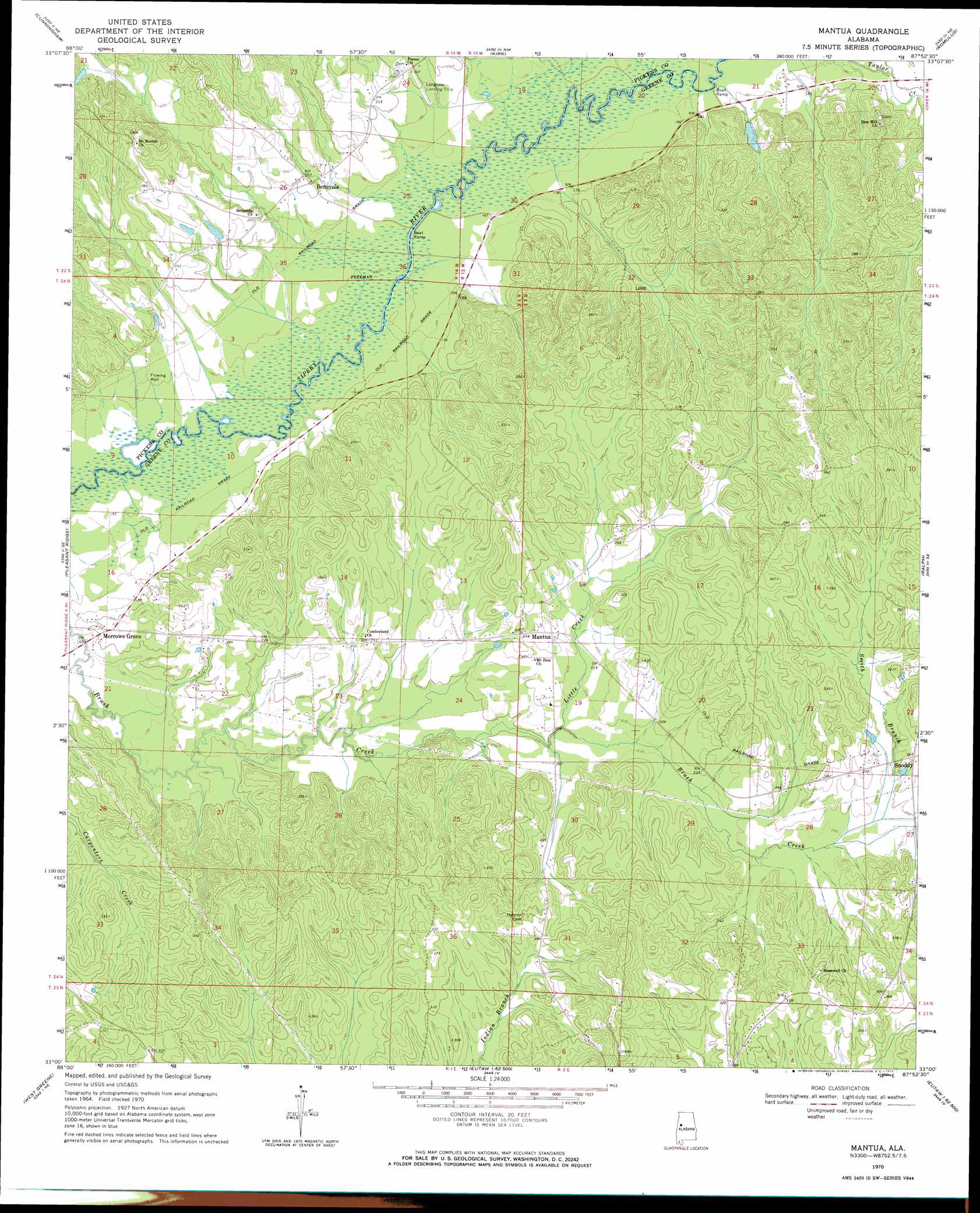
USGS Topo Quad 33087a8 - 1:24,000 scale
| Topo Map Name: | Mantua |
| USGS Topo Quad ID: | 33087a8 |
| Print Size: | ca. 21 1/4" wide x 27" high |
| Southeast Coordinates: | 33° N latitude / 87.875° W longitude |
| Map Center Coordinates: | 33.0625° N latitude / 87.9375° W longitude |
| U.S. State: | AL |
| Filename: | o33087a8.jpg |
| Download Map JPG Image: | Mantua topo map 1:24,000 scale |
| Map Type: | Topographic |
| Topo Series: | 7.5´ |
| Map Scale: | 1:24,000 |
| Source of Map Images: | United States Geological Survey (USGS) |
| Alternate Map Versions: |
Mantua AL 1970, updated 1972 Download PDF Buy paper map Mantua AL 1970, updated 1972 Download PDF Buy paper map Mantua AL 2011 Download PDF Buy paper map Mantua AL 2014 Download PDF Buy paper map |
1:24,000 Topo Quads surrounding Mantua
Reform Sw |
Carrollton |
Gordo |
Elrod |
Lake Lurleen |
Aliceville North |
Cunningham |
Kirk |
Romulus |
Coker |
Aliceville South |
Pleasant Ridge |
Mantua |
Ralph |
Fosters |
Warsaw |
West Greene |
Union |
Knoxville |
Moundville West |
Gainesville |
Boligee |
Eutaw |
Warrior Dam |
Sawyerville |
> Back to 33087a1 at 1:100,000 scale
> Back to 33086a1 at 1:250,000 scale
> Back to U.S. Topo Maps home
Mantua topo map: Gazetteer
Mantua: Bridges
Baileys Bridge (historical) elevation 52m 170′Cottons Bridge (historical) elevation 49m 160′
Mantua: Populated Places
Benevola elevation 61m 200′Mantua elevation 75m 246′
Morrows Grove elevation 63m 206′
Snoddy elevation 83m 272′
Mantua: Post Offices
Mantua Post Office elevation 75m 246′Mantua: Streams
Box Creek elevation 49m 160′Little Creek elevation 61m 200′
Smith Branch elevation 70m 229′
Mantua digital topo map on disk
Buy this Mantua topo map showing relief, roads, GPS coordinates and other geographical features, as a high-resolution digital map file on DVD: