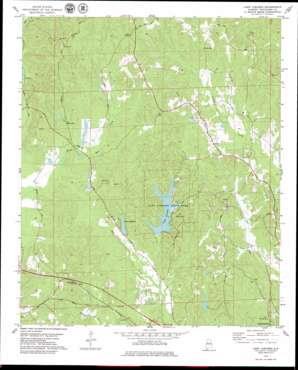
Lake Lurleen Topo Map Alabama
To zoom in, hover over the map of Lake Lurleen
USGS Topo Quad 33087c6 - 1:24,000 scale
| Topo Map Name: | Lake Lurleen |
| USGS Topo Quad ID: | 33087c6 |
| Print Size: | ca. 21 1/4" wide x 27" high |
| Southeast Coordinates: | 33.25° N latitude / 87.625° W longitude |
| Map Center Coordinates: | 33.3125° N latitude / 87.6875° W longitude |
| U.S. State: | AL |
| Filename: | o33087c6.jpg |
| Download Map JPG Image: | Lake Lurleen topo map 1:24,000 scale |
| Map Type: | Topographic |
| Topo Series: | 7.5´ |
| Map Scale: | 1:24,000 |
| Source of Map Images: | United States Geological Survey (USGS) |
| Alternate Map Versions: |
Lake Lurleen AL 1978, updated 1983 Download PDF Buy paper map Lake Lurleen AL 1978, updated 1987 Download PDF Buy paper map Lake Lurleen AL 2011 Download PDF Buy paper map Lake Lurleen AL 2014 Download PDF Buy paper map |
1:24,000 Topo Quads surrounding Lake Lurleen
> Back to 33087a1 at 1:100,000 scale
> Back to 33086a1 at 1:250,000 scale
> Back to U.S. Topo Maps home
Lake Lurleen topo map: Gazetteer
Lake Lurleen: Dams
Elledge Lake Dam elevation 64m 209′Lake Anedna Dam elevation 66m 216′
Lake Lurleen Dam elevation 62m 203′
Mills Lake Dam Lower elevation 86m 282′
Lake Lurleen: Parks
Lake Lurleen State Park elevation 71m 232′Lake Lurleen: Populated Places
Arnedra Subdivision elevation 89m 291′Bel Air Estates elevation 73m 239′
Chapelwood elevation 78m 255′
Cloverdale Estates elevation 72m 236′
Highview elevation 98m 321′
Mount Olive elevation 101m 331′
Saratoga Estates elevation 79m 259′
Shirley elevation 78m 255′
Thorndale elevation 102m 334′
Western Hills elevation 69m 226′
Western Hills Estates elevation 69m 226′
Westhill elevation 75m 246′
Lake Lurleen: Reservoirs
Elledge Lake elevation 64m 209′Lake Arnedra elevation 70m 229′
Lake Lurleen elevation 69m 226′
Mills Lake Lower elevation 86m 282′
Lake Lurleen: Streams
Hughes Mill Creek elevation 77m 252′Lake Lurleen digital topo map on disk
Buy this Lake Lurleen topo map showing relief, roads, GPS coordinates and other geographical features, as a high-resolution digital map file on DVD:


