Palmetto Topo Map Alabama
To zoom in, hover over the map of Palmetto
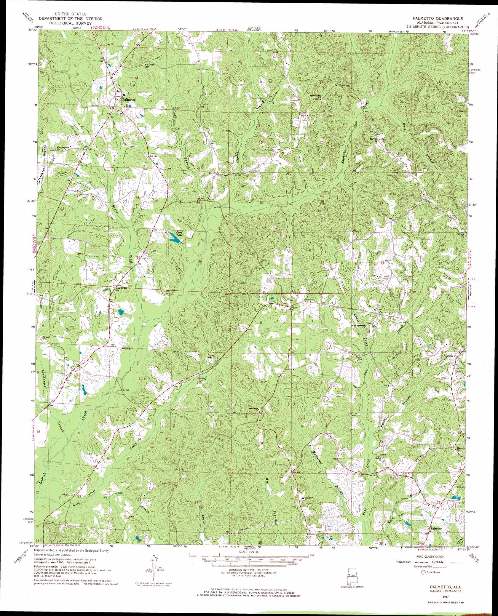
USGS Topo Quad 33087d8 - 1:24,000 scale
| Topo Map Name: | Palmetto |
| USGS Topo Quad ID: | 33087d8 |
| Print Size: | ca. 21 1/4" wide x 27" high |
| Southeast Coordinates: | 33.375° N latitude / 87.875° W longitude |
| Map Center Coordinates: | 33.4375° N latitude / 87.9375° W longitude |
| U.S. State: | AL |
| Filename: | o33087d8.jpg |
| Download Map JPG Image: | Palmetto topo map 1:24,000 scale |
| Map Type: | Topographic |
| Topo Series: | 7.5´ |
| Map Scale: | 1:24,000 |
| Source of Map Images: | United States Geological Survey (USGS) |
| Alternate Map Versions: |
Palmetto AL 1967, updated 1968 Download PDF Buy paper map Palmetto AL 1967, updated 1968 Download PDF Buy paper map Palmetto AL 2011 Download PDF Buy paper map Palmetto AL 2014 Download PDF Buy paper map |
1:24,000 Topo Quads surrounding Palmetto
Millport Nw |
Hightogy |
Belk |
Fayette |
Bankston |
Fernbank |
Millport |
Kennedy |
Newtonville |
New Lexington |
Ethelsville |
Reform |
Palmetto |
Brownville |
Gin Creek |
Reform Sw |
Carrollton |
Gordo |
Elrod |
Lake Lurleen |
Aliceville North |
Cunningham |
Kirk |
Romulus |
Coker |
> Back to 33087a1 at 1:100,000 scale
> Back to 33086a1 at 1:250,000 scale
> Back to U.S. Topo Maps home
Palmetto topo map: Gazetteer
Palmetto: Dams
Orrs Lake Dam elevation 86m 282′Palmetto: Populated Places
Fairview elevation 121m 396′Palmetto elevation 110m 360′
Zion elevation 135m 442′
Palmetto: Reservoirs
Orrs Lake elevation 95m 311′Palmetto: Streams
Beaver Creek elevation 76m 249′Duck Branch elevation 83m 272′
Duck Branch elevation 95m 311′
Elmore Creek elevation 94m 308′
Harper Branch elevation 88m 288′
Higdon Branch elevation 82m 269′
Koon Branch elevation 82m 269′
Linebarger Branch elevation 70m 229′
Mullican Branch elevation 82m 269′
No Head Branch elevation 88m 288′
Thornton Branch elevation 101m 331′
Wild Goose Creek elevation 69m 226′
Palmetto digital topo map on disk
Buy this Palmetto topo map showing relief, roads, GPS coordinates and other geographical features, as a high-resolution digital map file on DVD: