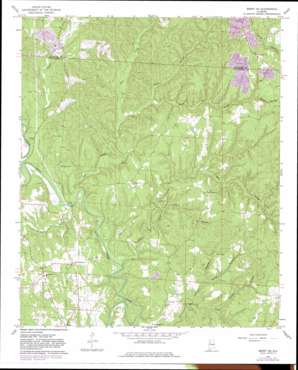
Berry Se Topo Map Alabama
To zoom in, hover over the map of Berry Se
USGS Topo Quad 33087e5 - 1:24,000 scale
| Topo Map Name: | Berry Se |
| USGS Topo Quad ID: | 33087e5 |
| Print Size: | ca. 21 1/4" wide x 27" high |
| Southeast Coordinates: | 33.5° N latitude / 87.5° W longitude |
| Map Center Coordinates: | 33.5625° N latitude / 87.5625° W longitude |
| U.S. State: | AL |
| Filename: | o33087e5.jpg |
| Download Map JPG Image: | Berry Se topo map 1:24,000 scale |
| Map Type: | Topographic |
| Topo Series: | 7.5´ |
| Map Scale: | 1:24,000 |
| Source of Map Images: | United States Geological Survey (USGS) |
| Alternate Map Versions: |
Berry SE AL 1967, updated 1968 Download PDF Buy paper map Berry SE AL 1967, updated 1979 Download PDF Buy paper map Berry SE AL 1967, updated 1983 Download PDF Buy paper map Berry SE AL 2011 Download PDF Buy paper map Berry SE AL 2014 Download PDF Buy paper map |
1:24,000 Topo Quads surrounding Berry Se
> Back to 33087e1 at 1:100,000 scale
> Back to 33086a1 at 1:250,000 scale
> Back to U.S. Topo Maps home
Berry Se topo map: Gazetteer
Berry Se: Bridges
Wittson Bridge elevation 83m 272′Berry Se: Mines
Meg Mine elevation 124m 406′North River Number 1 Mine elevation 108m 354′
Union Grove Mine elevation 190m 623′
Berry Se: Populated Places
Gorgas elevation 144m 472′Berry Se: Springs
Bethlehem Church Spring elevation 129m 423′Berry Se: Streams
Bear Creek elevation 78m 255′Boone Creek elevation 82m 269′
Brand Branch elevation 97m 318′
Cedar Creek elevation 94m 308′
Dry Branch elevation 85m 278′
Finley Branch elevation 97m 318′
Johnson Branch elevation 90m 295′
Little Tyro Creek elevation 93m 305′
Tyro Creek elevation 80m 262′
Wallace Branch elevation 96m 314′
Berry Se: Summits
Tyro Creek Hill elevation 142m 465′Berry Se: Valleys
Poplar Hollow elevation 128m 419′Berry Se digital topo map on disk
Buy this Berry Se topo map showing relief, roads, GPS coordinates and other geographical features, as a high-resolution digital map file on DVD:


