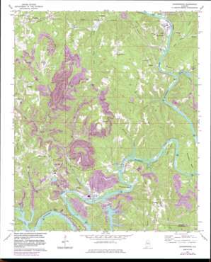
Goodsprings Topo Map Alabama
To zoom in, hover over the map of Goodsprings
USGS Topo Quad 33087f2 - 1:24,000 scale
| Topo Map Name: | Goodsprings |
| USGS Topo Quad ID: | 33087f2 |
| Print Size: | ca. 21 1/4" wide x 27" high |
| Southeast Coordinates: | 33.625° N latitude / 87.125° W longitude |
| Map Center Coordinates: | 33.6875° N latitude / 87.1875° W longitude |
| U.S. State: | AL |
| Filename: | o33087f2.jpg |
| Download Map JPG Image: | Goodsprings topo map 1:24,000 scale |
| Map Type: | Topographic |
| Topo Series: | 7.5´ |
| Map Scale: | 1:24,000 |
| Source of Map Images: | United States Geological Survey (USGS) |
| Alternate Map Versions: |
Goodsprings AL 1971, updated 1973 Download PDF Buy paper map Goodsprings AL 1971, updated 1978 Download PDF Buy paper map Goodsprings AL 1971, updated 1983 Download PDF Buy paper map Goodsprings AL 1971, updated 1983 Download PDF Buy paper map Goodsprings AL 1975, updated 1977 Download PDF Buy paper map Goodsprings AL 2011 Download PDF Buy paper map Goodsprings AL 2014 Download PDF Buy paper map |
1:24,000 Topo Quads surrounding Goodsprings
> Back to 33087e1 at 1:100,000 scale
> Back to 33086a1 at 1:250,000 scale
> Back to U.S. Topo Maps home
Goodsprings topo map: Gazetteer
Goodsprings: Bars
Bee Shoals elevation 76m 249′Birch Shoals elevation 76m 249′
Copeland Shoals elevation 76m 249′
Franklin Shoals elevation 76m 249′
Louis Shoals elevation 76m 249′
Tuggles Shoals elevation 76m 249′
Goodsprings: Bends
Bough Bend elevation 86m 282′Brake Bend elevation 76m 249′
Copeland Bend elevation 96m 314′
Davis Bend elevation 81m 265′
Franklin Bend elevation 120m 393′
Kemps Bend elevation 80m 262′
Payne Bend elevation 92m 301′
Shepherd Bend elevation 122m 400′
Tuggle Bend elevation 88m 288′
Goodsprings: Bridges
Copeland Ferry Bridge elevation 76m 249′Goodsprings: Crossings
Barnett Ferry (historical) elevation 76m 249′Copeland Ferry (historical) elevation 76m 249′
Copeland Ford elevation 76m 249′
Davis Ford elevation 76m 249′
Goodwin Ford elevation 76m 249′
Payne Ferry (historical) elevation 120m 393′
Payne Ferry (historical) elevation 76m 249′
Underwood Ferry (historical) elevation 76m 249′
Goodsprings: Dams
Lock Number Fifteen (historical) elevation 76m 249′Lock Number Fourteen (historical) elevation 76m 249′
Rattlesnake Dam elevation 93m 305′
Strip Mining Impoundment Dam Number 2 elevation 159m 521′
Goodsprings: Mines
Aldridge Mines elevation 115m 377′America Mine elevation 170m 557′
America Number 3 Mine elevation 165m 541′
America Number 4 Mine elevation 143m 469′
Big Ridge Mine elevation 173m 567′
Big Ridge Mine elevation 148m 485′
Butler Number 1 Mine elevation 154m 505′
Clipper Mine elevation 114m 374′
Cobb Mine elevation 152m 498′
Colta Mine elevation 153m 501′
Dalton Mine elevation 177m 580′
Domino Number 2 Mine elevation 131m 429′
Drifton Mine elevation 164m 538′
Drifton Mine elevation 123m 403′
Franklin Bend Mine elevation 92m 301′
Garrison-Dolphus Mine elevation 148m 485′
Goodsprings Mine elevation 178m 583′
Gorgas Mine elevation 123m 403′
Herron Mine elevation 145m 475′
High Level Mine elevation 184m 603′
Hyche Mine elevation 152m 498′
Ivy Bluff Mine elevation 104m 341′
Klondike Mine elevation 174m 570′
Mary Lee Number 2 Mine elevation 146m 479′
Mount Carmel Mine elevation 127m 416′
Odoms Mine elevation 114m 374′
O'Rear Mine elevation 137m 449′
Pate Mine elevation 128m 419′
Riverside Number 1 Mine elevation 123m 403′
Ruby Drift Mine elevation 124m 406′
Samoset Mine elevation 108m 354′
Sullivan Mine elevation 159m 521′
Taft Mine elevation 106m 347′
Wegra Mine elevation 159m 521′
Goodsprings: Populated Places
Aldridge elevation 136m 446′Barney elevation 143m 469′
Big Ridge elevation 135m 442′
Bradleytown elevation 127m 416′
Deason Hill elevation 143m 469′
Dovertown elevation 130m 426′
Drifton elevation 85m 278′
Goodsprings elevation 180m 590′
Gorgas elevation 153m 501′
High Level elevation 95m 311′
Littletons elevation 81m 265′
Pennsylvania Camp (historical) elevation 85m 278′
Pumpkin Center elevation 183m 600′
Ruby (historical) elevation 100m 328′
Samoset elevation 107m 351′
Short Camp elevation 161m 528′
Goodsprings: Reservoirs
Rattlesnake Lake elevation 93m 305′Strip Mining Impoundment Number 2 elevation 159m 521′
Goodsprings: Ridges
Big Ridge elevation 152m 498′Pea Ridge elevation 166m 544′
Goodsprings: Streams
Baker Creek elevation 76m 249′Barton Creek elevation 77m 252′
Big Lick Creek elevation 76m 249′
Cunningham Creek elevation 79m 259′
Fannys Branch elevation 76m 249′
Flat Rock Creek elevation 78m 255′
Horse Creek elevation 79m 259′
Japanese Creek elevation 85m 278′
Jones Creek elevation 77m 252′
Lard Creek elevation 91m 298′
Little Frog Ague Creek elevation 80m 262′
Mosquito Creek elevation 76m 249′
Paynes Creek elevation 79m 259′
Rattlesnake Creek elevation 76m 249′
Twin Slough elevation 76m 249′
Goodsprings: Valleys
Balls Hollow elevation 77m 252′Goodsprings digital topo map on disk
Buy this Goodsprings topo map showing relief, roads, GPS coordinates and other geographical features, as a high-resolution digital map file on DVD:


