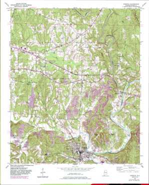
Cordova Topo Map Alabama
To zoom in, hover over the map of Cordova
USGS Topo Quad 33087g2 - 1:24,000 scale
| Topo Map Name: | Cordova |
| USGS Topo Quad ID: | 33087g2 |
| Print Size: | ca. 21 1/4" wide x 27" high |
| Southeast Coordinates: | 33.75° N latitude / 87.125° W longitude |
| Map Center Coordinates: | 33.8125° N latitude / 87.1875° W longitude |
| U.S. State: | AL |
| Filename: | o33087g2.jpg |
| Download Map JPG Image: | Cordova topo map 1:24,000 scale |
| Map Type: | Topographic |
| Topo Series: | 7.5´ |
| Map Scale: | 1:24,000 |
| Source of Map Images: | United States Geological Survey (USGS) |
| Alternate Map Versions: |
Cordova AL 1949, updated 1967 Download PDF Buy paper map Cordova AL 1949, updated 1977 Download PDF Buy paper map Cordova AL 1949, updated 1983 Download PDF Buy paper map Cordova AL 1949, updated 1983 Download PDF Buy paper map Cordova AL 1951 Download PDF Buy paper map Cordova AL 2011 Download PDF Buy paper map Cordova AL 2014 Download PDF Buy paper map |
1:24,000 Topo Quads surrounding Cordova
> Back to 33087e1 at 1:100,000 scale
> Back to 33086a1 at 1:250,000 scale
> Back to U.S. Topo Maps home
Cordova topo map: Gazetteer
Cordova: Bars
Sanders Shoals elevation 77m 252′Cordova: Bends
Barton Bend elevation 79m 259′Benoit Bend elevation 85m 278′
Stovatt Bend elevation 80m 262′
Cordova: Crossings
Bartons Ferry (historical) elevation 78m 255′Sanderson Ferry (historical) elevation 98m 321′
Cordova: Dams
Walker County Public Lake Dam elevation 101m 331′Cordova: Lakes
Sims Ponds elevation 114m 374′Cordova: Mines
Beards Mine elevation 132m 433′Broom Mine elevation 132m 433′
Cordova Mine elevation 147m 482′
Cordova Number 1 Mine elevation 86m 282′
Disney Drift Mine elevation 119m 390′
Oak Leaf Mine elevation 83m 272′
Rice Mine elevation 111m 364′
Riceton Number 5 Mine elevation 113m 370′
Riverside Mine elevation 122m 400′
Samoset Mine elevation 115m 377′
Sulphur Springs Mine elevation 128m 419′
Taft Mine elevation 103m 337′
Cordova: Parks
Hudson-Kirby Stadium elevation 98m 321′Cordova: Pillars
The Pinnacle elevation 165m 541′Cordova: Populated Places
Benoit elevation 92m 301′Boldo elevation 141m 462′
Chapel Hill elevation 131m 429′
Cordova elevation 93m 305′
Corinth elevation 101m 331′
Gardiners Gin elevation 138m 452′
Gobblers Crossing elevation 135m 442′
Lynns Park elevation 100m 328′
Madison Mobile Home Park elevation 116m 380′
Mount Hope elevation 101m 331′
Oak Hill Mobile Home Park elevation 131m 429′
Pine Tree Trailer Park elevation 116m 380′
Red Rock elevation 142m 465′
Sardis elevation 95m 311′
Union Chapel elevation 133m 436′
Uptain Mobile Home Park elevation 140m 459′
Cordova: Post Offices
Crossville Post Office (historical) elevation 90m 295′Cordova: Reservoirs
Walker County Lake elevation 89m 291′Cordova: Streams
Bates Creek elevation 84m 275′Blackwater Creek elevation 77m 252′
Blue Branch elevation 80m 262′
Bullbarn Creek elevation 79m 259′
Cane Creek elevation 83m 272′
Evans Creek elevation 78m 255′
Flat Branch elevation 84m 275′
Frog Ague Creek elevation 78m 255′
Gode Branch elevation 114m 374′
Little Blackwater Creek elevation 77m 252′
Poley Creek elevation 77m 252′
Spokage Creek elevation 84m 275′
Standard Branch elevation 85m 278′
Watts Creek elevation 79m 259′
Cordova: Summits
Reservoir Hill elevation 144m 472′Riceston Hill elevation 178m 583′
Cordova digital topo map on disk
Buy this Cordova topo map showing relief, roads, GPS coordinates and other geographical features, as a high-resolution digital map file on DVD:


