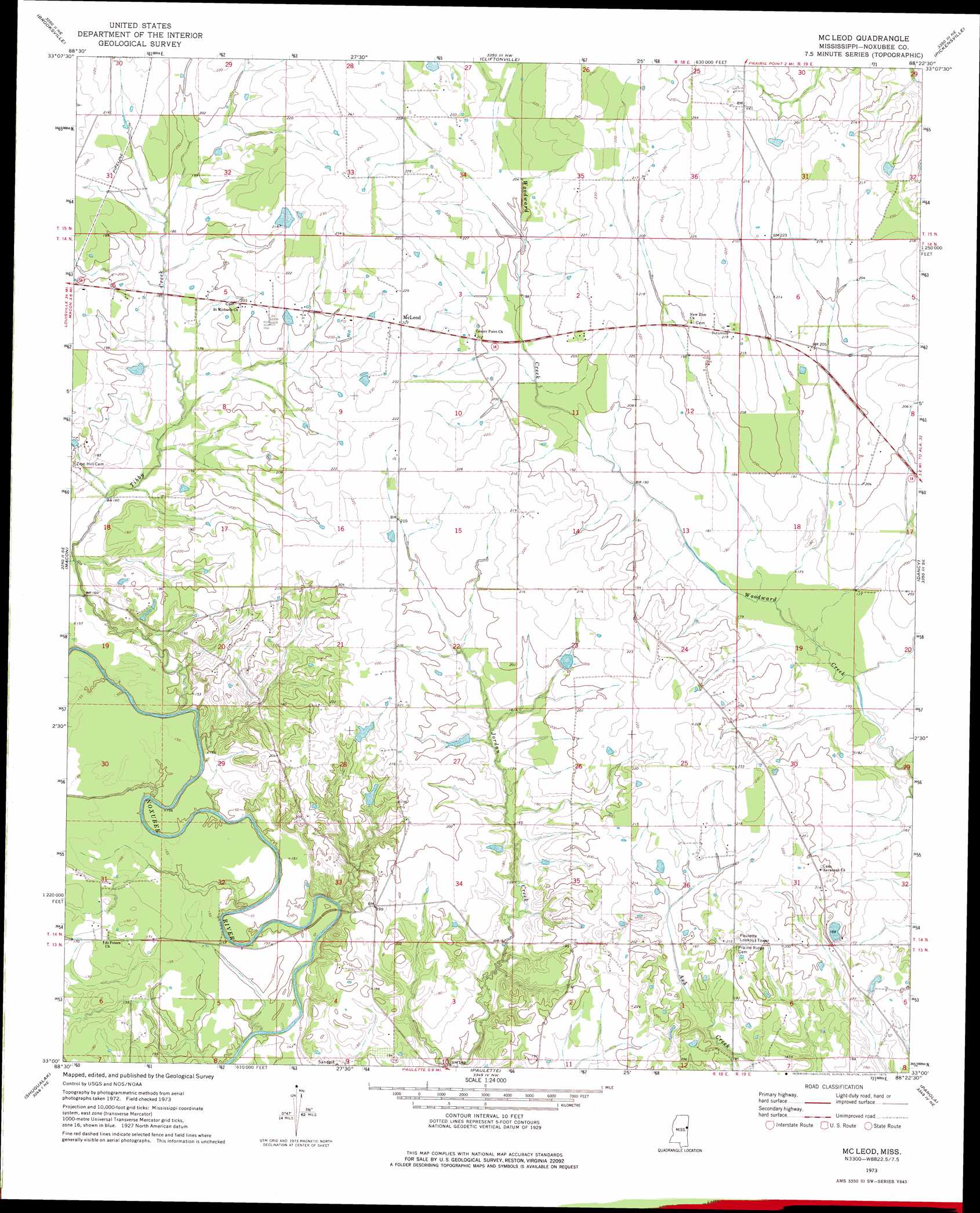
Mcleod Topo Map Mississippi
To zoom in, hover over the map of Mcleod
USGS Topo Quad 33088a4 - 1:24,000 scale
| Topo Map Name: | Mcleod |
| USGS Topo Quad ID: | 33088a4 |
| Print Size: | ca. 21 1/4" wide x 27" high |
| Southeast Coordinates: | 33° N latitude / 88.375° W longitude |
| Map Center Coordinates: | 33.0625° N latitude / 88.4375° W longitude |
| U.S. State: | MS |
| Filename: | o33088a4.jpg |
| Download Map JPG Image: | Mcleod topo map 1:24,000 scale |
| Map Type: | Topographic |
| Topo Series: | 7.5´ |
| Map Scale: | 1:24,000 |
| Source of Map Images: | United States Geological Survey (USGS) |
| Alternate Map Versions: |
McLeod MS 1973, updated 1975 Download PDF Buy paper map McLeod MS 2012 Download PDF Buy paper map McLeod MS 2015 Download PDF Buy paper map |
1:24,000 Topo Quads surrounding Mcleod
Crawford West |
Crawford East |
Trinity |
Forreston |
Reform Sw |
Lynn Creek |
Brooksville |
Cliftonville |
Pickensville |
Aliceville North |
Mashulaville |
Macon |
Mcleod |
Dancy |
Aliceville South |
Gholson |
Shuqualak |
Paulette |
Panola |
Warsaw |
De Kalb |
Townsend |
Scooba |
Geiger |
Gainesville |
> Back to 33088a1 at 1:100,000 scale
> Back to 33088a1 at 1:250,000 scale
> Back to U.S. Topo Maps home
Mcleod topo map: Gazetteer
Mcleod: Dams
Avery Lake Dam elevation 59m 193′Avery Lake Dam elevation 64m 209′
Land Lake Dam elevation 62m 203′
Sellers Lake Dam elevation 57m 187′
Mcleod: Populated Places
Big Lake (historical) elevation 58m 190′Center Point (historical) elevation 64m 209′
Cross Roads (historical) elevation 59m 193′
Harlan (historical) elevation 66m 216′
McLeod elevation 69m 226′
Mcleod: Streams
Tibby Creek elevation 42m 137′Mcleod digital topo map on disk
Buy this Mcleod topo map showing relief, roads, GPS coordinates and other geographical features, as a high-resolution digital map file on DVD: