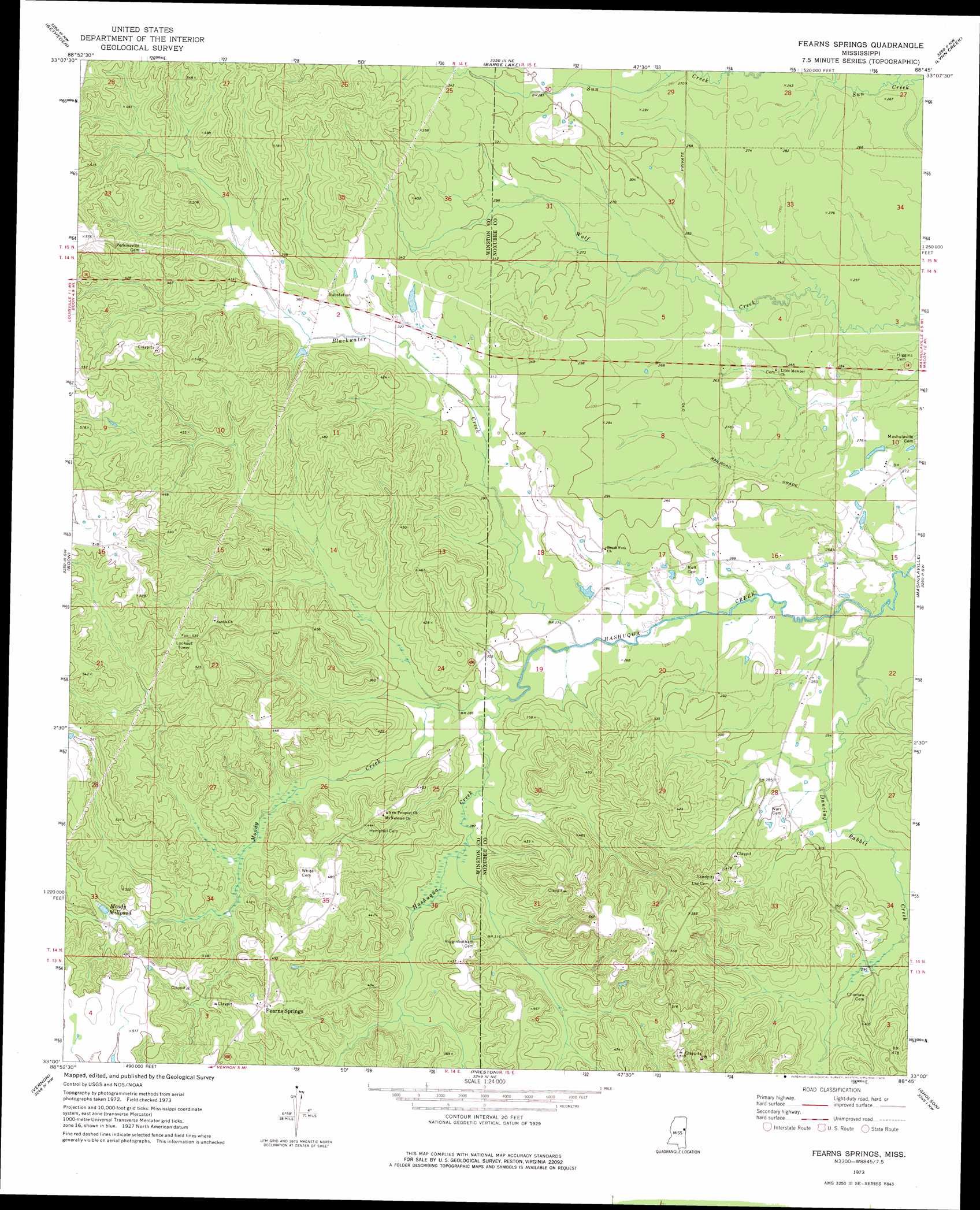
Fearns Springs Topo Map Mississippi
To zoom in, hover over the map of Fearns Springs
USGS Topo Quad 33088a7 - 1:24,000 scale
| Topo Map Name: | Fearns Springs |
| USGS Topo Quad ID: | 33088a7 |
| Print Size: | ca. 21 1/4" wide x 27" high |
| Southeast Coordinates: | 33° N latitude / 88.75° W longitude |
| Map Center Coordinates: | 33.0625° N latitude / 88.8125° W longitude |
| U.S. State: | MS |
| Filename: | o33088a7.jpg |
| Download Map JPG Image: | Fearns Springs topo map 1:24,000 scale |
| Map Type: | Topographic |
| Topo Series: | 7.5´ |
| Map Scale: | 1:24,000 |
| Source of Map Images: | United States Geological Survey (USGS) |
| Alternate Map Versions: |
Fearns Springs MS 1973, updated 1975 Download PDF Buy paper map Fearns Springs MS 2012 Download PDF Buy paper map Fearns Springs MS 2015 Download PDF Buy paper map |
1:24,000 Topo Quads surrounding Fearns Springs
Sturgis |
Bradley |
Bluff Lake |
Crawford West |
Crawford East |
Louisville North |
Betheden |
Barge Lake |
Lynn Creek |
Brooksville |
Louisville South |
Boon |
Fearns Springs |
Mashulaville |
Macon |
Noxapater |
Vernon |
Preston |
Gholson |
Shuqualak |
Philadelphia |
Owl Creek |
Lynville |
De Kalb |
Townsend |
> Back to 33088a1 at 1:100,000 scale
> Back to 33088a1 at 1:250,000 scale
> Back to U.S. Topo Maps home
Fearns Springs topo map: Gazetteer
Fearns Springs: Dams
Triplett Lake Dam elevation 104m 341′Fearns Springs: Populated Places
Fearns Springs elevation 143m 469′Perkinsville (historical) elevation 147m 482′
Triplets Corners elevation 97m 318′
Fearns Springs: Reservoirs
Moody Millpond elevation 114m 374′Fearns Springs: Springs
Dancing Rabbit Springs elevation 121m 396′Fearns Springs: Streams
Blackwater Creek elevation 78m 255′Dancing Rabbit Creek elevation 71m 232′
Moody Creek elevation 79m 259′
Fearns Springs digital topo map on disk
Buy this Fearns Springs topo map showing relief, roads, GPS coordinates and other geographical features, as a high-resolution digital map file on DVD: