Cedar Bluff Topo Map Mississippi
To zoom in, hover over the map of Cedar Bluff
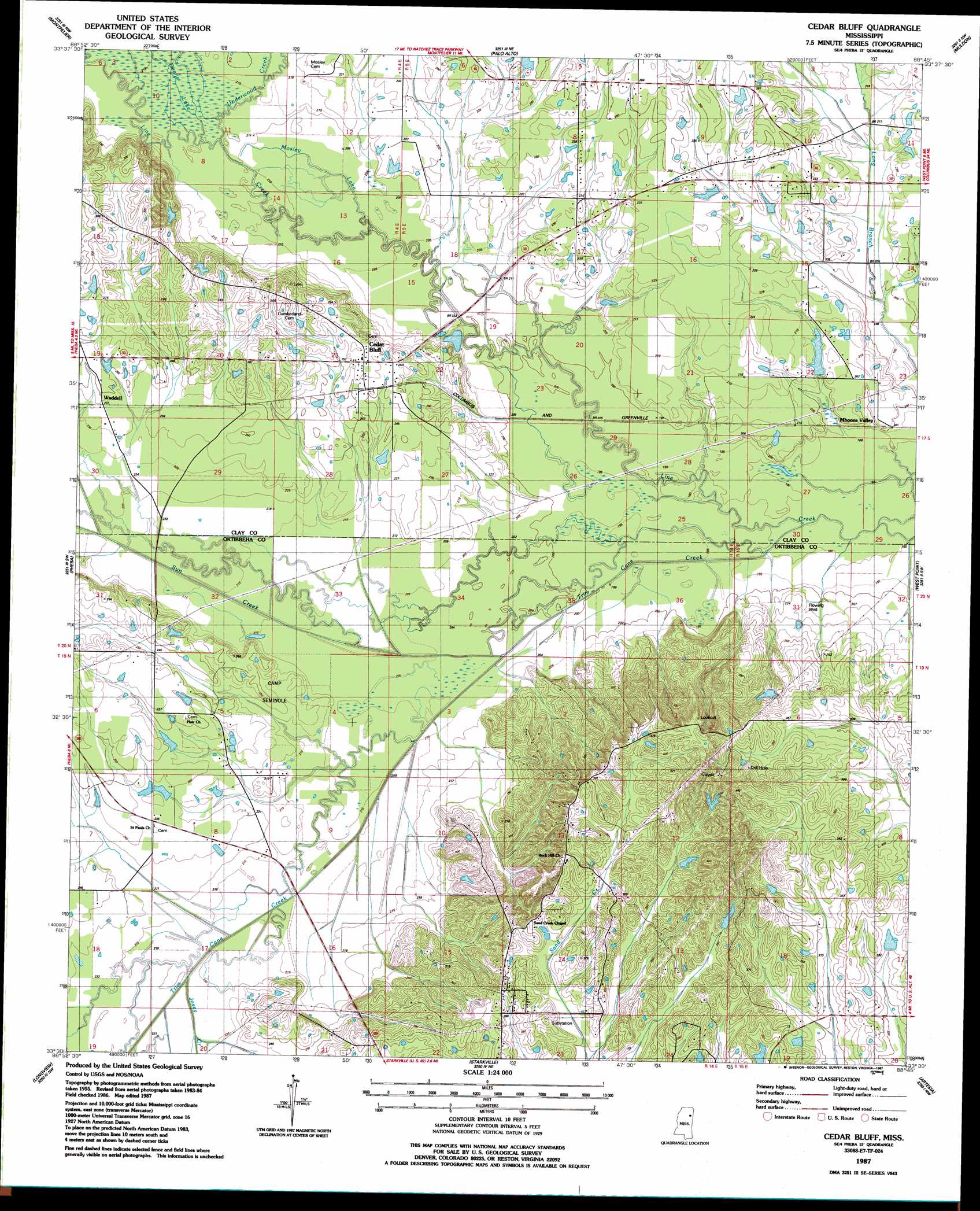
USGS Topo Quad 33088e7 - 1:24,000 scale
| Topo Map Name: | Cedar Bluff |
| USGS Topo Quad ID: | 33088e7 |
| Print Size: | ca. 21 1/4" wide x 27" high |
| Southeast Coordinates: | 33.5° N latitude / 88.75° W longitude |
| Map Center Coordinates: | 33.5625° N latitude / 88.8125° W longitude |
| U.S. State: | MS |
| Filename: | o33088e7.jpg |
| Download Map JPG Image: | Cedar Bluff topo map 1:24,000 scale |
| Map Type: | Topographic |
| Topo Series: | 7.5´ |
| Map Scale: | 1:24,000 |
| Source of Map Images: | United States Geological Survey (USGS) |
| Alternate Map Versions: |
Cedar Bluff MS 1987, updated 1987 Download PDF Buy paper map Cedar Bluff MS 2012 Download PDF Buy paper map Cedar Bluff MS 2015 Download PDF Buy paper map |
1:24,000 Topo Quads surrounding Cedar Bluff
Woodland |
Sparta |
Trebloc |
Prairie |
Aberdeen |
Mantee |
Montpelier |
Palo Alto |
Muldon |
Strong |
Maben |
Pheba |
Cedar Bluff |
West Point |
Waverly |
Double Springs |
Longview |
Starkville |
Artesia |
Bent Oak |
Sturgis |
Bradley |
Bluff Lake |
Crawford West |
Crawford East |
> Back to 33088e1 at 1:100,000 scale
> Back to 33088a1 at 1:250,000 scale
> Back to U.S. Topo Maps home
Cedar Bluff topo map: Gazetteer
Cedar Bluff: Dams
Bock Lake Dam elevation 101m 331′Hawkins Lake Dam elevation 62m 203′
Henderson Lake Dam elevation 67m 219′
Jennings Lake Dam elevation 70m 229′
Portera Lake Dam elevation 63m 206′
Stacy Lake Dam elevation 107m 351′
Cedar Bluff: Populated Places
Cedar Bluff elevation 81m 265′Mhoons Valley elevation 62m 203′
Plairs elevation 76m 249′
Rocky Hill elevation 116m 380′
Waddell elevation 72m 236′
Cedar Bluff: Streams
Deans Lake elevation 63m 206′Josey Creek elevation 63m 206′
Mosley Lake elevation 60m 196′
Sun Creek elevation 60m 196′
Trim Cane Creek elevation 56m 183′
Underwood Creek elevation 62m 203′
Cedar Bluff digital topo map on disk
Buy this Cedar Bluff topo map showing relief, roads, GPS coordinates and other geographical features, as a high-resolution digital map file on DVD: