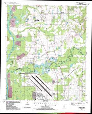
Hamilton Topo Map Mississippi
To zoom in, hover over the map of Hamilton
USGS Topo Quad 33088f4 - 1:24,000 scale
| Topo Map Name: | Hamilton |
| USGS Topo Quad ID: | 33088f4 |
| Print Size: | ca. 21 1/4" wide x 27" high |
| Southeast Coordinates: | 33.625° N latitude / 88.375° W longitude |
| Map Center Coordinates: | 33.6875° N latitude / 88.4375° W longitude |
| U.S. State: | MS |
| Filename: | o33088f4.jpg |
| Download Map JPG Image: | Hamilton topo map 1:24,000 scale |
| Map Type: | Topographic |
| Topo Series: | 7.5´ |
| Map Scale: | 1:24,000 |
| Source of Map Images: | United States Geological Survey (USGS) |
| Alternate Map Versions: |
Hamilton MS 1987, updated 1987 Download PDF Buy paper map Hamilton MS 2012 Download PDF Buy paper map Hamilton MS 2015 Download PDF Buy paper map |
1:24,000 Topo Quads surrounding Hamilton
> Back to 33088e1 at 1:100,000 scale
> Back to 33088a1 at 1:250,000 scale
> Back to U.S. Topo Maps home
Hamilton topo map: Gazetteer
Hamilton: Bends
Horseshoe Bend elevation 52m 170′Travis Lott Bend elevation 51m 167′
Hamilton: Channels
Barton Ferry Cutoff elevation 48m 157′Cane Creek Cutoff elevation 56m 183′
Denmon Cutoff elevation 49m 160′
Lockridge Creek Cutoff elevation 49m 160′
McKinley Creek Cutoff elevation 49m 160′
New Hamilton Cutoff elevation 49m 160′
Richardson Lake Cutoff elevation 49m 160′
Vinton Cutoff elevation 49m 160′
Hamilton: Crossings
Bartons Ferry (historical) elevation 51m 167′Doalms Ferry (historical) elevation 55m 180′
Indian Ford (historical) elevation 52m 170′
Hamilton: Dams
J G Fairchilds Pond Dam elevation 71m 232′Ker Magee Lake Dam elevation 65m 213′
Hamilton: Flats
Shell Field elevation 55m 180′Hamilton: Lakes
Mealer Lake (historical) elevation 52m 170′Otter Lake (historical) elevation 49m 160′
Hamilton: Oilfields
Corinne Gas Field elevation 54m 177′Hamilton Gas Field elevation 74m 242′
Maple Branch Gas Field elevation 63m 206′
McKinley Creek Gas Field elevation 58m 190′
Hamilton: Parks
McKinley Creek Access Area elevation 55m 180′Hamilton: Populated Places
Chins Springs (historical) elevation 62m 203′Hamilton elevation 74m 242′
Kolola Springs elevation 68m 223′
New Hamilton elevation 68m 223′
Hamilton: Streams
Cedar Grove Creek elevation 61m 200′Denman Branch elevation 52m 170′
Maple Branch elevation 63m 206′
McKinley Creek elevation 50m 164′
Running Slu elevation 61m 200′
Wilson Creek elevation 61m 200′
Hamilton digital topo map on disk
Buy this Hamilton topo map showing relief, roads, GPS coordinates and other geographical features, as a high-resolution digital map file on DVD:


