Muldon Topo Map Mississippi
To zoom in, hover over the map of Muldon
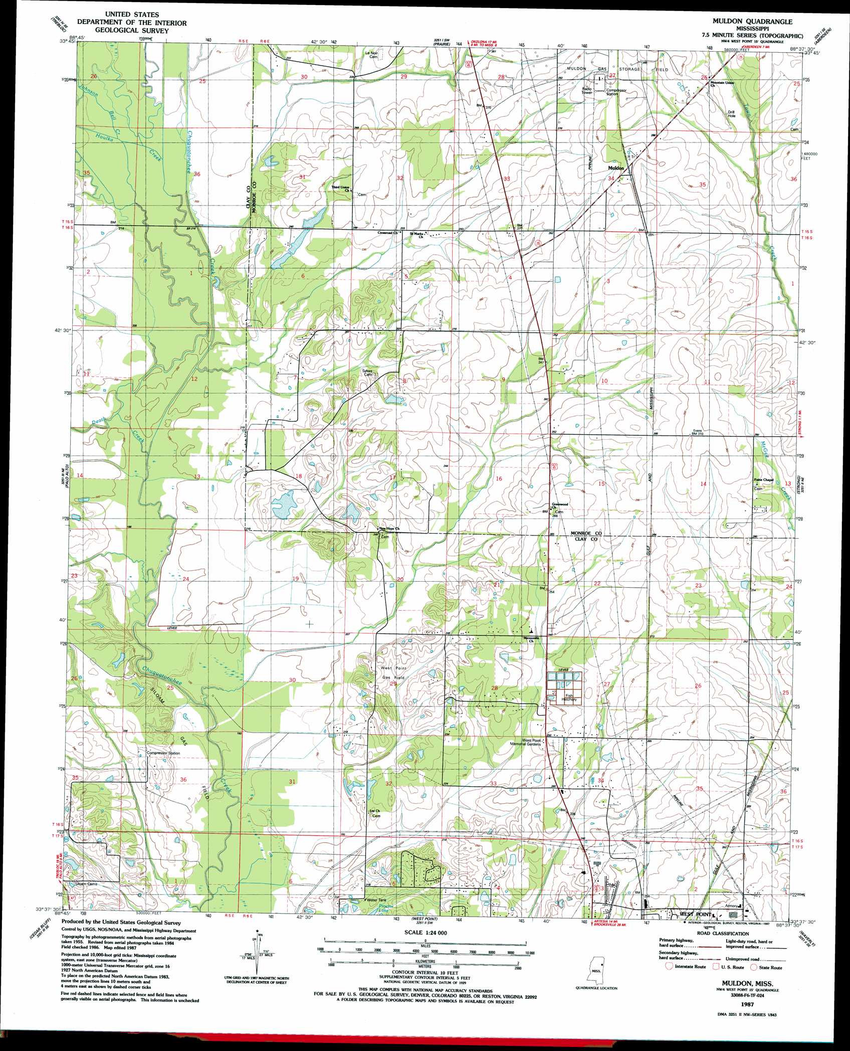
USGS Topo Quad 33088f6 - 1:24,000 scale
| Topo Map Name: | Muldon |
| USGS Topo Quad ID: | 33088f6 |
| Print Size: | ca. 21 1/4" wide x 27" high |
| Southeast Coordinates: | 33.625° N latitude / 88.625° W longitude |
| Map Center Coordinates: | 33.6875° N latitude / 88.6875° W longitude |
| U.S. State: | MS |
| Filename: | o33088f6.jpg |
| Download Map JPG Image: | Muldon topo map 1:24,000 scale |
| Map Type: | Topographic |
| Topo Series: | 7.5´ |
| Map Scale: | 1:24,000 |
| Source of Map Images: | United States Geological Survey (USGS) |
| Alternate Map Versions: |
Muldon MS 1987, updated 1987 Download PDF Buy paper map Muldon MS 2012 Download PDF Buy paper map Muldon MS 2015 Download PDF Buy paper map |
1:24,000 Topo Quads surrounding Muldon
Houston East |
Buena Vista |
Egypt |
Wren |
Amory |
Sparta |
Trebloc |
Prairie |
Aberdeen |
Amory Sw |
Montpelier |
Palo Alto |
Muldon |
Strong |
Hamilton |
Pheba |
Cedar Bluff |
West Point |
Waverly |
Columbus North |
Longview |
Starkville |
Artesia |
Bent Oak |
Columbus South |
> Back to 33088e1 at 1:100,000 scale
> Back to 33088a1 at 1:250,000 scale
> Back to U.S. Topo Maps home
Muldon topo map: Gazetteer
Muldon: Dams
Ben Lilly Pond Dam elevation 71m 232′Ben Lilly Pond Dam elevation 67m 219′
Muldon: Oilfields
Muldon Gas Storage Field elevation 91m 298′Siloam Gas Field elevation 60m 196′
West Point Gas Field elevation 69m 226′
Muldon: Populated Places
Muldon elevation 92m 301′Northgate elevation 76m 249′
Oakridge Estates elevation 70m 229′
Pine Acres elevation 73m 239′
Rodgers (historical) elevation 88m 288′
Muldon: Streams
Death Creek elevation 58m 190′Houlka Creek elevation 61m 200′
Johnson Bell Creek elevation 62m 203′
Muldon digital topo map on disk
Buy this Muldon topo map showing relief, roads, GPS coordinates and other geographical features, as a high-resolution digital map file on DVD: