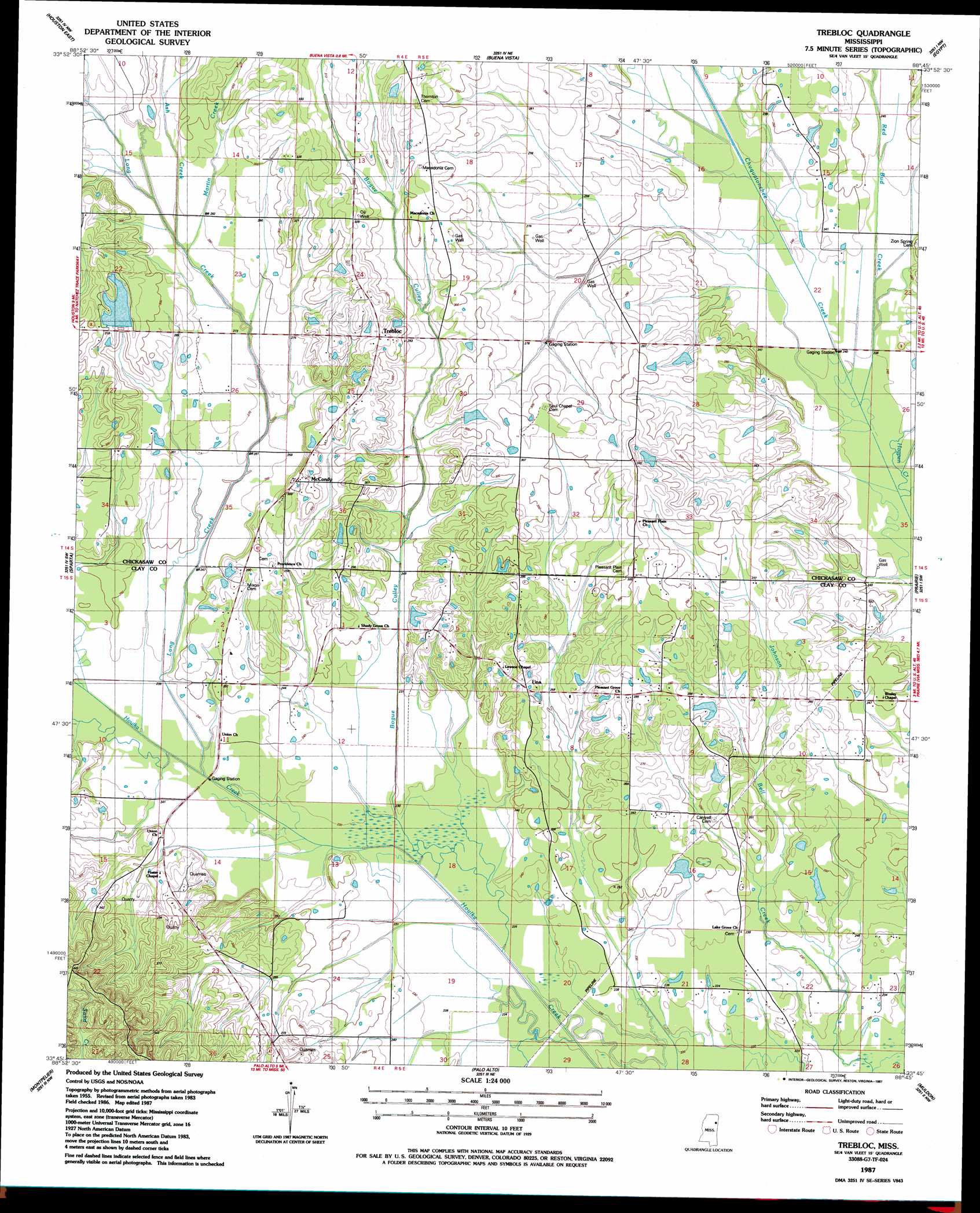
Trebloc Topo Map Mississippi
To zoom in, hover over the map of Trebloc
USGS Topo Quad 33088g7 - 1:24,000 scale
| Topo Map Name: | Trebloc |
| USGS Topo Quad ID: | 33088g7 |
| Print Size: | ca. 21 1/4" wide x 27" high |
| Southeast Coordinates: | 33.75° N latitude / 88.75° W longitude |
| Map Center Coordinates: | 33.8125° N latitude / 88.8125° W longitude |
| U.S. State: | MS |
| Filename: | o33088g7.jpg |
| Download Map JPG Image: | Trebloc topo map 1:24,000 scale |
| Map Type: | Topographic |
| Topo Series: | 7.5´ |
| Map Scale: | 1:24,000 |
| Source of Map Images: | United States Geological Survey (USGS) |
| Alternate Map Versions: |
Trebloc MS 1987, updated 1987 Download PDF Buy paper map Trebloc MS 2012 Download PDF Buy paper map Trebloc MS 2015 Download PDF Buy paper map |
1:24,000 Topo Quads surrounding Trebloc
Houlka |
Troy |
Troy Se |
Shannon |
Nettleton |
Houston West |
Houston East |
Buena Vista |
Egypt |
Wren |
Woodland |
Sparta |
Trebloc |
Prairie |
Aberdeen |
Mantee |
Montpelier |
Palo Alto |
Muldon |
Strong |
Maben |
Pheba |
Cedar Bluff |
West Point |
Waverly |
> Back to 33088e1 at 1:100,000 scale
> Back to 33088a1 at 1:250,000 scale
> Back to U.S. Topo Maps home
Trebloc topo map: Gazetteer
Trebloc: Dams
Miller Pond Dam elevation 83m 272′Mississippi No Name 140 Dam elevation 76m 249′
W J Linn Lake Dam elevation 87m 285′
Trebloc: Populated Places
Barrs Mill elevation 77m 252′Macedonia elevation 95m 311′
McCondy elevation 91m 298′
Trebloc elevation 98m 321′
Una elevation 86m 282′
Trebloc: Post Offices
Trebloc Post Office elevation 98m 321′Trebloc: Streams
Ash Creek elevation 82m 269′Bogue Culley elevation 67m 219′
Hogpen Creek elevation 68m 223′
Long Creek elevation 69m 226′
Martin Creek elevation 82m 269′
Red Bud Creek elevation 68m 223′
Trebloc digital topo map on disk
Buy this Trebloc topo map showing relief, roads, GPS coordinates and other geographical features, as a high-resolution digital map file on DVD: