Sparta Topo Map Mississippi
To zoom in, hover over the map of Sparta
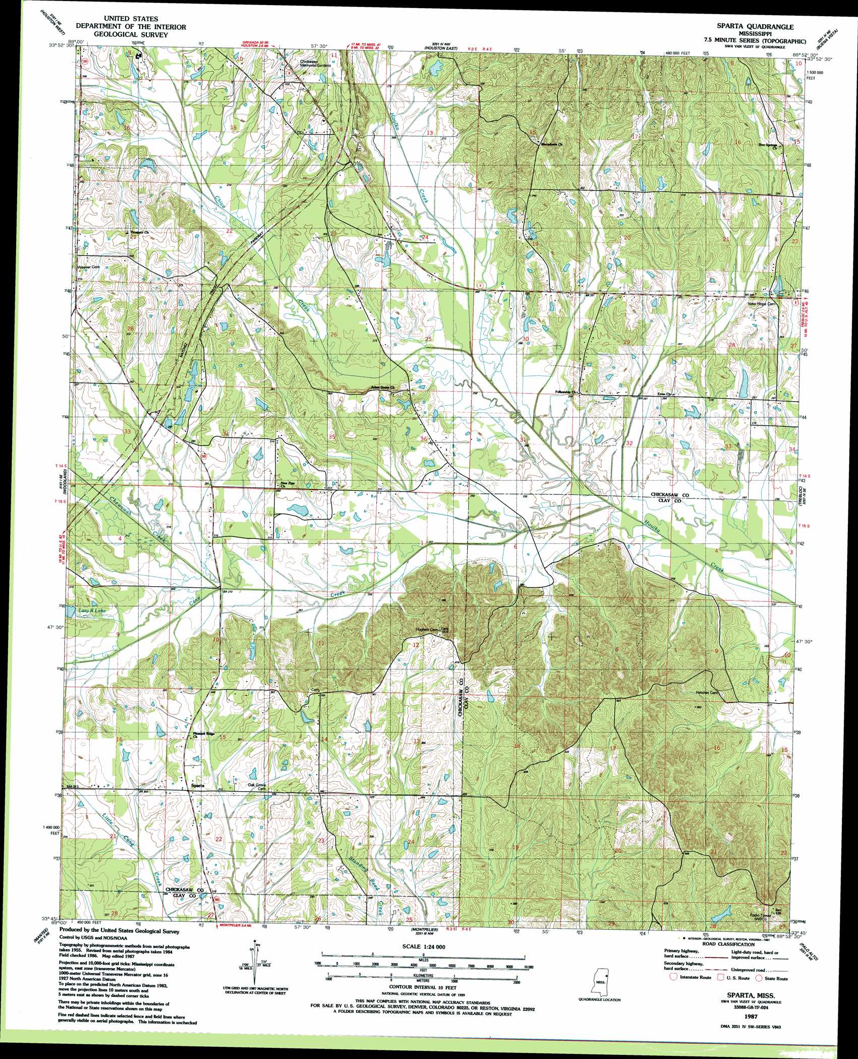
USGS Topo Quad 33088g8 - 1:24,000 scale
| Topo Map Name: | Sparta |
| USGS Topo Quad ID: | 33088g8 |
| Print Size: | ca. 21 1/4" wide x 27" high |
| Southeast Coordinates: | 33.75° N latitude / 88.875° W longitude |
| Map Center Coordinates: | 33.8125° N latitude / 88.9375° W longitude |
| U.S. State: | MS |
| Filename: | o33088g8.jpg |
| Download Map JPG Image: | Sparta topo map 1:24,000 scale |
| Map Type: | Topographic |
| Topo Series: | 7.5´ |
| Map Scale: | 1:24,000 |
| Source of Map Images: | United States Geological Survey (USGS) |
| Alternate Map Versions: |
Sparta MS 1987, updated 1987 Download PDF Buy paper map Sparta MS 2012 Download PDF Buy paper map Sparta MS 2015 Download PDF Buy paper map |
1:24,000 Topo Quads surrounding Sparta
Robbs |
Houlka |
Troy |
Troy Se |
Shannon |
Vardaman |
Houston West |
Houston East |
Buena Vista |
Egypt |
Atlanta |
Woodland |
Sparta |
Trebloc |
Prairie |
Hohenlinden |
Mantee |
Montpelier |
Palo Alto |
Muldon |
Sapa |
Maben |
Pheba |
Cedar Bluff |
West Point |
> Back to 33088e1 at 1:100,000 scale
> Back to 33088a1 at 1:250,000 scale
> Back to U.S. Topo Maps home
Sparta topo map: Gazetteer
Sparta: Dams
Gene Verell Lake Dam elevation 81m 265′Hollomans Lake Dam elevation 96m 314′
McCrory Lake Dam elevation 93m 305′
Stevens Lake Dam elevation 126m 413′
Sparta: Populated Places
Elize (historical) elevation 94m 308′Enon elevation 89m 291′
Prospect (historical) elevation 101m 331′
Sonora elevation 103m 337′
Sparta elevation 101m 331′
Sparta: Reservoirs
Lazy K Lake elevation 88m 288′Linn Lake elevation 94m 308′
Sparta: Streams
Bray Creek elevation 85m 278′Cane Creek elevation 73m 239′
Chewawah Creek elevation 81m 265′
Chico Creek elevation 76m 249′
Horse Nation Creek elevation 75m 246′
Sparta digital topo map on disk
Buy this Sparta topo map showing relief, roads, GPS coordinates and other geographical features, as a high-resolution digital map file on DVD: