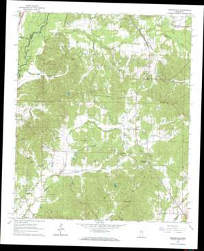
Hesterville Topo Map Mississippi
To zoom in, hover over the map of Hesterville
USGS Topo Quad 33089b6 - 1:24,000 scale
| Topo Map Name: | Hesterville |
| USGS Topo Quad ID: | 33089b6 |
| Print Size: | ca. 21 1/4" wide x 27" high |
| Southeast Coordinates: | 33.125° N latitude / 89.625° W longitude |
| Map Center Coordinates: | 33.1875° N latitude / 89.6875° W longitude |
| U.S. State: | MS |
| Filename: | o33089b6.jpg |
| Download Map JPG Image: | Hesterville topo map 1:24,000 scale |
| Map Type: | Topographic |
| Topo Series: | 7.5´ |
| Map Scale: | 1:24,000 |
| Source of Map Images: | United States Geological Survey (USGS) |
| Alternate Map Versions: |
Hesterville MS 1964, updated 1965 Download PDF Buy paper map Hesterville MS 2012 Download PDF Buy paper map Hesterville MS 2015 Download PDF Buy paper map |
1:24,000 Topo Quads surrounding Hesterville
> Back to 33089a1 at 1:100,000 scale
> Back to 33088a1 at 1:250,000 scale
> Back to U.S. Topo Maps home
Hesterville topo map: Gazetteer
Hesterville: Dams
Armstrong Lake Dam elevation 91m 298′Clark Pond Dam elevation 113m 370′
Dan Oak Dam elevation 94m 308′
Hesterville: Populated Places
Auris (historical) elevation 86m 282′Carmack elevation 91m 298′
Hesterville elevation 134m 439′
Mount Herman elevation 98m 321′
North Union (historical) elevation 122m 400′
Possumneck elevation 99m 324′
Rocky Point elevation 114m 374′
Sand Hill (historical) elevation 143m 469′
Unity (historical) elevation 126m 413′
Hesterville: Streams
Baxter Creek elevation 90m 295′Buzzard Creek elevation 78m 255′
Hudson Creek elevation 80m 262′
Little Sharkey Creek elevation 90m 295′
Mayo Branch elevation 83m 272′
Redden Branch elevation 87m 285′
Scoobachita Creek elevation 88m 288′
Zilpha Creek elevation 80m 262′
Hesterville digital topo map on disk
Buy this Hesterville topo map showing relief, roads, GPS coordinates and other geographical features, as a high-resolution digital map file on DVD:


