Peachahala Creek Topo Map Mississippi
To zoom in, hover over the map of Peachahala Creek
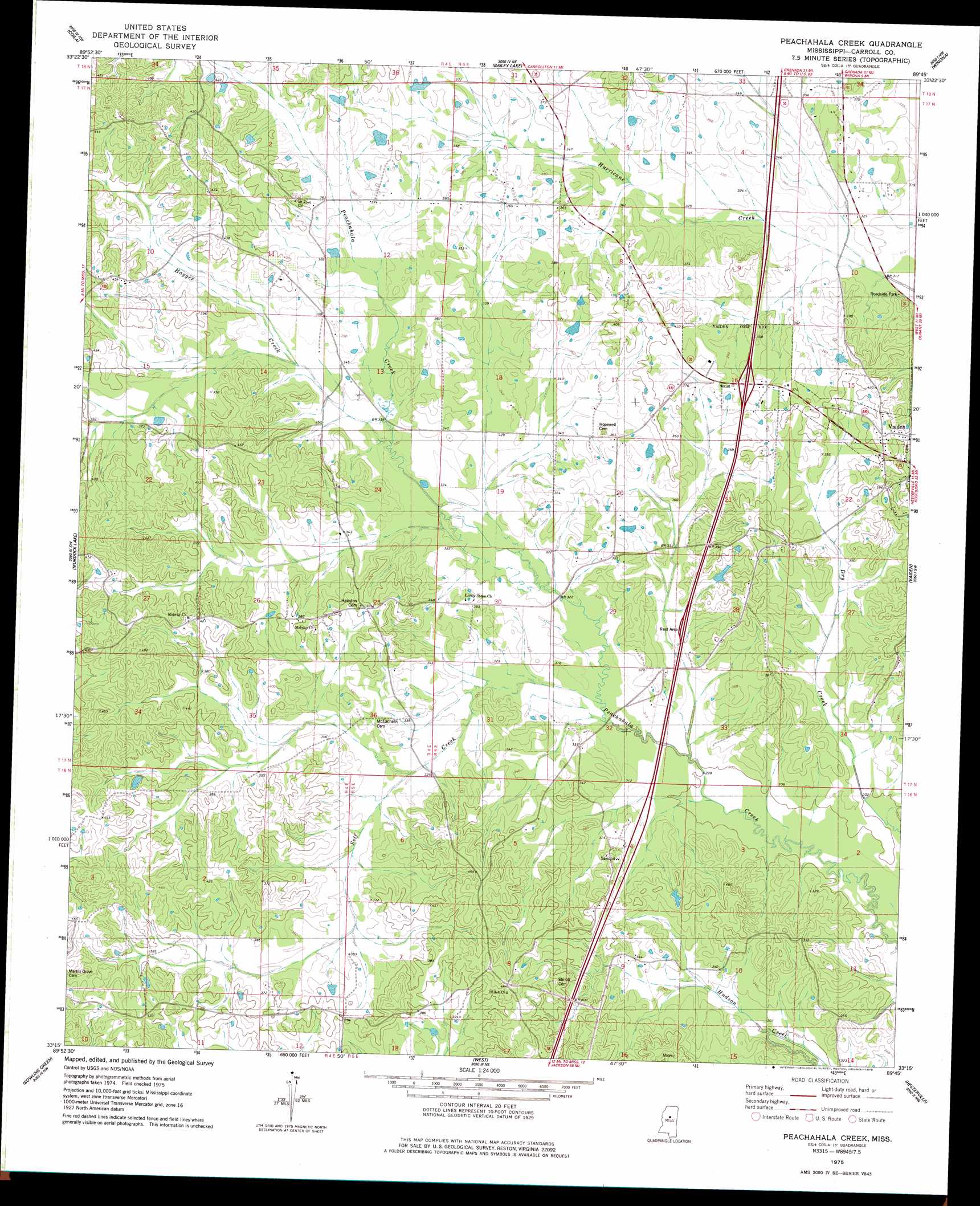
USGS Topo Quad 33089c7 - 1:24,000 scale
| Topo Map Name: | Peachahala Creek |
| USGS Topo Quad ID: | 33089c7 |
| Print Size: | ca. 21 1/4" wide x 27" high |
| Southeast Coordinates: | 33.25° N latitude / 89.75° W longitude |
| Map Center Coordinates: | 33.3125° N latitude / 89.8125° W longitude |
| U.S. State: | MS |
| Filename: | o33089c7.jpg |
| Download Map JPG Image: | Peachahala Creek topo map 1:24,000 scale |
| Map Type: | Topographic |
| Topo Series: | 7.5´ |
| Map Scale: | 1:24,000 |
| Source of Map Images: | United States Geological Survey (USGS) |
| Alternate Map Versions: |
Peachahala Creek MS 1975, updated 1978 Download PDF Buy paper map Peachahala Creek MS 2012 Download PDF Buy paper map Peachahala Creek MS 2015 Download PDF Buy paper map |
1:24,000 Topo Quads surrounding Peachahala Creek
Browning |
North Carrollton |
Mccarley |
Eskridge |
Lodi |
Gravel Hill |
Coila |
Bailey Lake |
Winona |
Kilmichael |
Black Hawk |
Murdock Lake |
Peachahala Creek |
Vaiden |
Poplar Creek |
Lexington North |
Bowling Green |
West |
Hesterville |
Kosciusko Ne |
Lexington South |
Owens Wells |
Durant |
Mcadams |
Kosciusko |
> Back to 33089a1 at 1:100,000 scale
> Back to 33088a1 at 1:250,000 scale
> Back to U.S. Topo Maps home
Peachahala Creek topo map: Gazetteer
Peachahala Creek: Crossings
Interchange 174 elevation 116m 380′Peachahala Creek: Populated Places
Wiltshire elevation 128m 419′Peachahala Creek: Streams
Hagger Creek elevation 99m 324′Self Creek elevation 92m 301′
Peachahala Creek digital topo map on disk
Buy this Peachahala Creek topo map showing relief, roads, GPS coordinates and other geographical features, as a high-resolution digital map file on DVD: