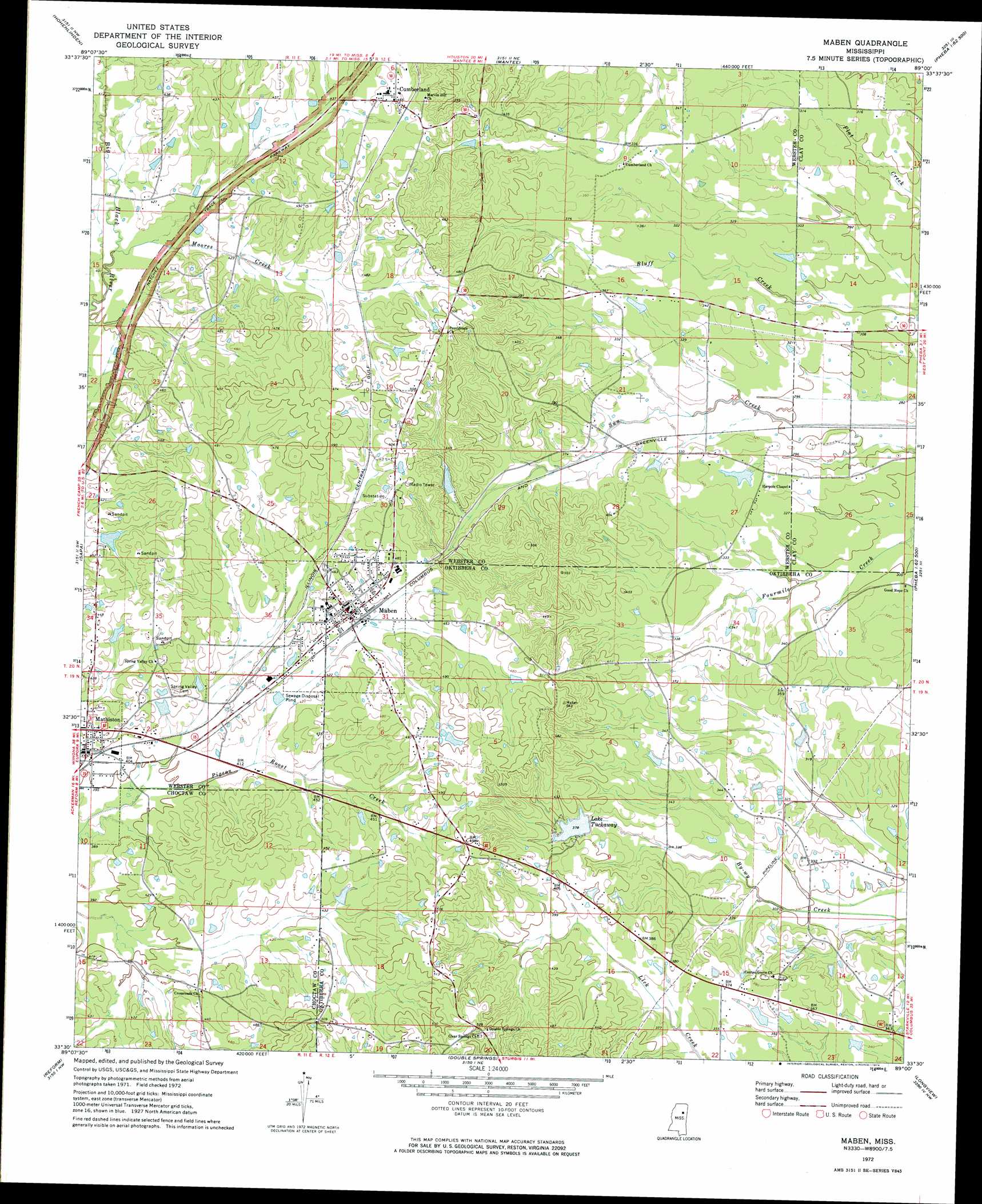
Maben Topo Map Mississippi
To zoom in, hover over the map of Maben
USGS Topo Quad 33089e1 - 1:24,000 scale
| Topo Map Name: | Maben |
| USGS Topo Quad ID: | 33089e1 |
| Print Size: | ca. 21 1/4" wide x 27" high |
| Southeast Coordinates: | 33.5° N latitude / 89° W longitude |
| Map Center Coordinates: | 33.5625° N latitude / 89.0625° W longitude |
| U.S. State: | MS |
| Filename: | o33089e1.jpg |
| Download Map JPG Image: | Maben topo map 1:24,000 scale |
| Map Type: | Topographic |
| Topo Series: | 7.5´ |
| Map Scale: | 1:24,000 |
| Source of Map Images: | United States Geological Survey (USGS) |
| Alternate Map Versions: |
Maben MS 1972, updated 1974 Download PDF Buy paper map Maben MS 2012 Download PDF Buy paper map Maben MS 2015 Download PDF Buy paper map |
1:24,000 Topo Quads surrounding Maben
Calhoun City |
Atlanta |
Woodland |
Sparta |
Trebloc |
Bellefontaine |
Hohenlinden |
Mantee |
Montpelier |
Palo Alto |
Eupora |
Sapa |
Maben |
Pheba |
Cedar Bluff |
Tomnolen |
Reform |
Double Springs |
Longview |
Starkville |
Weir |
Ackerman |
Sturgis |
Bradley |
Bluff Lake |
> Back to 33089e1 at 1:100,000 scale
> Back to 33088a1 at 1:250,000 scale
> Back to U.S. Topo Maps home
Maben topo map: Gazetteer
Maben: Dams
Cane Lake Dam elevation 105m 344′Crowly Lake Dam elevation 104m 341′
J Crowley Pond Dam elevation 102m 334′
Johnson Lake Dam elevation 137m 449′
McMullen Lake Dam elevation 141m 462′
Page Lake Dam elevation 124m 406′
Sanders Lake Dam elevation 115m 377′
Shurls Pond Dam elevation 98m 321′
Tuckaway Lake Dam elevation 108m 354′
Turner Lake Dam elevation 146m 479′
Maben: Populated Places
Center Grove elevation 111m 364′Cumberland elevation 141m 462′
Maben elevation 135m 442′
Mathiston elevation 129m 423′
Spring Valley elevation 141m 462′
Maben: Reservoirs
Lake Tuckaway elevation 111m 364′Maben: Streams
Moores Creek elevation 122m 400′Maben digital topo map on disk
Buy this Maben topo map showing relief, roads, GPS coordinates and other geographical features, as a high-resolution digital map file on DVD: