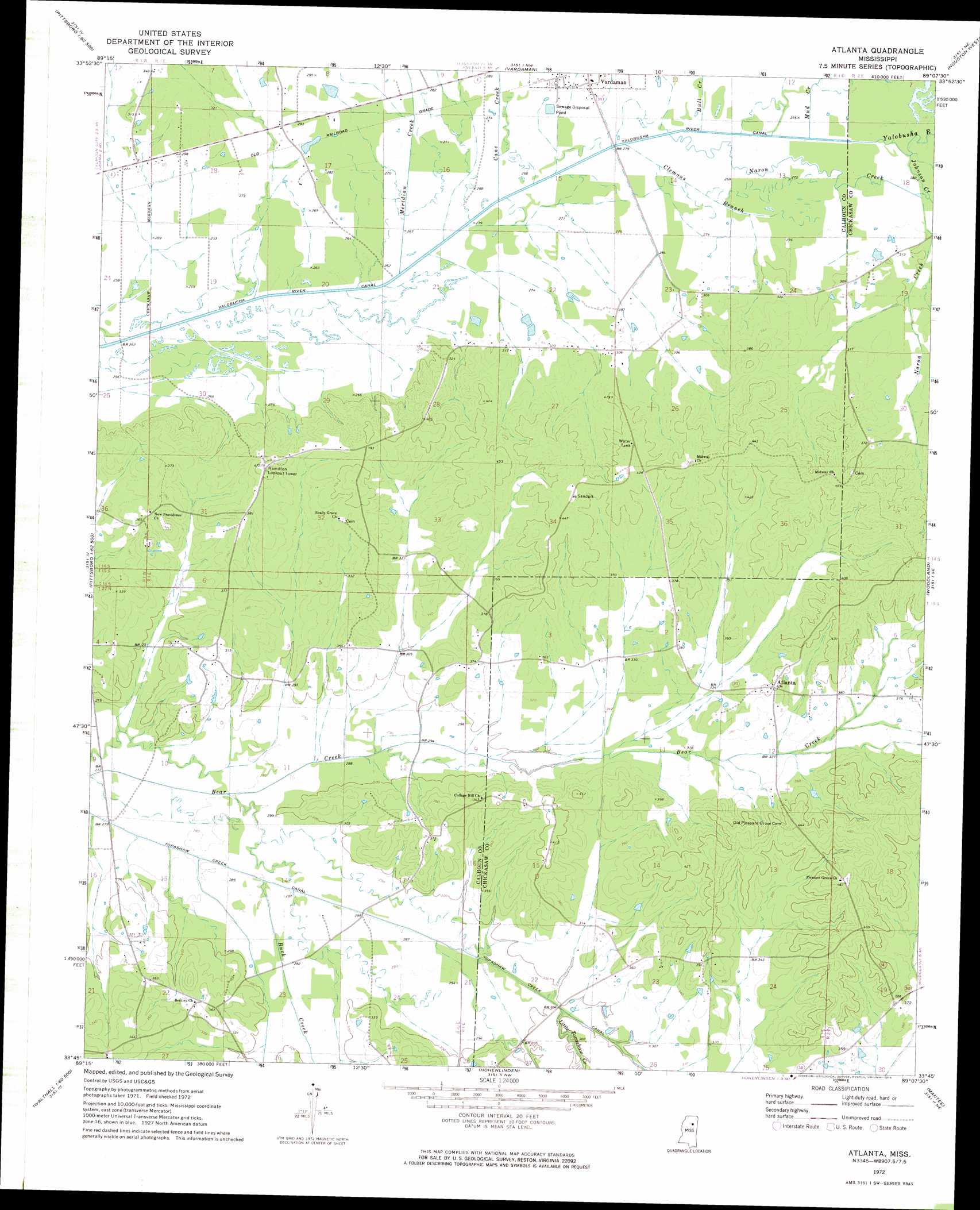
Atlanta Topo Map Mississippi
To zoom in, hover over the map of Atlanta
USGS Topo Quad 33089g2 - 1:24,000 scale
| Topo Map Name: | Atlanta |
| USGS Topo Quad ID: | 33089g2 |
| Print Size: | ca. 21 1/4" wide x 27" high |
| Southeast Coordinates: | 33.75° N latitude / 89.125° W longitude |
| Map Center Coordinates: | 33.8125° N latitude / 89.1875° W longitude |
| U.S. State: | MS |
| Filename: | o33089g2.jpg |
| Download Map JPG Image: | Atlanta topo map 1:24,000 scale |
| Map Type: | Topographic |
| Topo Series: | 7.5´ |
| Map Scale: | 1:24,000 |
| Source of Map Images: | United States Geological Survey (USGS) |
| Alternate Map Versions: |
Atlanta MS 1972, updated 1974 Download PDF Buy paper map Atlanta MS 2012 Download PDF Buy paper map Atlanta MS 2015 Download PDF Buy paper map |
1:24,000 Topo Quads surrounding Atlanta
Banner |
Sarepta |
Robbs |
Houlka |
Troy |
Skuna |
Bruce |
Vardaman |
Houston West |
Houston East |
Big Creek |
Calhoun City |
Atlanta |
Woodland |
Sparta |
Cadaretta |
Bellefontaine |
Hohenlinden |
Mantee |
Montpelier |
Little Sand Creek |
Eupora |
Sapa |
Maben |
Pheba |
> Back to 33089e1 at 1:100,000 scale
> Back to 33088a1 at 1:250,000 scale
> Back to U.S. Topo Maps home
Atlanta topo map: Gazetteer
Atlanta: Canals
Topashaw Creek Canal elevation 83m 272′Yalobusha River Canal elevation 75m 246′
Atlanta: Dams
Inman Lake Dam elevation 83m 272′Tetter Lake Dam elevation 88m 288′
Atlanta: Populated Places
Atlanta elevation 122m 400′Bently elevation 104m 341′
Bowles (historical) elevation 134m 439′
Hollis elevation 97m 318′
Atlanta: Streams
Buck Creek elevation 80m 262′Bull Creek elevation 79m 259′
Cane Creek elevation 78m 255′
Clemons Branch elevation 79m 259′
Johnson Creek elevation 81m 265′
Little Topashaw Creek elevation 85m 278′
Meridian Creek elevation 76m 249′
Mud Creek elevation 79m 259′
Naron Creek elevation 80m 262′
Atlanta digital topo map on disk
Buy this Atlanta topo map showing relief, roads, GPS coordinates and other geographical features, as a high-resolution digital map file on DVD: