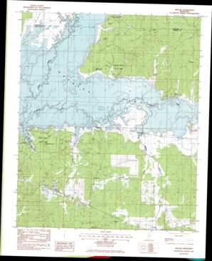
Kincaid Topo Map Mississippi
To zoom in, hover over the map of Kincaid
USGS Topo Quad 33089g6 - 1:24,000 scale
| Topo Map Name: | Kincaid |
| USGS Topo Quad ID: | 33089g6 |
| Print Size: | ca. 21 1/4" wide x 27" high |
| Southeast Coordinates: | 33.75° N latitude / 89.625° W longitude |
| Map Center Coordinates: | 33.8125° N latitude / 89.6875° W longitude |
| U.S. State: | MS |
| Filename: | o33089g6.jpg |
| Download Map JPG Image: | Kincaid topo map 1:24,000 scale |
| Map Type: | Topographic |
| Topo Series: | 7.5´ |
| Map Scale: | 1:24,000 |
| Source of Map Images: | United States Geological Survey (USGS) |
| Alternate Map Versions: |
Kincaid MS 1983, updated 1984 Download PDF Buy paper map Kincaid MS 2012 Download PDF Buy paper map Kincaid MS 2015 Download PDF Buy paper map |
1:24,000 Topo Quads surrounding Kincaid
> Back to 33089e1 at 1:100,000 scale
> Back to 33088a1 at 1:250,000 scale
> Back to U.S. Topo Maps home
Kincaid topo map: Gazetteer
Kincaid: Bays
Old Orchard Bay elevation 61m 200′Kincaid: Capes
Cape Retreat elevation 65m 213′Carver Point elevation 73m 239′
Kincaid: Cliffs
Carver Bluff elevation 90m 295′Kincaid: Dams
Keeton Lake Dam elevation 80m 262′Phillips Lake Dam elevation 91m 298′
Kincaid: Parks
Carver Point State Park elevation 71m 232′Choctaw Public Use Area elevation 63m 206′
Hugh White State Park elevation 95m 311′
Piney Woods Public Use Area elevation 70m 229′
Wolf Creek Public Use Area elevation 63m 206′
Kincaid: Populated Places
Choctaw elevation 83m 272′Hurricane Branch elevation 64m 209′
Kincaid elevation 79m 259′
Kincaid: Ridges
Crescent Ridge elevation 92m 301′Kincaid: Streams
Hurricane Branch elevation 63m 206′Knight Creek elevation 61m 200′
Redgrass Creek elevation 61m 200′
Kincaid: Summits
Little Mountain elevation 146m 479′Kincaid: Woods
Piney Woods elevation 79m 259′Kincaid digital topo map on disk
Buy this Kincaid topo map showing relief, roads, GPS coordinates and other geographical features, as a high-resolution digital map file on DVD:


