Thornton Topo Map Mississippi
To zoom in, hover over the map of Thornton
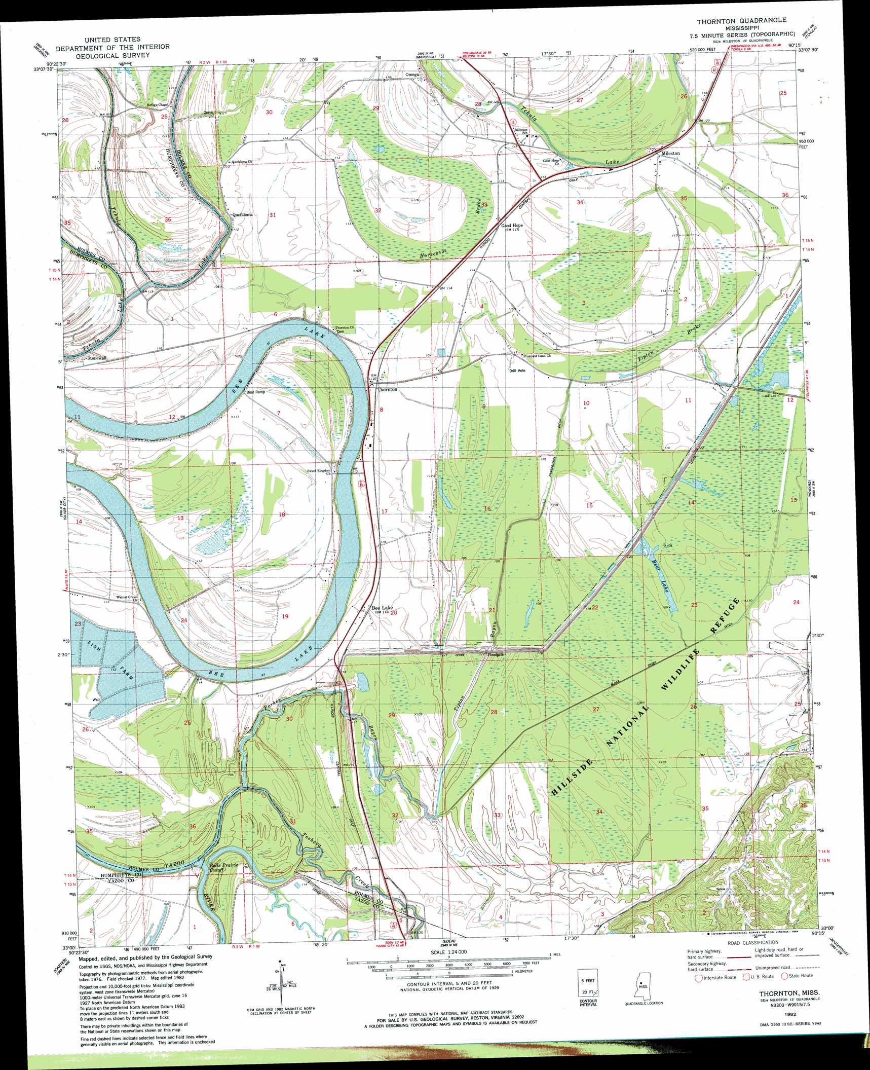
USGS Topo Quad 33090a3 - 1:24,000 scale
| Topo Map Name: | Thornton |
| USGS Topo Quad ID: | 33090a3 |
| Print Size: | ca. 21 1/4" wide x 27" high |
| Southeast Coordinates: | 33° N latitude / 90.25° W longitude |
| Map Center Coordinates: | 33.0625° N latitude / 90.3125° W longitude |
| U.S. State: | MS |
| Filename: | o33090a3.jpg |
| Download Map JPG Image: | Thornton topo map 1:24,000 scale |
| Map Type: | Topographic |
| Topo Series: | 7.5´ |
| Map Scale: | 1:24,000 |
| Source of Map Images: | United States Geological Survey (USGS) |
| Alternate Map Versions: |
Thornton MS 1982, updated 1984 Download PDF Buy paper map Thornton MS 2012 Download PDF Buy paper map Thornton MS 2015 Download PDF Buy paper map |
1:24,000 Topo Quads surrounding Thornton
Inverness |
Swiftown |
Montgomery |
Cruger |
Black Hawk |
Bellewood |
Belzoni |
Marcella |
Tchula |
Lexington North |
Midnight |
Silver City |
Thornton |
Howard |
Lexington South |
Louise |
Carter |
Eden |
Zeiglerville |
Ebenezer |
Bayland Se |
Yazoo City |
Benton |
Linwood |
Vaughan |
> Back to 33090a1 at 1:100,000 scale
> Back to 33090a1 at 1:250,000 scale
> Back to U.S. Topo Maps home
Thornton topo map: Gazetteer
Thornton: Bends
Belle Prairie Cut-Off elevation 29m 95′Thornton: Canals
Black Creek Ditch elevation 31m 101′Fannegusha Ditch elevation 34m 111′
Thornton: Lakes
Bee Lake elevation 28m 91′Thornton: Parks
Hillside National Wildlife Refuge elevation 32m 104′Thornton: Populated Places
Bee Lake elevation 35m 114′Good Hope elevation 34m 111′
Mileston elevation 34m 111′
Omega elevation 32m 104′
Quofaloma elevation 34m 111′
Stonewall elevation 36m 118′
Thornton elevation 35m 114′
Thornton: Streams
Old Black Creek elevation 29m 95′Parker Bayou elevation 30m 98′
Tesheva Creek elevation 31m 101′
Tipton Bayou elevation 30m 98′
Thornton: Swamps
Horseshoe Brake elevation 33m 108′Tipton Brake elevation 32m 104′
Thornton digital topo map on disk
Buy this Thornton topo map showing relief, roads, GPS coordinates and other geographical features, as a high-resolution digital map file on DVD: