Delta City Topo Map Mississippi
To zoom in, hover over the map of Delta City
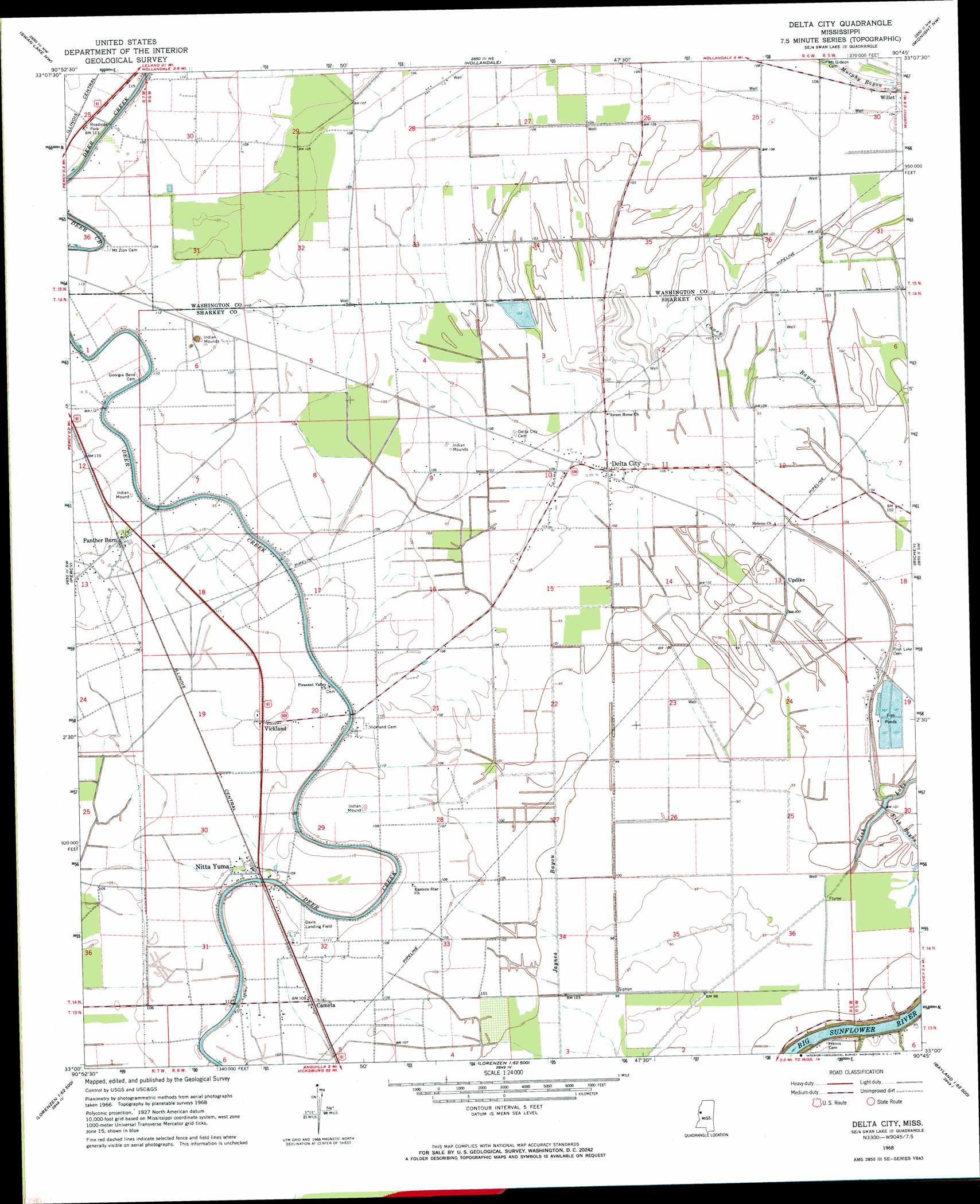
USGS Topo Quad 33090a7 - 1:24,000 scale
| Topo Map Name: | Delta City |
| USGS Topo Quad ID: | 33090a7 |
| Print Size: | ca. 21 1/4" wide x 27" high |
| Southeast Coordinates: | 33° N latitude / 90.75° W longitude |
| Map Center Coordinates: | 33.0625° N latitude / 90.8125° W longitude |
| U.S. State: | MS |
| Filename: | o33090a7.jpg |
| Download Map JPG Image: | Delta City topo map 1:24,000 scale |
| Map Type: | Topographic |
| Topo Series: | 7.5´ |
| Map Scale: | 1:24,000 |
| Source of Map Images: | United States Geological Survey (USGS) |
| Alternate Map Versions: |
Delta City MS 1968, updated 1970 Download PDF Buy paper map Delta City MS 1968, updated 1970 Download PDF Buy paper map Delta City MS 2012 Download PDF Buy paper map Delta City MS 2015 Download PDF Buy paper map |
1:24,000 Topo Quads surrounding Delta City
Wayside |
Arcola |
Tribbett |
Kinlock |
Inverness |
Avon |
Swan Lake Nw |
Hollandale |
Midnight Nw |
Bellewood |
Glen Allan |
Percy |
Delta City |
Richey |
Midnight |
Mayersville |
Rolling Fork West |
Rolling Fork East |
Bayland |
Louise |
Whiting Bayou |
Cary |
Red Rock |
Holly Bluff |
Bayland Se |
> Back to 33090a1 at 1:100,000 scale
> Back to 33090a1 at 1:250,000 scale
> Back to U.S. Topo Maps home
Delta City topo map: Gazetteer
Delta City: Dams
A B Williams Catfish Ponds Dam elevation 31m 101′Delta City: Lakes
Fish Lake elevation 27m 88′Delta City: Populated Places
Cameta elevation 33m 108′Delta City elevation 32m 104′
Nitta Yuma elevation 34m 111′
Panther Burn elevation 32m 104′
Shraderville elevation 32m 104′
Updike elevation 31m 101′
Vickland elevation 33m 108′
Willet elevation 32m 104′
Delta City: Post Offices
Delta City Post Office elevation 32m 104′Nitta Yuma Post Office elevation 34m 111′
Delta City digital topo map on disk
Buy this Delta City topo map showing relief, roads, GPS coordinates and other geographical features, as a high-resolution digital map file on DVD: