Tribbett Topo Map Mississippi
To zoom in, hover over the map of Tribbett
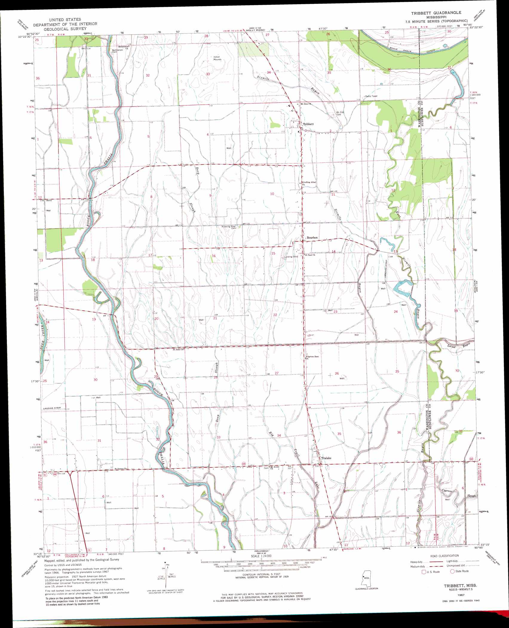
USGS Topo Quad 33090c7 - 1:24,000 scale
| Topo Map Name: | Tribbett |
| USGS Topo Quad ID: | 33090c7 |
| Print Size: | ca. 21 1/4" wide x 27" high |
| Southeast Coordinates: | 33.25° N latitude / 90.75° W longitude |
| Map Center Coordinates: | 33.3125° N latitude / 90.8125° W longitude |
| U.S. State: | MS |
| Filename: | o33090c7.jpg |
| Download Map JPG Image: | Tribbett topo map 1:24,000 scale |
| Map Type: | Topographic |
| Topo Series: | 7.5´ |
| Map Scale: | 1:24,000 |
| Source of Map Images: | United States Geological Survey (USGS) |
| Alternate Map Versions: |
Tribbett MS 1967, updated 1968 Download PDF Buy paper map Tribbett MS 1967, updated 1981 Download PDF Buy paper map Tribbett MS 2012 Download PDF Buy paper map Tribbett MS 2015 Download PDF Buy paper map |
1:24,000 Topo Quads surrounding Tribbett
Scott |
Stringtown |
Shaw |
Boyer |
Sunflower |
Greenville |
Leland |
Holly Ridge |
Indianola |
Moorhead |
Wayside |
Arcola |
Tribbett |
Kinlock |
Inverness |
Avon |
Swan Lake Nw |
Hollandale |
Midnight Nw |
Bellewood |
Glen Allan |
Percy |
Delta City |
Richey |
Midnight |
> Back to 33090a1 at 1:100,000 scale
> Back to 33090a1 at 1:250,000 scale
> Back to U.S. Topo Maps home
Tribbett topo map: Gazetteer
Tribbett: Dams
Brown Lake Dam elevation 34m 111′J M Dean Pond elevation 32m 104′
Tribbett: Populated Places
Bourbon elevation 33m 108′Manhattan elevation 35m 114′
McGrath elevation 32m 104′
New Town elevation 30m 98′
Osseola elevation 36m 118′
Randolph (historical) elevation 33m 108′
Tralake elevation 32m 104′
Tribbett elevation 35m 114′
Tribbett: Streams
Bear Lake elevation 28m 91′Big Trail Lake elevation 31m 101′
East Sixmile Bayou elevation 31m 101′
Tribbett digital topo map on disk
Buy this Tribbett topo map showing relief, roads, GPS coordinates and other geographical features, as a high-resolution digital map file on DVD: