Indianola Topo Map Mississippi
To zoom in, hover over the map of Indianola
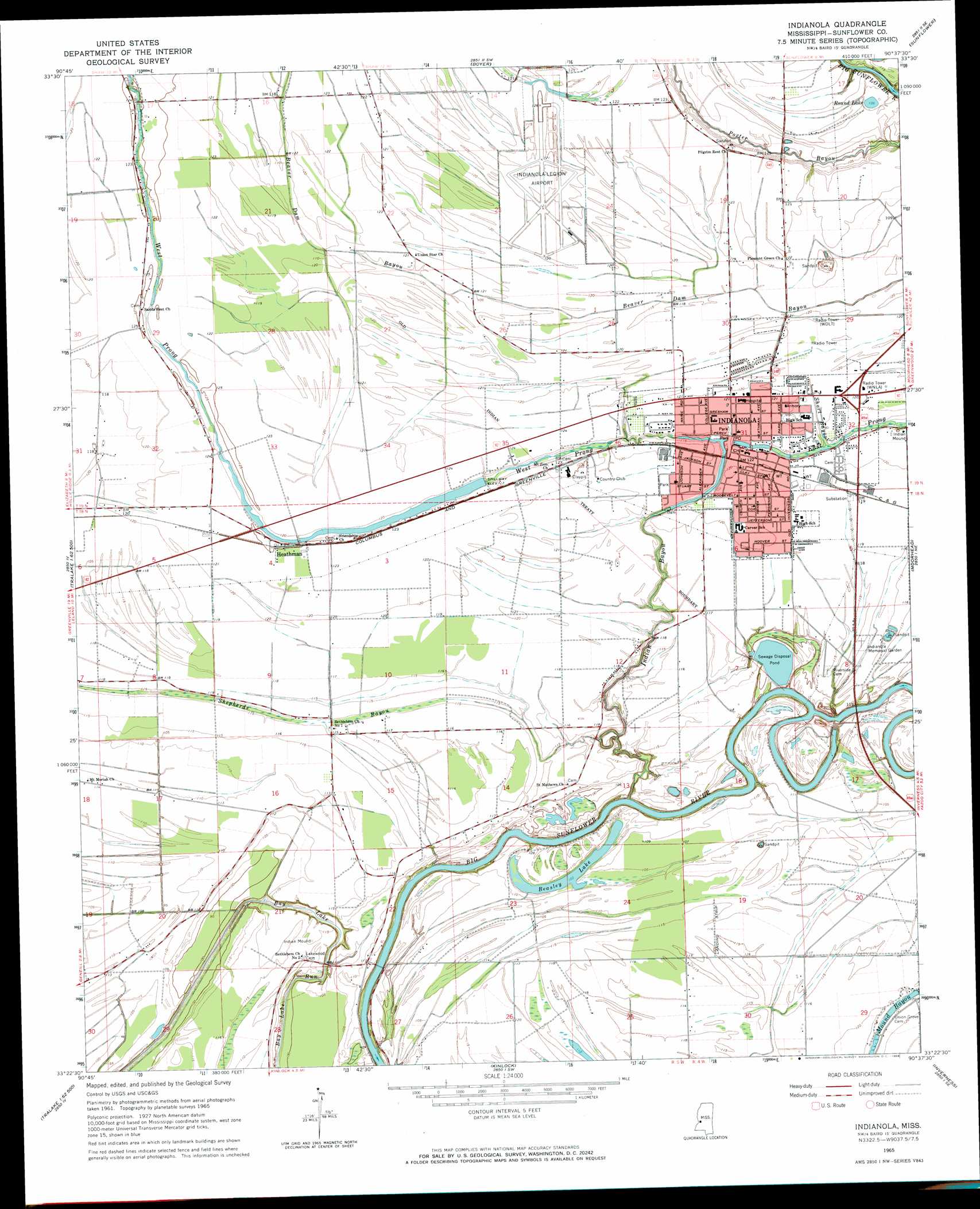
USGS Topo Quad 33090d6 - 1:24,000 scale
| Topo Map Name: | Indianola |
| USGS Topo Quad ID: | 33090d6 |
| Print Size: | ca. 21 1/4" wide x 27" high |
| Southeast Coordinates: | 33.375° N latitude / 90.625° W longitude |
| Map Center Coordinates: | 33.4375° N latitude / 90.6875° W longitude |
| U.S. State: | MS |
| Filename: | o33090d6.jpg |
| Download Map JPG Image: | Indianola topo map 1:24,000 scale |
| Map Type: | Topographic |
| Topo Series: | 7.5´ |
| Map Scale: | 1:24,000 |
| Source of Map Images: | United States Geological Survey (USGS) |
| Alternate Map Versions: |
Indianola MS 1965, updated 1966 Download PDF Buy paper map Indianola MS 2012 Download PDF Buy paper map Indianola MS 2015 Download PDF Buy paper map |
1:24,000 Topo Quads surrounding Indianola
Lobdell |
Skene |
Cleveland |
Ruleville |
Rattlesnake Bayou |
Stringtown |
Shaw |
Boyer |
Sunflower |
Bear Gut Bayou |
Leland |
Holly Ridge |
Indianola |
Moorhead |
Colony Town |
Arcola |
Tribbett |
Kinlock |
Inverness |
Swiftown |
Swan Lake Nw |
Hollandale |
Midnight Nw |
Bellewood |
Belzoni |
> Back to 33090a1 at 1:100,000 scale
> Back to 33090a1 at 1:250,000 scale
> Back to U.S. Topo Maps home
Indianola topo map: Gazetteer
Indianola: Airports
Billups Plantation Airport elevation 37m 121′Indianola Municipal Airport elevation 36m 118′
Indianola: Crossings
Heard Ferry (historical) elevation 27m 88′Indianola: Dams
Fratesi Pond Dam elevation 36m 118′Indianola Sewage Lagoon Dam elevation 32m 104′
Indianola: Lakes
Bay Lake elevation 27m 88′Beasley Lake elevation 31m 101′
Round Lake elevation 34m 111′
Thigpen Lake (historical) elevation 33m 108′
Indianola: Parks
Legion Field elevation 37m 121′Indianola: Populated Places
Heathman elevation 38m 124′Indianola elevation 37m 121′
Indianola: Post Offices
Indianola Post Office elevation 37m 121′Indianola: Streams
East Prong Indian Bayou elevation 32m 104′Indian Bayou elevation 28m 91′
Shepherds Bayou elevation 33m 108′
Short Bayou elevation 35m 114′
West Prong Indian Bayou elevation 32m 104′
Indianola digital topo map on disk
Buy this Indianola topo map showing relief, roads, GPS coordinates and other geographical features, as a high-resolution digital map file on DVD: