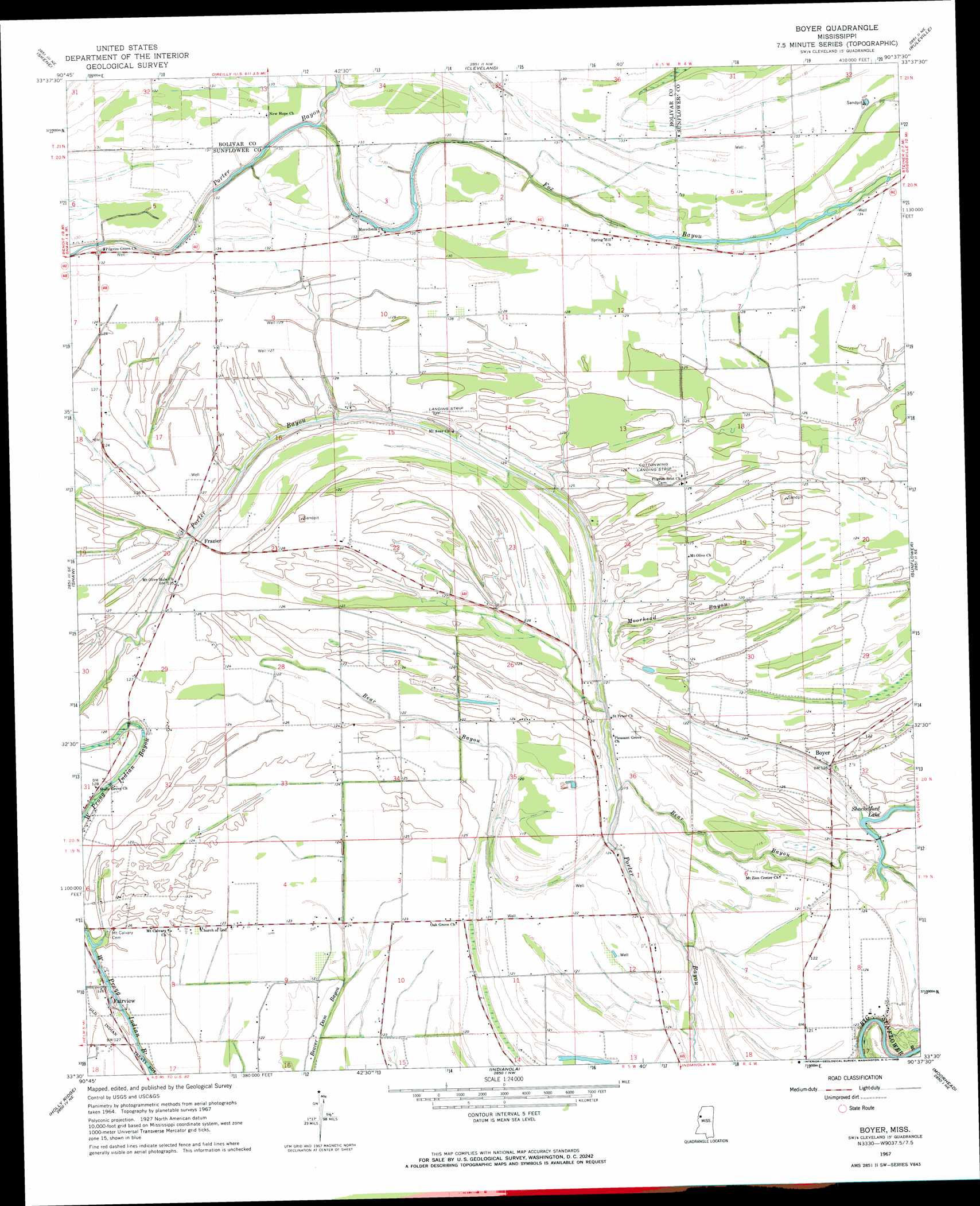
Boyer Topo Map Mississippi
To zoom in, hover over the map of Boyer
USGS Topo Quad 33090e6 - 1:24,000 scale
| Topo Map Name: | Boyer |
| USGS Topo Quad ID: | 33090e6 |
| Print Size: | ca. 21 1/4" wide x 27" high |
| Southeast Coordinates: | 33.5° N latitude / 90.625° W longitude |
| Map Center Coordinates: | 33.5625° N latitude / 90.6875° W longitude |
| U.S. State: | MS |
| Filename: | o33090e6.jpg |
| Download Map JPG Image: | Boyer topo map 1:24,000 scale |
| Map Type: | Topographic |
| Topo Series: | 7.5´ |
| Map Scale: | 1:24,000 |
| Source of Map Images: | United States Geological Survey (USGS) |
| Alternate Map Versions: |
Boyer MS 1967, updated 1968 Download PDF Buy paper map Boyer MS 1967, updated 1982 Download PDF Buy paper map Boyer MS 2012 Download PDF Buy paper map Boyer MS 2015 Download PDF Buy paper map |
1:24,000 Topo Quads surrounding Boyer
Beulah |
Pace |
Merigold |
Drew |
Brooks |
Lobdell |
Skene |
Cleveland |
Ruleville |
Rattlesnake Bayou |
Stringtown |
Shaw |
Boyer |
Sunflower |
Bear Gut Bayou |
Leland |
Holly Ridge |
Indianola |
Moorhead |
Colony Town |
Arcola |
Tribbett |
Kinlock |
Inverness |
Swiftown |
> Back to 33090e1 at 1:100,000 scale
> Back to 33090a1 at 1:250,000 scale
> Back to U.S. Topo Maps home
Boyer topo map: Gazetteer
Boyer: Airports
Cottonwing Airport elevation 37m 121′Boyer: Dams
A E Britt Pond Dam elevation 37m 121′Bishop Pond Dam elevation 37m 121′
Charles Ellis Pond Dam elevation 38m 124′
Tommy Ellis Lake Dam elevation 38m 124′
Tommy Ellis Pond Dam elevation 38m 124′
Boyer: Lakes
Shackelford Lake elevation 34m 111′Boyer: Populated Places
Boyer elevation 37m 121′Fairview elevation 38m 124′
Faisonia elevation 37m 121′
Frazier elevation 38m 124′
Stephenville elevation 37m 121′
Waltonia (historical) elevation 36m 118′
Boyer: Streams
Fox Bayou elevation 36m 118′Moorhead Bayou elevation 33m 108′
Boyer digital topo map on disk
Buy this Boyer topo map showing relief, roads, GPS coordinates and other geographical features, as a high-resolution digital map file on DVD: