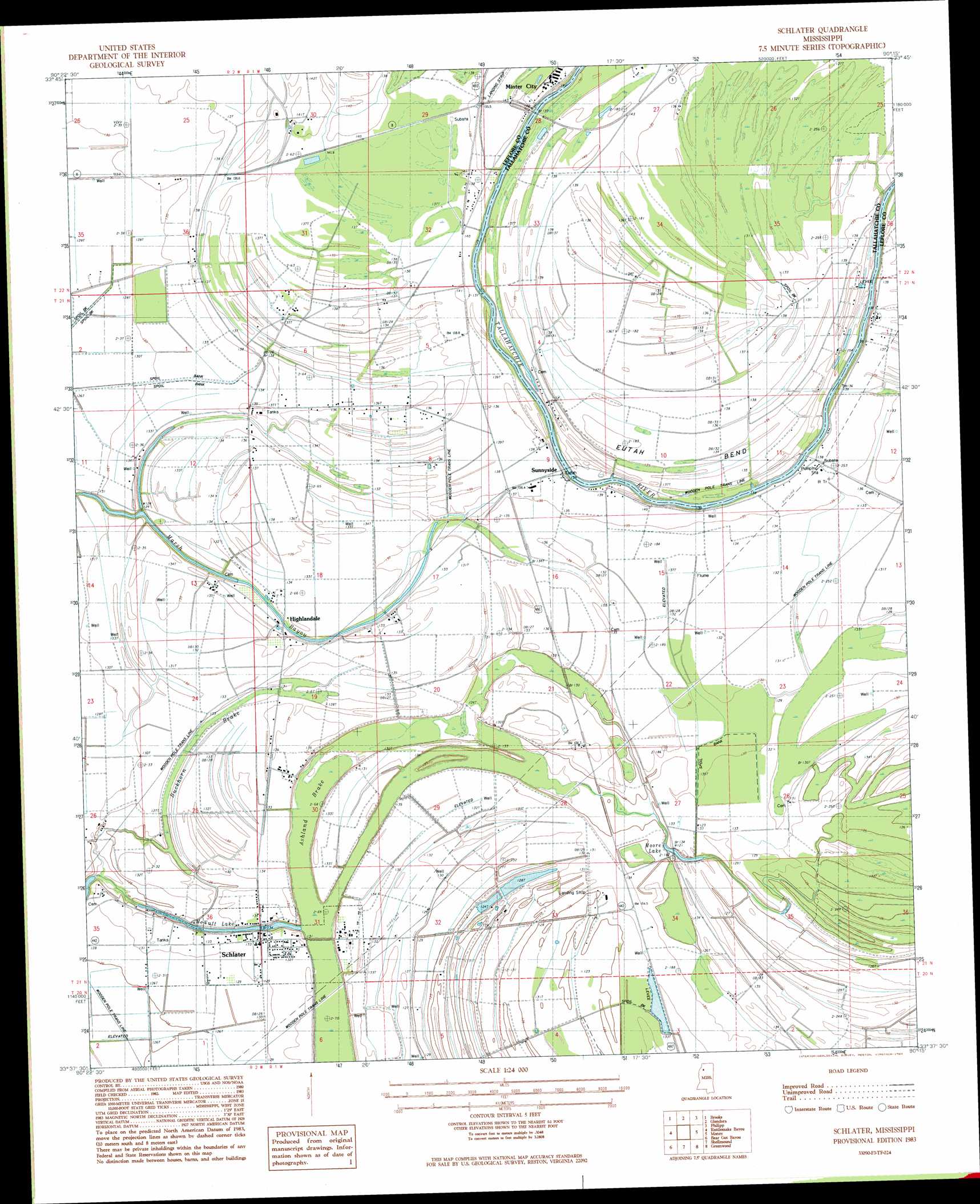
Schlater Topo Map Mississippi
To zoom in, hover over the map of Schlater
USGS Topo Quad 33090f3 - 1:24,000 scale
| Topo Map Name: | Schlater |
| USGS Topo Quad ID: | 33090f3 |
| Print Size: | ca. 21 1/4" wide x 27" high |
| Southeast Coordinates: | 33.625° N latitude / 90.25° W longitude |
| Map Center Coordinates: | 33.6875° N latitude / 90.3125° W longitude |
| U.S. State: | MS |
| Filename: | o33090f3.jpg |
| Download Map JPG Image: | Schlater topo map 1:24,000 scale |
| Map Type: | Topographic |
| Topo Series: | 7.5´ |
| Map Scale: | 1:24,000 |
| Source of Map Images: | United States Geological Survey (USGS) |
| Alternate Map Versions: |
Schlater NE MS 1974, updated 1975 Download PDF Buy paper map Schlater MS 1983, updated 1984 Download PDF Buy paper map Schlater MS 2012 Download PDF Buy paper map Schlater MS 2015 Download PDF Buy paper map |
1:24,000 Topo Quads surrounding Schlater
Baltzer |
Rome |
Webb |
Tippo |
Paynes |
Drew |
Brooks |
Glendora |
Philipp |
Cascilla |
Ruleville |
Rattlesnake Bayou |
Schlater |
Money |
Avalon |
Sunflower |
Bear Gut Bayou |
Shellmound |
Greenwood |
Browning |
Moorhead |
Colony Town |
Itta Bena |
Sidon |
Gravel Hill |
> Back to 33090e1 at 1:100,000 scale
> Back to 33090a1 at 1:250,000 scale
> Back to U.S. Topo Maps home
Schlater topo map: Gazetteer
Schlater: Bends
Eutah Bend elevation 41m 134′Schlater: Crossings
James Minter Ferry (historical) elevation 41m 134′Schlater: Guts
Marsh Bayou elevation 39m 127′Schlater: Lakes
McNutt Lake elevation 34m 111′Moore Lake elevation 37m 121′
Schlater: Populated Places
Highlandale elevation 38m 124′McNutt elevation 40m 131′
Schlater elevation 39m 127′
Sunnyside elevation 42m 137′
Schlater: Swamps
Ashland Brake elevation 35m 114′Buckhorn Brake elevation 40m 131′
Schlater digital topo map on disk
Buy this Schlater topo map showing relief, roads, GPS coordinates and other geographical features, as a high-resolution digital map file on DVD: