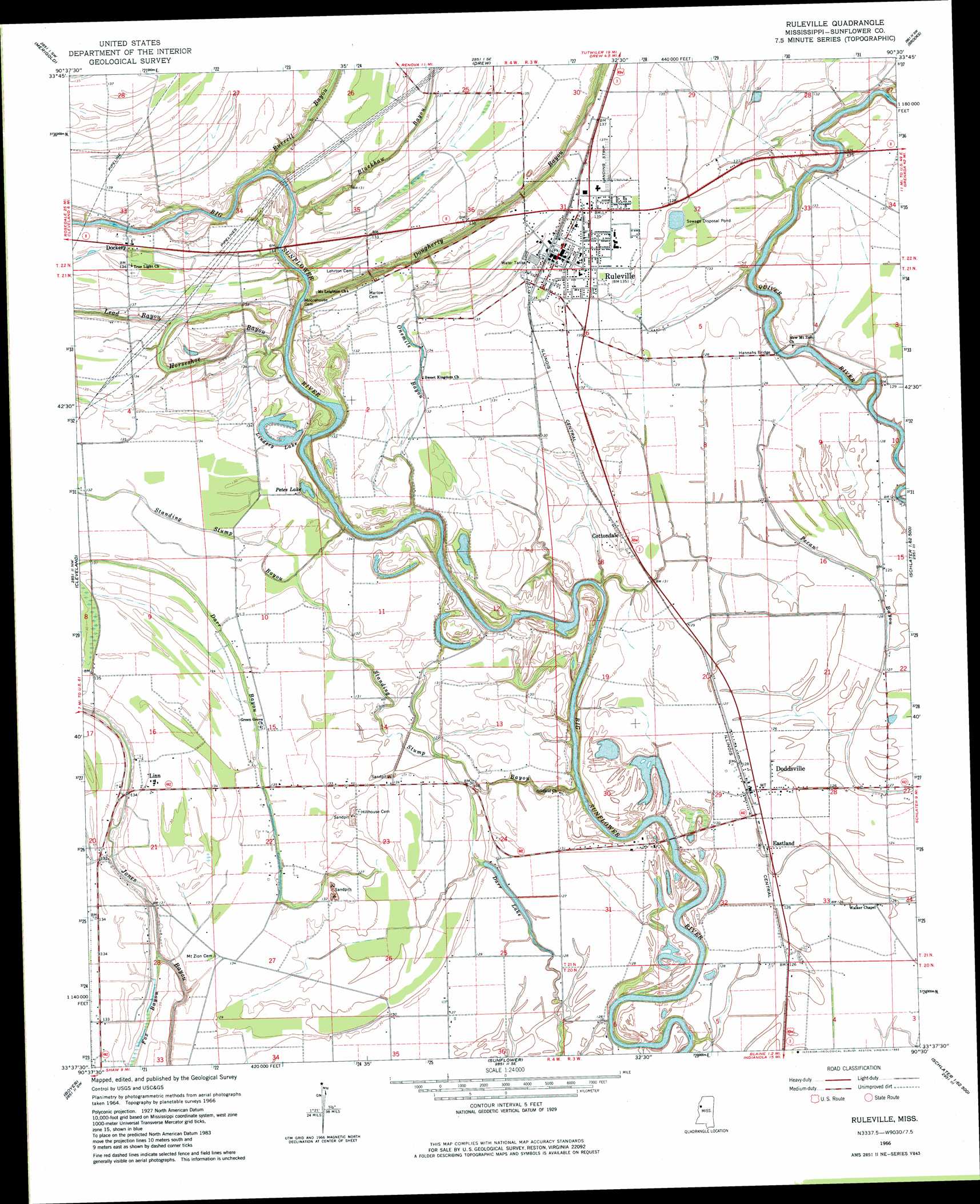
Ruleville Topo Map Mississippi
To zoom in, hover over the map of Ruleville
USGS Topo Quad 33090f5 - 1:24,000 scale
| Topo Map Name: | Ruleville |
| USGS Topo Quad ID: | 33090f5 |
| Print Size: | ca. 21 1/4" wide x 27" high |
| Southeast Coordinates: | 33.625° N latitude / 90.5° W longitude |
| Map Center Coordinates: | 33.6875° N latitude / 90.5625° W longitude |
| U.S. State: | MS |
| Filename: | o33090f5.jpg |
| Download Map JPG Image: | Ruleville topo map 1:24,000 scale |
| Map Type: | Topographic |
| Topo Series: | 7.5´ |
| Map Scale: | 1:24,000 |
| Source of Map Images: | United States Geological Survey (USGS) |
| Alternate Map Versions: |
Ruleville MS 1966, updated 1967 Download PDF Buy paper map Ruleville MS 1966, updated 1982 Download PDF Buy paper map Ruleville MS 2012 Download PDF Buy paper map Ruleville MS 2015 Download PDF Buy paper map |
1:24,000 Topo Quads surrounding Ruleville
Shelby |
Mound Bayou |
Baltzer |
Rome |
Webb |
Pace |
Merigold |
Drew |
Brooks |
Glendora |
Skene |
Cleveland |
Ruleville |
Rattlesnake Bayou |
Schlater |
Shaw |
Boyer |
Sunflower |
Bear Gut Bayou |
Shellmound |
Holly Ridge |
Indianola |
Moorhead |
Colony Town |
Itta Bena |
> Back to 33090e1 at 1:100,000 scale
> Back to 33090a1 at 1:250,000 scale
> Back to U.S. Topo Maps home
Ruleville topo map: Gazetteer
Ruleville: Areas
Standing Stump elevation 40m 131′Ruleville: Bends
Big Eddy Bend elevation 41m 134′Ruleville: Bridges
Hannahs Bridge elevation 33m 108′Old Lehrton Bridge elevation 32m 104′
Ruleville: Crossings
Dewberry Ferry (historical) elevation 32m 104′Ruleville: Dams
Ruleville Lagoon Dam elevation 37m 121′Ruleville: Lakes
Darr Lake elevation 37m 121′Lindsey Lake elevation 37m 121′
Petes Lake elevation 36m 118′
Ruleville: Parks
Ruleville Memorial Park elevation 41m 134′Ruleville: Populated Places
Cottondale elevation 40m 131′Dockery elevation 41m 134′
Doddsville elevation 39m 127′
Eastland elevation 39m 127′
Lehrton (historical) elevation 42m 137′
Linn elevation 41m 134′
Quiver (historical) elevation 39m 127′
Ruleville elevation 41m 134′
Ruleville: Streams
Blackhaw Bayou elevation 33m 108′Burrell Bayou elevation 33m 108′
Dougherty Bayou elevation 32m 104′
Horseshoe Bayou elevation 34m 111′
Lead Bayou elevation 36m 118′
Onemile Bayou elevation 33m 108′
Standing Stump Bayou elevation 37m 121′
Ruleville: Swamps
Lion Brake elevation 41m 134′Ruleville digital topo map on disk
Buy this Ruleville topo map showing relief, roads, GPS coordinates and other geographical features, as a high-resolution digital map file on DVD: