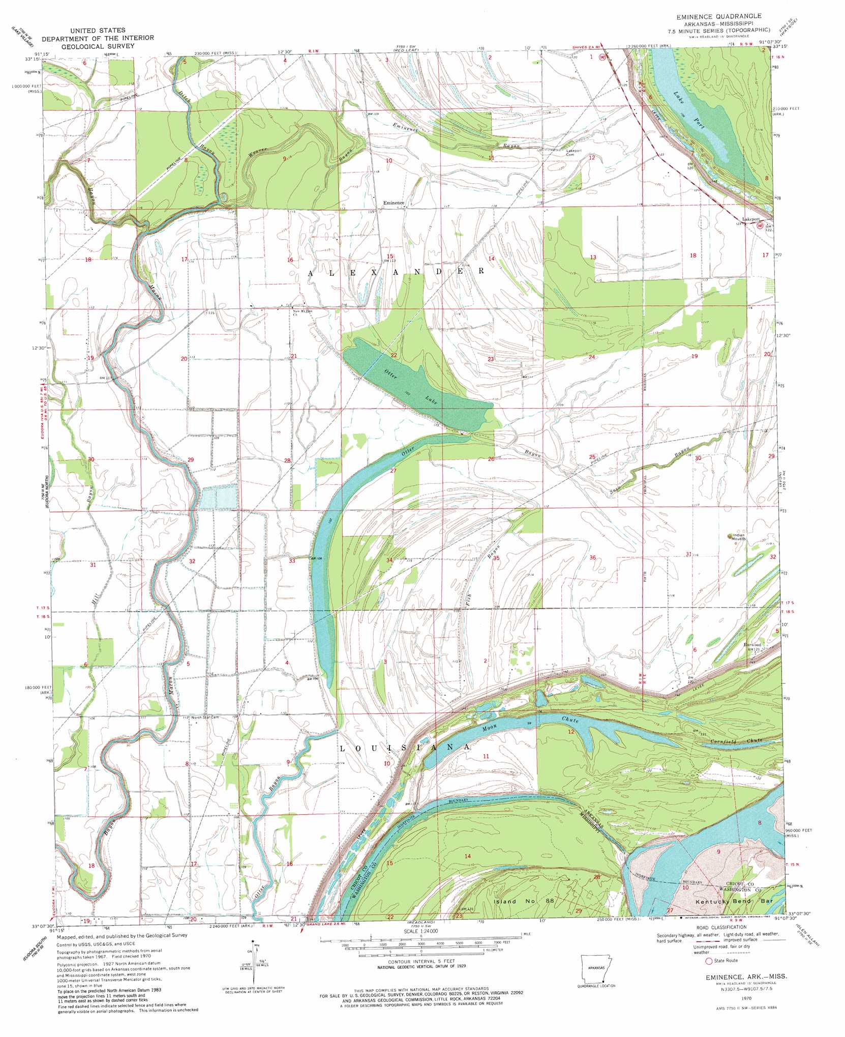
Eminence Topo Map Arkansas
To zoom in, hover over the map of Eminence
USGS Topo Quad 33091b2 - 1:24,000 scale
| Topo Map Name: | Eminence |
| USGS Topo Quad ID: | 33091b2 |
| Print Size: | ca. 21 1/4" wide x 27" high |
| Southeast Coordinates: | 33.125° N latitude / 91.125° W longitude |
| Map Center Coordinates: | 33.1875° N latitude / 91.1875° W longitude |
| U.S. States: | AR, MS |
| Filename: | o33091b2.jpg |
| Download Map JPG Image: | Eminence topo map 1:24,000 scale |
| Map Type: | Topographic |
| Topo Series: | 7.5´ |
| Map Scale: | 1:24,000 |
| Source of Map Images: | United States Geological Survey (USGS) |
| Alternate Map Versions: |
Eminence AR 1970, updated 1972 Download PDF Buy paper map Eminence AR 1970, updated 1982 Download PDF Buy paper map Eminence AR 2011 Download PDF Buy paper map Eminence AR 2014 Download PDF Buy paper map |
1:24,000 Topo Quads surrounding Eminence
Jerome |
Macon Lake |
Luna |
Greenville |
Leland |
Montrose |
Lake Village |
Red Leaf |
Wayside |
Arcola |
Eudora Nw |
Eudora North |
Eminence |
Avon |
Swan Lake Nw |
Empire |
Eudora South |
Readland |
Glen Allan |
Percy |
Fiske |
Kilbourne |
Millikin |
Mayersville |
Rolling Fork West |
> Back to 33091a1 at 1:100,000 scale
> Back to 33090a1 at 1:250,000 scale
> Back to U.S. Topo Maps home
Eminence topo map: Gazetteer
Eminence: Areas
Howard Island elevation 35m 114′Island Number 87 elevation 33m 108′
Eminence: Bends
Matthews Bend elevation 26m 85′Eminence: Capes
Worthington Point elevation 27m 88′Eminence: Guts
Ditch Bayou elevation 30m 98′Fish Bayou elevation 31m 101′
Otter Bayou elevation 31m 101′
Otter Bayou elevation 30m 98′
Soso Bayou elevation 36m 118′
Eminence: Islands
Worthington Towhead elevation 33m 108′Eminence: Lakes
Lake Port elevation 32m 104′Moon Chute elevation 30m 98′
Otter Lake elevation 32m 104′
Eminence: Levees
Grand Lake Revetment elevation 28m 91′Eminence: Populated Places
Eminence elevation 34m 111′Harwood elevation 38m 124′
Lakeport elevation 37m 121′
Scaife (historical) elevation 38m 124′
Eminence: Streams
Eminence Bayou elevation 33m 108′Weaver Bayou elevation 30m 98′
Eminence digital topo map on disk
Buy this Eminence topo map showing relief, roads, GPS coordinates and other geographical features, as a high-resolution digital map file on DVD: