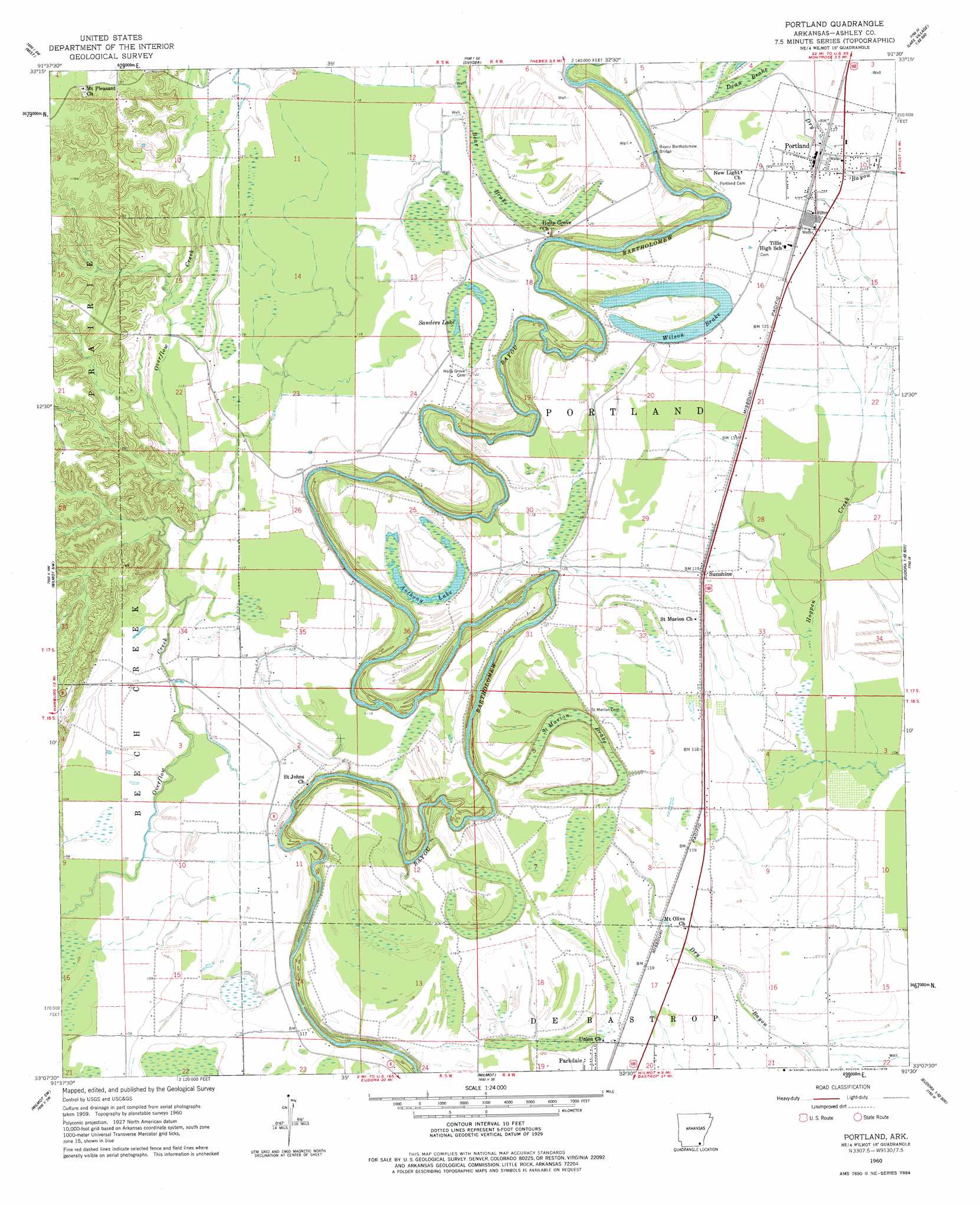
Portland Topo Map Arkansas
To zoom in, hover over the map of Portland
USGS Topo Quad 33091b5 - 1:24,000 scale
| Topo Map Name: | Portland |
| USGS Topo Quad ID: | 33091b5 |
| Print Size: | ca. 21 1/4" wide x 27" high |
| Southeast Coordinates: | 33.125° N latitude / 91.5° W longitude |
| Map Center Coordinates: | 33.1875° N latitude / 91.5625° W longitude |
| U.S. State: | AR |
| Filename: | o33091b5.jpg |
| Download Map JPG Image: | Portland topo map 1:24,000 scale |
| Map Type: | Topographic |
| Topo Series: | 7.5´ |
| Map Scale: | 1:24,000 |
| Source of Map Images: | United States Geological Survey (USGS) |
| Alternate Map Versions: |
Portland AR 1960, updated 1961 Download PDF Buy paper map Portland AR 1960, updated 1979 Download PDF Buy paper map Portland AR 2002, updated 2004 Download PDF Buy paper map Portland AR 2011 Download PDF Buy paper map Portland AR 2014 Download PDF Buy paper map |
1:24,000 Topo Quads surrounding Portland
Ladelle |
Mist Nw |
Line |
Jerome |
Macon Lake |
Fountain Hill |
Mist |
Snyder |
Montrose |
Lake Village |
Hamburg |
Wilmot Nw |
Portland |
Eudora Nw |
Eudora North |
Berlin |
Wilmot Sw |
Wilmot |
Empire |
Eudora South |
Twin Oaks |
Bonita |
Laark |
Fiske |
Kilbourne |
> Back to 33091a1 at 1:100,000 scale
> Back to 33090a1 at 1:250,000 scale
> Back to U.S. Topo Maps home
Portland topo map: Gazetteer
Portland: Bridges
Bayou Bartholomew Bridge elevation 33m 108′Portland: Dams
Wilson Brake Dam elevation 36m 118′Portland: Lakes
Anthony Lake elevation 35m 114′Sanders Lake elevation 34m 111′
Wilson Brake elevation 38m 124′
Portland: Populated Places
Mount Pleasant elevation 56m 183′Portland elevation 38m 124′
Sunshine elevation 36m 118′
Portland: Reservoirs
Wilson Brake Reservoir elevation 36m 118′Portland: Swamps
Bear Brake elevation 34m 111′Saint Marion Brake elevation 33m 108′
Portland digital topo map on disk
Buy this Portland topo map showing relief, roads, GPS coordinates and other geographical features, as a high-resolution digital map file on DVD: