Crossett North Topo Map Arkansas
To zoom in, hover over the map of Crossett North
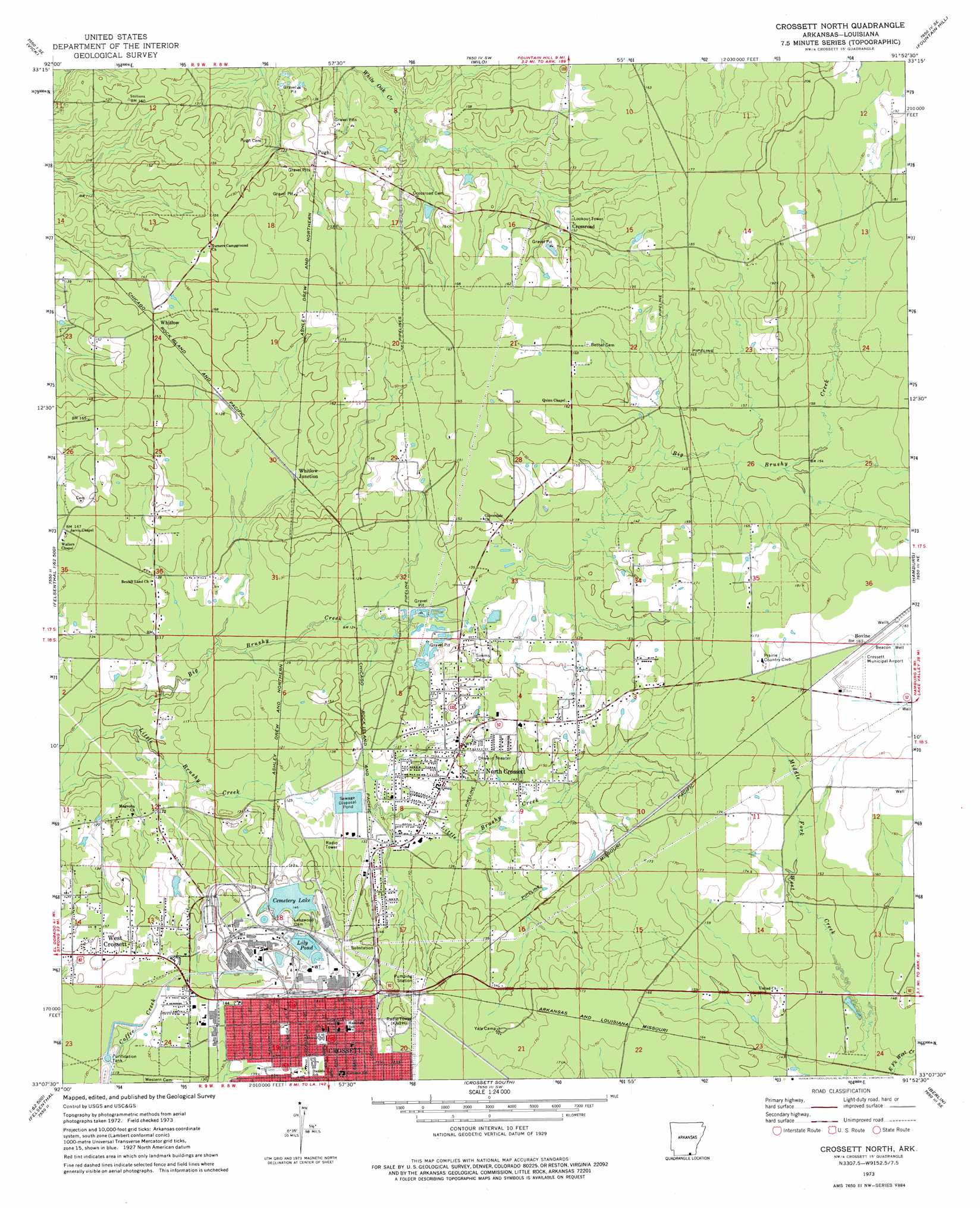
USGS Topo Quad 33091b8 - 1:24,000 scale
| Topo Map Name: | Crossett North |
| USGS Topo Quad ID: | 33091b8 |
| Print Size: | ca. 21 1/4" wide x 27" high |
| Southeast Coordinates: | 33.125° N latitude / 91.875° W longitude |
| Map Center Coordinates: | 33.1875° N latitude / 91.9375° W longitude |
| U.S. State: | AR |
| Filename: | o33091b8.jpg |
| Download Map JPG Image: | Crossett North topo map 1:24,000 scale |
| Map Type: | Topographic |
| Topo Series: | 7.5´ |
| Map Scale: | 1:24,000 |
| Source of Map Images: | United States Geological Survey (USGS) |
| Alternate Map Versions: |
Crossett North AR 1973, updated 1975 Download PDF Buy paper map Crossett North AR 2011 Download PDF Buy paper map Crossett North AR 2014 Download PDF Buy paper map |
1:24,000 Topo Quads surrounding Crossett North
Hermitage |
Sumpter |
Longview |
Ladelle |
Mist Nw |
Marsden |
Vick |
Milo |
Fountain Hill |
Mist |
New Union |
Marais Saline |
Crossett North |
Hamburg |
Wilmot Nw |
Huttig |
Felsenthal Dam |
Crossett South |
Berlin |
Wilmot Sw |
Marion East |
Fish Lake |
Beckman |
Twin Oaks |
Bonita |
> Back to 33091a1 at 1:100,000 scale
> Back to 33090a1 at 1:250,000 scale
> Back to U.S. Topo Maps home
Crossett North topo map: Gazetteer
Crossett North: Airports
Crossett Municipal Airport elevation 51m 167′Crossett North: Areas
Smith Prairie elevation 54m 177′Crossett North: Populated Places
Bovine elevation 54m 177′Brushy (historical) elevation 35m 114′
Crossett elevation 51m 167′
Crossroad elevation 47m 154′
North Crossett elevation 46m 150′
Pugh elevation 46m 150′
Unity elevation 46m 150′
West Crossett elevation 46m 150′
Whitlow elevation 47m 154′
Whitlow Junction elevation 41m 134′
Crossett North: Post Offices
Crossett Post Office elevation 51m 167′Crossett North digital topo map on disk
Buy this Crossett North topo map showing relief, roads, GPS coordinates and other geographical features, as a high-resolution digital map file on DVD: