Lake Village Topo Map Arkansas
To zoom in, hover over the map of Lake Village
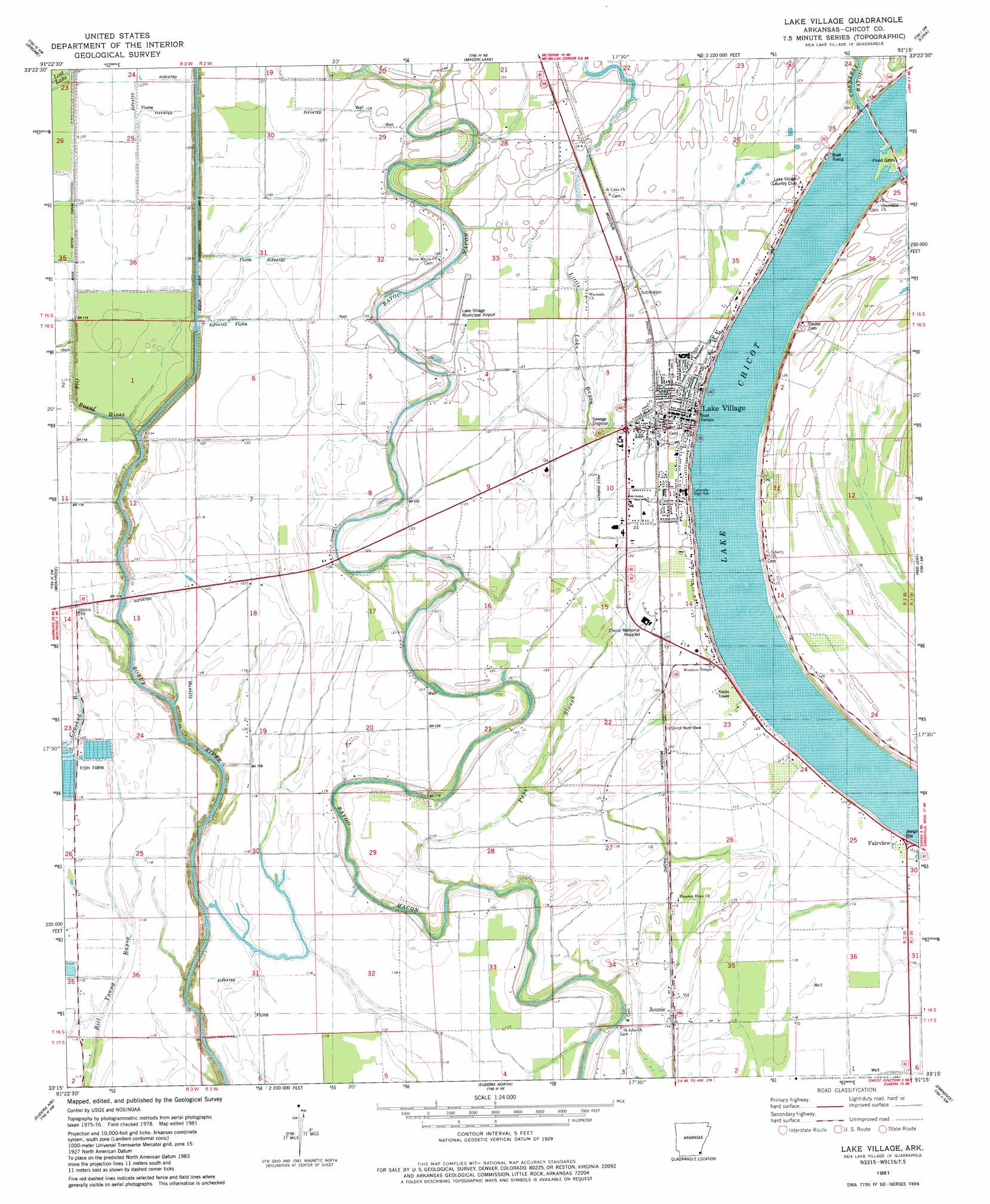
USGS Topo Quad 33091c3 - 1:24,000 scale
| Topo Map Name: | Lake Village |
| USGS Topo Quad ID: | 33091c3 |
| Print Size: | ca. 21 1/4" wide x 27" high |
| Southeast Coordinates: | 33.25° N latitude / 91.25° W longitude |
| Map Center Coordinates: | 33.3125° N latitude / 91.3125° W longitude |
| U.S. State: | AR |
| Filename: | o33091c3.jpg |
| Download Map JPG Image: | Lake Village topo map 1:24,000 scale |
| Map Type: | Topographic |
| Topo Series: | 7.5´ |
| Map Scale: | 1:24,000 |
| Source of Map Images: | United States Geological Survey (USGS) |
| Alternate Map Versions: |
Lake Village AR 1981, updated 1982 Download PDF Buy paper map Lake Village AR 2011 Download PDF Buy paper map Lake Village AR 2014 Download PDF Buy paper map |
1:24,000 Topo Quads surrounding Lake Village
Collins |
Mcgehee South |
Halley |
Arkansas City |
Scott |
Line |
Jerome |
Macon Lake |
Luna |
Greenville |
Snyder |
Montrose |
Lake Village |
Red Leaf |
Wayside |
Portland |
Eudora Nw |
Eudora North |
Eminence |
Avon |
Wilmot |
Empire |
Eudora South |
Readland |
Glen Allan |
> Back to 33091a1 at 1:100,000 scale
> Back to 33090a1 at 1:250,000 scale
> Back to U.S. Topo Maps home
Lake Village topo map: Gazetteer
Lake Village: Airports
Chicot Memorial Hospital Heliport elevation 36m 118′Lake Village Municipal Airport elevation 38m 124′
Lake Village: Dams
Lake Chicot Dam North elevation 33m 108′Whiskey Chute Dam elevation 35m 114′
Lake Village: Guts
Little Lake Bayou elevation 35m 114′Paps Slough elevation 33m 108′
Lake Village: Lakes
Lake Chicot elevation 32m 104′Lake Village: Populated Places
Ashton elevation 34m 111′Bayou Macon (historical) elevation 33m 108′
Chanticleer elevation 37m 121′
Fairview elevation 36m 118′
Jennie elevation 35m 114′
Lake Village elevation 33m 108′
Lakehall elevation 37m 121′
Myrtle Grove elevation 36m 118′
Reeves (historical) elevation 34m 111′
Lake Village: Reservoirs
Whiskey Chute Reservoir elevation 35m 114′Lake Village: Streams
Old Boeuf River elevation 34m 111′Lake Village digital topo map on disk
Buy this Lake Village topo map showing relief, roads, GPS coordinates and other geographical features, as a high-resolution digital map file on DVD: