Fountain Hill Topo Map Arkansas
To zoom in, hover over the map of Fountain Hill
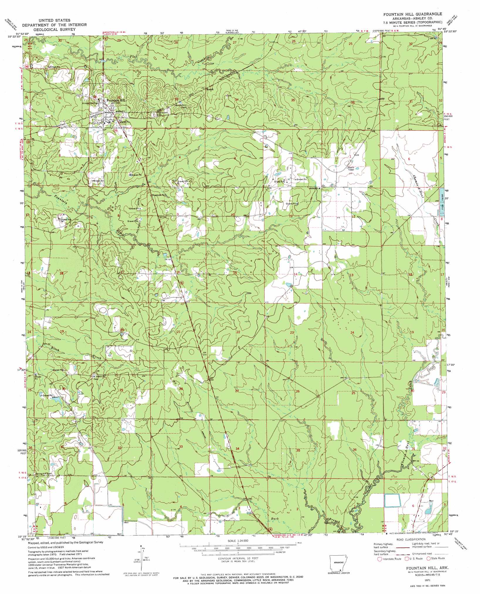
USGS Topo Quad 33091c7 - 1:24,000 scale
| Topo Map Name: | Fountain Hill |
| USGS Topo Quad ID: | 33091c7 |
| Print Size: | ca. 21 1/4" wide x 27" high |
| Southeast Coordinates: | 33.25° N latitude / 91.75° W longitude |
| Map Center Coordinates: | 33.3125° N latitude / 91.8125° W longitude |
| U.S. State: | AR |
| Filename: | o33091c7.jpg |
| Download Map JPG Image: | Fountain Hill topo map 1:24,000 scale |
| Map Type: | Topographic |
| Topo Series: | 7.5´ |
| Map Scale: | 1:24,000 |
| Source of Map Images: | United States Geological Survey (USGS) |
| Alternate Map Versions: |
Fountain Hill AR 1952, updated 1976 Download PDF Buy paper map Fountain Hill AR 2011 Download PDF Buy paper map Fountain Hill AR 2014 Download PDF Buy paper map |
1:24,000 Topo Quads surrounding Fountain Hill
Warren |
Wilmar South |
Monticello South |
Cominto |
Collins |
Sumpter |
Longview |
Ladelle |
Mist Nw |
Line |
Vick |
Milo |
Fountain Hill |
Mist |
Snyder |
Marais Saline |
Crossett North |
Hamburg |
Wilmot Nw |
Portland |
Felsenthal Dam |
Crossett South |
Berlin |
Wilmot Sw |
Wilmot |
> Back to 33091a1 at 1:100,000 scale
> Back to 33090a1 at 1:250,000 scale
> Back to U.S. Topo Maps home
Fountain Hill topo map: Gazetteer
Fountain Hill: Areas
Fountain Prairie elevation 64m 209′Fountain Hill: Dams
Shiloh Lake Dam elevation 62m 203′Fountain Hill: Populated Places
Fountain Hill elevation 59m 193′Roark elevation 53m 173′
Fountain Hill: Reservoirs
Shiloh Lake elevation 62m 203′Fountain Hill digital topo map on disk
Buy this Fountain Hill topo map showing relief, roads, GPS coordinates and other geographical features, as a high-resolution digital map file on DVD: