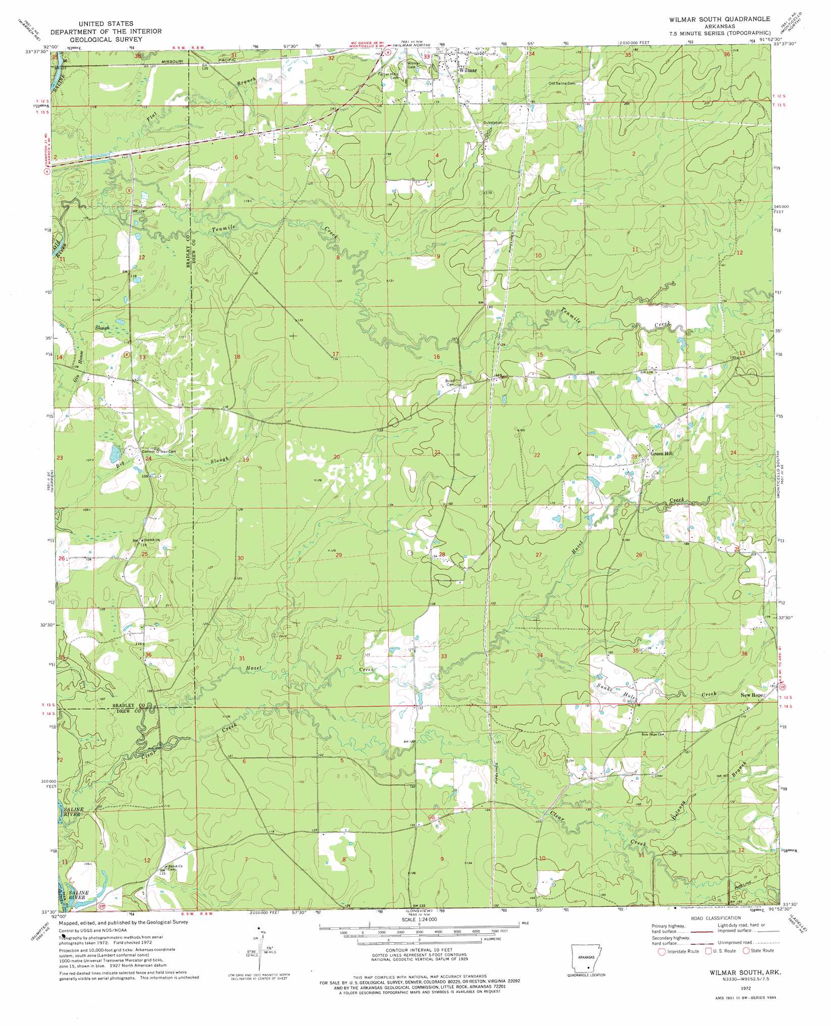
Wilmar South Topo Map Arkansas
To zoom in, hover over the map of Wilmar South
USGS Topo Quad 33091e8 - 1:24,000 scale
| Topo Map Name: | Wilmar South |
| USGS Topo Quad ID: | 33091e8 |
| Print Size: | ca. 21 1/4" wide x 27" high |
| Southeast Coordinates: | 33.5° N latitude / 91.875° W longitude |
| Map Center Coordinates: | 33.5625° N latitude / 91.9375° W longitude |
| U.S. State: | AR |
| Filename: | o33091e8.jpg |
| Download Map JPG Image: | Wilmar South topo map 1:24,000 scale |
| Map Type: | Topographic |
| Topo Series: | 7.5´ |
| Map Scale: | 1:24,000 |
| Source of Map Images: | United States Geological Survey (USGS) |
| Alternate Map Versions: |
Wilmar South AR 1972, updated 1975 Download PDF Buy paper map Wilmar South AR 2011 Download PDF Buy paper map Wilmar South AR 2014 Download PDF Buy paper map |
1:24,000 Topo Quads surrounding Wilmar South
New Edinburg |
Herbine |
Cornerville |
Relfs Bluff |
Tyro |
Mckinney |
Warren Ne |
Wilmar North |
Monticello North |
Collins Nw |
Farmville |
Warren |
Wilmar South |
Monticello South |
Cominto |
Hermitage |
Sumpter |
Longview |
Ladelle |
Mist Nw |
Marsden |
Vick |
Milo |
Fountain Hill |
Mist |
> Back to 33091e1 at 1:100,000 scale
> Back to 33090a1 at 1:250,000 scale
> Back to U.S. Topo Maps home
Wilmar South topo map: Gazetteer
Wilmar South: Areas
The Prairie elevation 35m 114′Wilmar South: Populated Places
Corinth elevation 35m 114′Green Hill elevation 52m 170′
New Hope elevation 56m 183′
Saline (historical) elevation 36m 118′
Shiloh elevation 35m 114′
Wilmar South: Streams
Clear Creek elevation 28m 91′Delaney Branch elevation 48m 157′
Flat Branch elevation 30m 98′
Hazel Creek elevation 33m 108′
Snake Hole Creek elevation 41m 134′
Wilmar South digital topo map on disk
Buy this Wilmar South topo map showing relief, roads, GPS coordinates and other geographical features, as a high-resolution digital map file on DVD: